
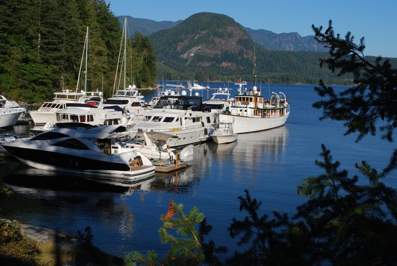
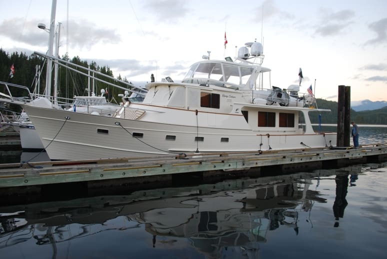
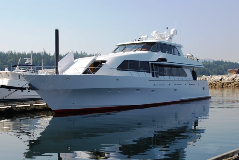
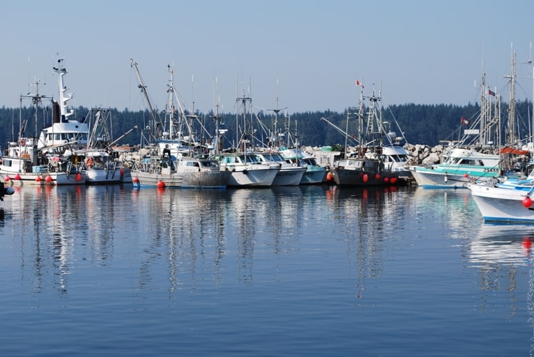
Tuesday, August 10 – SYC Cortes Bay Outstation to Dent Island Lodge – 28 Nautical Miles; 3:32 Minutes Cruising Time
It was time to head north, and hopefully, get away from the heavier crowds of cruising boats. When Kap flew back from Seattle, the floatplane approach was over Squirrel Cove – a popular anchorage to the NE of Cortes Bay. She reported the boats at anchor were so crowded you could almost walk from one to the other. July and August in Desolation Sound isn’t really a place we want to be.
Next stop – Dent Island. This route is considered “the back way” to the Broughton’s – winding through the island chain closest to the British Columbia mainland, as opposed to going directly northward on Johnstone Strait along the east side of Vancouver Island from Campbell River.
Johnstone Strait holds a terror for many novice cruisers – we were one of those our first year of boating, doing almost anything to stay away from Johnstone Strait, as the wind often funnels SW or NE at gale force (34-40 knots is considered gale force in the Beaufort Scale). Also, most times that you’re on Johnstone Strait you’re there long enough to have a current change, going with you to start (which is great), then turning to against you later (which is not so great), or vice versus – and if the winds are blowing against the current it can be particularly nasty. Another peril of Johnstone Strait is logs in the water, so you always have to keep a sharp eye out. Nevertheless, the terror of Johnstone Strait has subsided for us, and while we watch the weather very carefully if our route is on it – but otherwise, we feel much more comfortable on Johnstone Strait. We’ve now gone the full length of Johnstone Strait several times, treating it with respect, but with much less fear. This time, we were going up the back way just for a change.
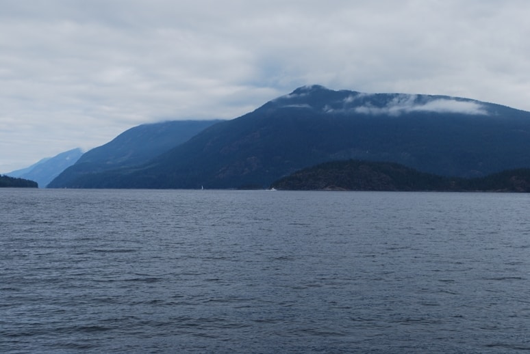
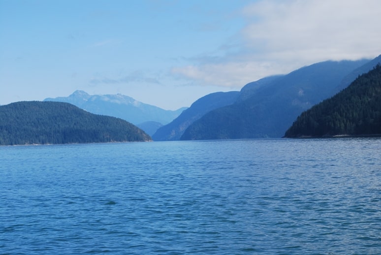
Cruising across Desolation Sound, heading north along the east side of Cortes Island. This looks like a huge expanse of water - because it is. Capt. George Vancouver named this Desolation Sound back in the 1700s during his exploration of the area. It was dreary and rainy, and he felt desolate here. Now, it's one of the most popular cruising areas in the world. As soon as we approach the land up ahead we'll be in Lewis Channel and it narrows down to about 1/2 mile width.
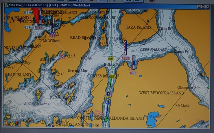
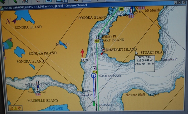
Nobeltec chart plotting screen on Lewis Channel. Flying Colours is the green boat symbol at the bottom, and the green line is our course line.
The cruise up Lewis and Calm Channels was calm and uneventful – which is exactly the idea – and the rough passage three days earlier was still fresh in our minds (and even fresher for Raz, Gator, and particularly ZuZu!) There was still a bit of smoke haze in the air, but otherwise, a really nice cruising day. The views looking up each side inlet were spectacular, and the morning light was great for photographs.
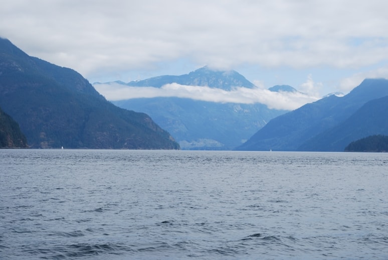
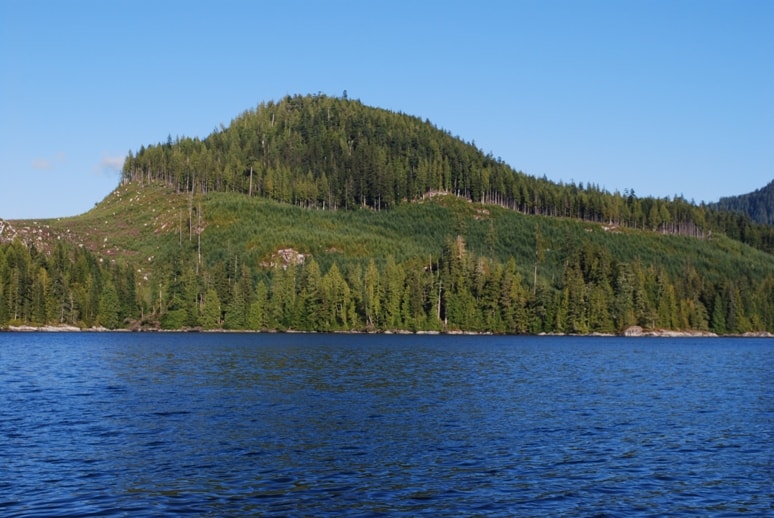
Looking up Teakerne Arm, a popular anchorage area for people who want to get into a more remote area from Desolation Sound.
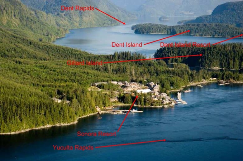
An aerial view of Sonora Resort and the surrounding area. Click on it to see the labels. Photo with permission of Sonora Resort, photo by Darren Bernaerdt, and copyright Sonora Resort. You can see how "flash" this resort is by going to www.sonoraresort.com.
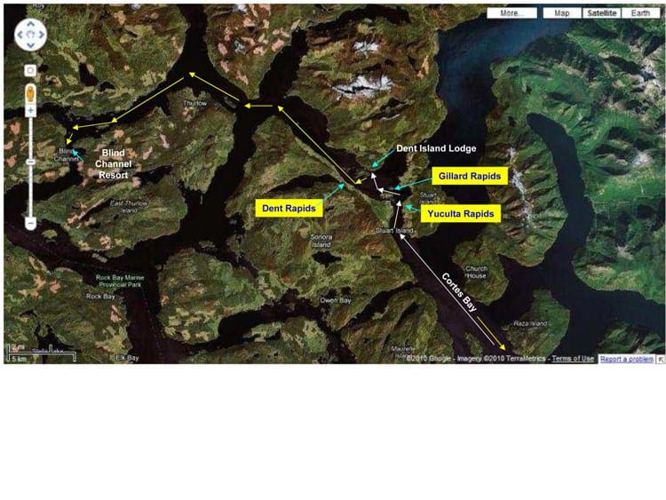
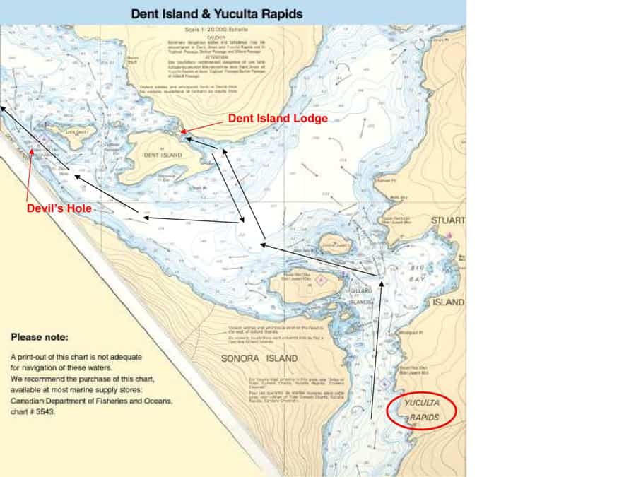
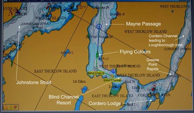
In white, here's the route from north of Cortes Bay, through Yuculta Rapids, then through Gillard Rapids and into Dent Lodge. The following day we took the yellow route through Dent Rapids to Blind Channel.
The route through Dent Island has multiple rapids you have to plan for – with currents running fast enough that you have to plan your transit. The first is Yuculta Rapids, at a pinch point between Sonora Island to the west and Stuart Island to the east; the second is Gillard Passage less than a mile further, when you turn 90° west to go between the main island of the Gillard Islands group and Jimmy Judd Island; the third – and easily the most serious – is Dent Island, where the notorious Devil’s Hole whirlpool runs so fast that it actually opens to a visible hole that can suck a small boat into it. Timing is everything – if you hit the first one at slack, you can make it through all three without problem. If you arrive at flood or ebb, you pick a spot to wait, or you slow your approach. With our Nobeltec chart plotting software, it’s great for calculating your best departure time to arrive at the slack time, based on your cruise speed and the current speed and direction during your cruise.
Approaching Yuculta Rapids - Calm Channel looks exactly that - calm. This view is looking towards the approach to Yuculta Rapids, but you’d never know it.
Nobeltec chart plotter screen showing approach to Yuculta Rapids.
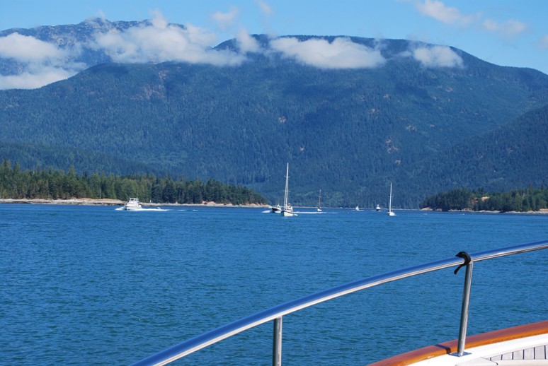
The flotilla of boats heading south, meeting us as we start into Yuculta Rapids to the north.
The rapids at Yuculta are deceiving – the passage seems wide enough that you wouldn’t expect rapids if you didn’t know they were there. It’s fairly shallow, though, at around 50’ average depth in the center of the channel, and it shoals to 15-20’ along the sides. This sets up whirlpools and eddies that are almost invisible until you’re right on them. The shoreline is sensitive to erosion, and there are always fast boats going through, prompting people on the shore to radio their displeasure, oftentimes in unrepeatable language. Along the west shore is a very large fishing lodge, the Sonora Resort – all on land, and not at all like the float-based “resorts” we’re used to for cruising boaters in the Broughton’s. It’s easily the largest resort of any that we see along this route, and wouldn’t look out of place at Whistler Ski Resort.
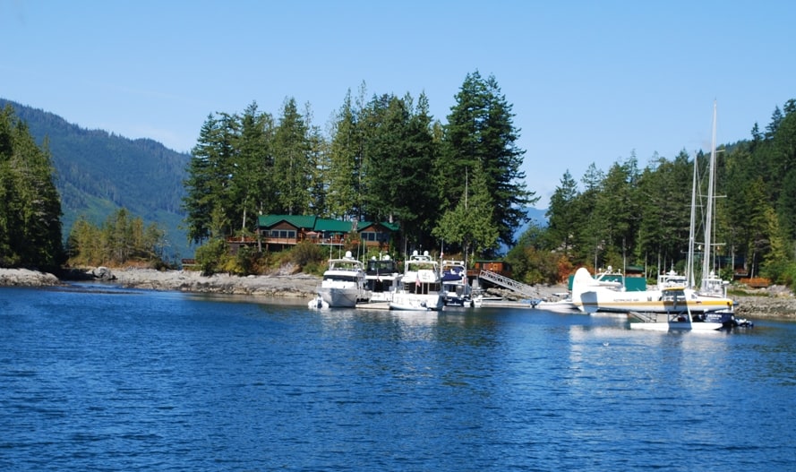
Approaching Dent Lodge. The daily Kenmore Air flight from Seattle was at the dock when we arrived. The main lodge with dining room is directly behind the boats in center.
One of the “cabins” that can be rented for a fishing holiday. We've not ever been in one of them, but we're told they're very nice.
Between Dent Island and Little Dent Island is a small rapids that has exposed rocks at low tide; at high tide, the small fishing boats roar through it to save time going around, but also to have fun.
Dent Island Lodge is always an interesting place to stop over. It’s small, but a very upscale destination for small parties, created years ago as a private retreat and fishing lodge for the Nordstrom family (yes, the Nordstrom family of Seattle who founded and own controlling interest in Nordstrom’s). A few years ago when they discovered the family wasn’t using it enough to warrant the expense, they converted it into a fishing lodge, with docks for cruising boaters to overnight at. The moorage fee is over 2½ times that of other resorts in the area, and the quality of the docks matches the price. The big attraction for cruisers is the fixed price dinner – at C$175 for a couple, plus the cost of the wine – and it’s worth every penny of it. Most of all, the service is right out of Nordstrom’s. In the last couple of years, they’ve opened a Tapas Bar for dinner as well, with a fix-price 15-course dinner that takes about three hours.
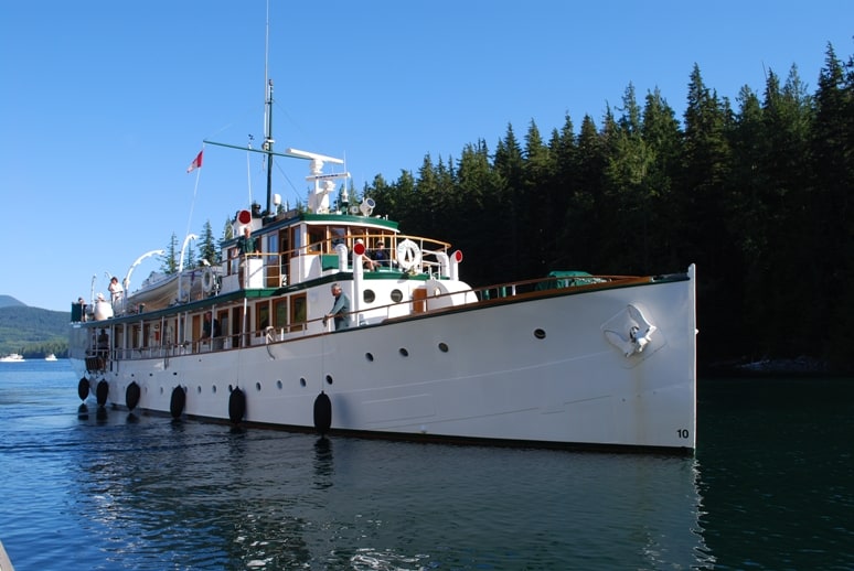
The Thea Foss arriving across the dock from us.
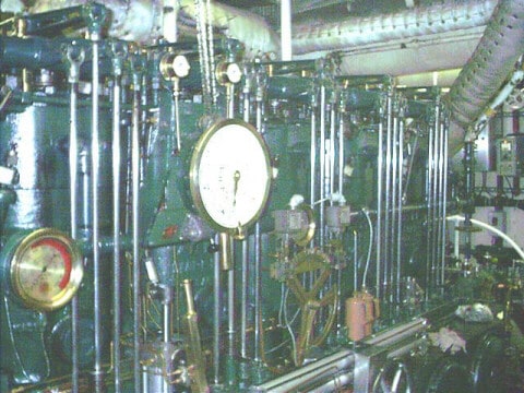
The Thea Foss' Atlas-Imperial exposed cylinder engine. The engineer told us he has to "oil 'er" every 45 minutes.
Our view from the lodge dining deck. Flying Colours is almost hidden, on the other side of the dock from the bow of the Thea Foss.
A few minutes before our scheduled dinner reservation, we looked up to see the 120’ Thea Foss arrive at our dock to tie up directly across from us. She’s one of the most beautiful classic fantail yachts, built in 1930 for John Barrymore (the actor). She was requisitioned for patrol duty during WWII, after which the Foss family (that’s the Foss Tug family) bought her for their private yacht and named her after Thea Foss, the founder of the company.
Sidebar: Thea Foss was a recent immigrant from Norway in 1889, living in Tacoma, WA and married to a carpenter. When her husband went off for the summer on a carpentry job, young Thea saw a need and bought a couple of small rowboats and rented them out to fishermen. By summer’s end when her husband returned, her net income was higher than his, and she started Foss Tug – now Foss Maritime, and one of the largest tug operations in the U.S. Thea Foss was the inspiration for the 1933 movie character Tugboat Annie.
Watching this old tug dock was amazing. She’s been reconditioned at the Foss Maritime shipyard on Seattle’s Ship Canal leading from Puget Sound to Lake Union, with a bow thruster and helm controls on both the port and starboard side just outside the pilot house. We didn’t offer to help with the lines, as they are the giant 4” rope hawsers – and we’re used to 5/8” lines for our boat. I wouldn’t have had a clue how to cleat a line like this to the bull rails on the dock. It had a crew of at least 4 – a Skipper, two mates, and it looked like someone inside who looked after the passengers.
Wednesday, August 11 – Dent Island Lodge to Blind Channel Resort – 17 Nautical Miles; 2:25 Minutes Cruising Time
Thea Foss at anchor as we departed Dent Island Lodge.
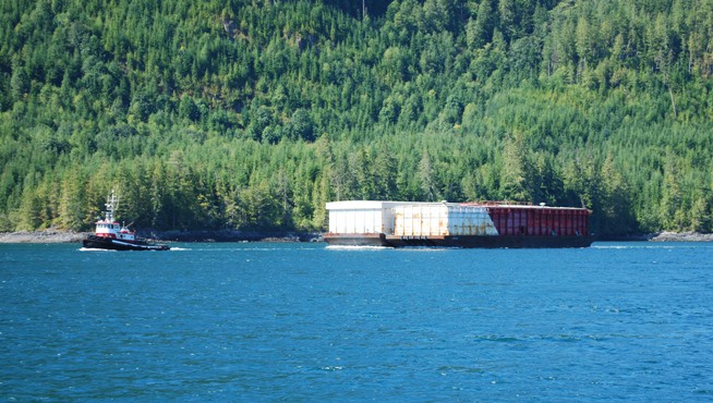
A tug and double-wide tow at Dent Rapids.
Heading to the north from Dent Island Lodge requires transit of the Dent Rapids – the most powerful of the three in this area. After breakfast at the lodge – a really good cooked breakfast of eggs, bacon/sausage, hash browns and toast, which we never have on the boat – Kap stopped to talk with Justin, the Lodge manager, to get his take on how to best time passage through the rapids. Slack was scheduled for 11:45AM, so Kap decided to pull away from the dock at 11:00AM, and wait until it looked good to go through. As we turned the corner on Little Dent Island, we saw a tug and tow coming through the rapids, just as we heard his Securité call. It was an unusual double-wide barge, and Kap decided the better part of discretion was to circle and wait for him to go through. These rapids are definitely not to be messed with, particularly to the west side at the notorious Devil’s Hole.
Canadian chart of our route through the rapids.
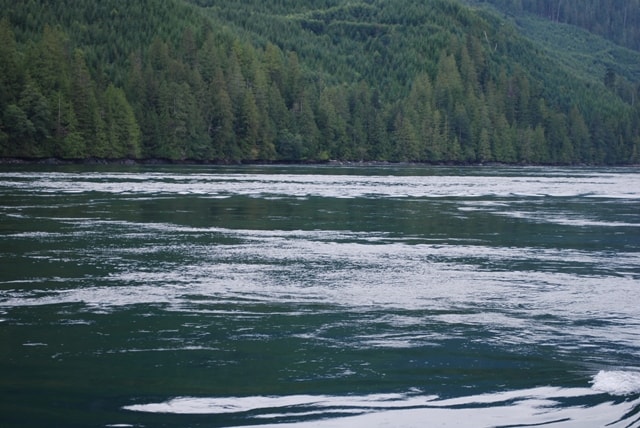
Swirling whirlpools and eddies are clearly visible in the waters of Dent Rapids - and this is at slack! It's hard to imagine the power of this until you try to steer a boat through it - Flying Colours weighs 70,000 lbs, and she twists and turns going through these like she's a little rowboat. Imagine what it would be like at full flood or ebb?
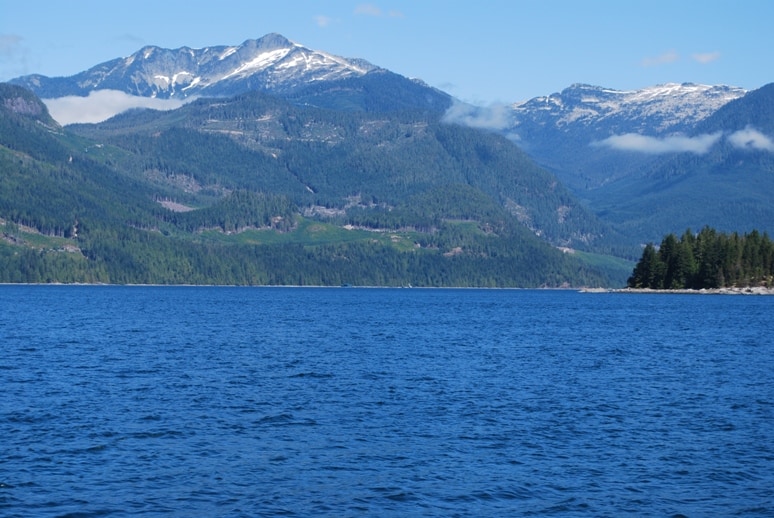
The mountains to the north of Dent Island are pretty spectacular.
Last year, the day before we arrived at Dent Island Lodge on our maiden voyage of Flying Colours, we learned of two fishing buddies from Alberta who were out in a chartered Dent Island Lodge fishing boat. As they were returning to the Lodge from the day’s fishing, they asked the guide driving the boat if they could pass by Devil’s Hole. As they approached it, one guy stood up in the boat and looked over the side at the swirling whirlpool – and just then the whirlpool tossed the boat sideways, pitching the guy into the water. A boat approaching from behind reported all they saw was the guy’s arm sticking upright in the water as it sucked him down. The other guy in the boat was tossed around but landed inside and survived. Here’s the newspaper article I got from an online copy of the Victoria Times Colonist.
Albertan feared drowned while fishing in B.C.
Victoria Times Colonist; August 23, 2009
VICTORIA — A missing boater is feared drowned after he plunged into rapids ominously dubbed “the Devil’s Hole” while sport-fishing between Stewart and Sonora islands in the straits between Vancouver Island and the mainland.
The man, a visitor from Alberta, was fishing in a private guide boat in the Dent Rapids area, a narrow channel about 30 kilometres northeast of Campbell River. He was standing in the boat when he lost his balance and fell overboard around 3:30 p.m. Saturday, according to coast guard officer Bob Bennett. The man, who was not wearing a life jacket, was swallowed by the fierce rapids and never resurfaced, witnesses said.
Within 10 minutes, local fishing guides, boaters in the area and two civilian helicopters began to search the waters. The Victoria Joint Rescue Co-ordination Centre sent in three coast guard search-and-rescue teams from Campbell River, Cortez Island and the Chatham Point light station to assist in the search. A Cormorant helicopter from CFB Comox 442 Transport and Rescue Squadron also circled overheard, scouring the waters for the man. At one point, Bennett said, there were more than 20 vessels looking for him. Justin Farr, manager of the Dent Island Lodge, where the man and his colleague rented a cabin, said he and his staff, along with boats from several neighbouring lodges, began combing the area as soon as they heard the distress call.
“We function in a very heavy tidal area, very dangerous waters. So when someone goes into the water, we realize there’s just a short period of time to find someone before they are swept away by the tide,” Farr said. “Unfortunately, it seems like that was the case.” The missing man’s name had not been released as of Sunday night.
The Dent Rapids area is a popular spot among fishermen and operators of pleasure craft and whale-watching boats.
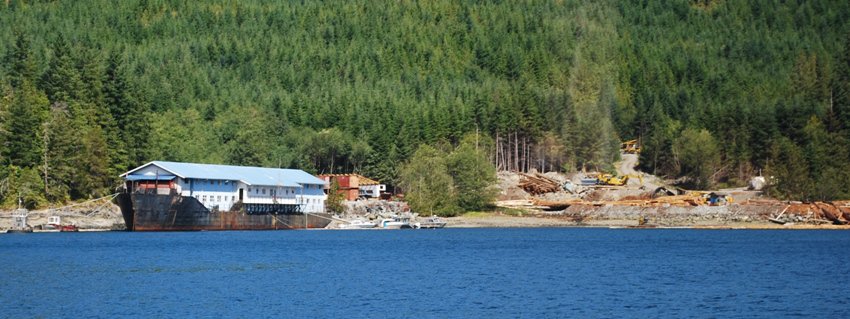
A logging operation on the shoreline along Cordero Channel. These are usually temporary camps, set up while they're logging in the nearby backwoods. When we first spotted the large vessel hull, we thought it might be a grounded freighter, with buildings behind it on the shore. With the binoculars we could tell it's a clever "camp" they can tow from site to site, utilizing an old ship's hull with office and housing quarters built atop it. All of the heavy equipment on shore is most likely brought in on a barge.
Clearcut logging across from Blind Channel Resort. It's pretty ugly when you have to look at it, but luckily, oftentimes it's back behind the coastline hills.
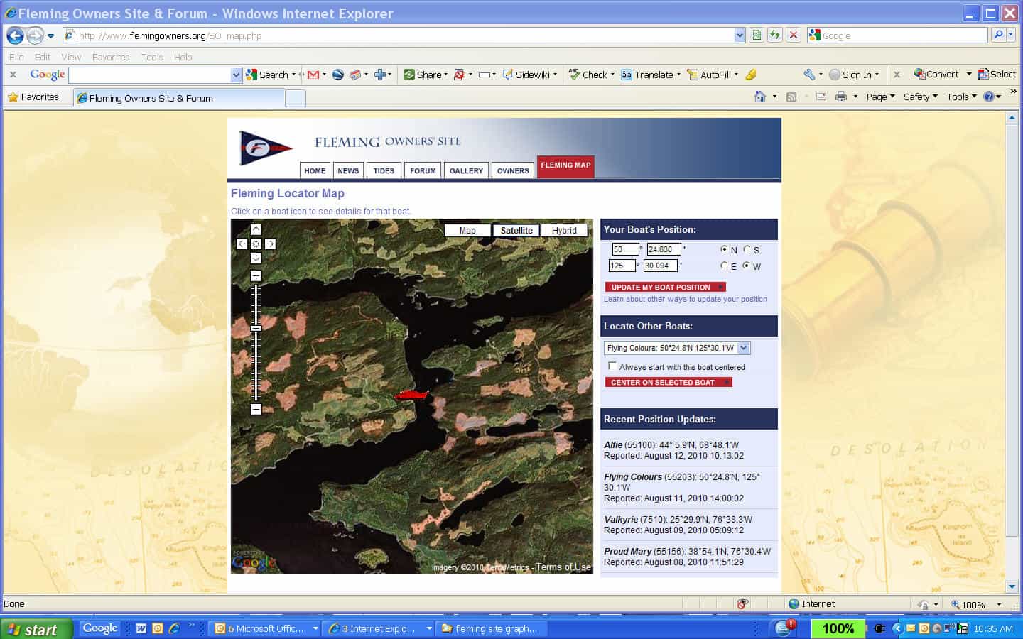
A screen shot from the Fleming Owner’s site of Flying Colours at Blind Channel. It might look like a plowed field pattern in the surrounding area from the satellite photo, but it’s actually brown earth from nearby clear-cut logging.
After maneuvering through Dent Rapids, the rest of the short cruise up to Blind Channel was uneventful, and we pulled in at 1:25PM. By the time we got Flying Colours securely tied at the dock, we were almost too late for the BBQ lunch on the patio deck just outside the resort general store. The food had already been taken back inside and the young college student working a great summer job was kind enough to open back up for us. It’s great sitting on this patio overlooking the marina and able to watch other boats go by on the channel.
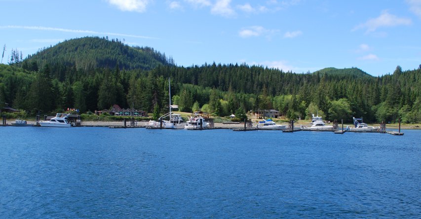
Blind Channel Resort, as we approached.
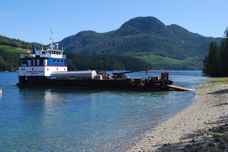
This is how fuel, propane, and heavy equipment is moved around in these remote parts. This particular barge is hooked up with Marine Link Tours from Campbell River, and they have up to 15 paying guests on board for a 5-day working-type cruise around the area. While the barge unloaded here, the guests came ashore for a hike on a nearby trail to see a huge tree that's famous in the area.
Compare this photo with the next one - can you spot the difference? (Hint: look at the piling sticking through the dock next to Flying Colours.) That's Kap standing to the right of the piling, and the top is clearly twice her height.
The tidal difference in this part of the world is pretty dramatic! It increases as you go north on the Pacific Coast - and is over 25' from low tide to high tide in SE Alaska. Here it's more like 10-12'. In this photo, the top of the piling wouldn't reach much more than to your knees.
Usually, we only overnight in Blind Channel on our way from Desolation Sound to the Broughton’s, but there’s a great German restaurant at the resort that we hate to miss, and nearby is an even better German restaurant at the Cordero Lodge fishing resort. These two resorts were founded by German immigrants almost 50 years ago, and both created very popular restaurants at their resorts. The resort and restaurant at Blind Channel is larger, but I actually prefer the schnitzel at Cordero Lodge. So far, we’ve preferred to moor the boat at Blind Channel as the docks are more sheltered from the wakes of boats going by too fast, so having dinner at Cordero Lodge requires a dinghy ride of about 3 miles each way
Cordero Lodge, for the absolute best schnitzel north of Sidney, B.C.
Friday, August 13 – Blind Channel Resort to Port McNeill – 65 Nautical Miles; 6:41 Minutes Cruising Time
Early morning light at Blind Channel as we pulled out, heading for Port McNeill. The calm waters and wonderful light are good reasons to drag yourself out of a warm bed and onto the water.
Our onward cruise plans from Blind Channel have been unsettled. Given that we had such a late start on the summer, the weather reports have been fluctuating all over the place, and we just didn’t know where we wanted to go. It seemed too crowded down in Desolation Sound, yet in the Broughton’s we have difficulty managing the dog’s daily schedule of “doing their business”. It seems like the majority of boats have at least one dog aboard, so we aren’t alone in wanting to have our pets with us. The difference is, Raz is now 12 years old and she’s always had a touchy stomach. So far, neither one of them has accepted the idea of “going” aboard the boat in an artificial grass-filled “pup head” that we carry along. Therefore, we find ourselves spending almost all of our nights at marina moorage, whereas we’d really like to be at anchor. In the Broughton’s, there are hundreds of wonderful little bays that just tug at you to anchor in them, but the shorelines are so impenetrable, with dense trees right to the waterline, that it’s very difficult to get them ashore twice a day in the dinghy. When there are little rocky patches along the shore, it’s tough at both high and low tide to get the dinghy in, then offload two 20 lb dogs without having to wade in sticky goo that you sink in to your ankles.
Our big problem was, where to go next. Bob (Gladics) and Glenna (Doke), our good friends from Sun Valley, have been “watching” our SPOT GPS locations, and Bob was sending e-mails that we should head up Loughborough Inlet to visit some friends of theirs who have a remote cabin on the tiny Beaver Inlet. We seriously considered this, as the weather reports for Johnstone Strait sounded horrible. Typically, this channel that runs along the NE side of Vancouver Island is notorious for high winds, high waves, and lots of floating logs in the water. One way or another, if we continued north, we’d have to get out on Johnstone Strait, even if it was for the 11 miles needed to get up to Savannah Channel to duck in at Lagoon Cove, the gateway to the Broughton’s. Whichever way we went, our Nobeltec software told us the best departure time was around 6AM – the currents would be best in Johnstone Strait – and if we went up to Beaver Inlet it was also the slack water time for passage through Greene Point Rapids around the NE tip of West Thurlow Island to get to Loughborough Inlet. Either way, it would be an early morning.
In the end, Raz unwittingly decided it for us. One dog fate of getting old is the inability to “express” their anal glands (sorry for this indelicate subject) – and if you’ve ever been around a dog whose anal glands have “packed up” and squirted out at the worst possible time – well, you don’t want to hear about it, much less experience it. In any case, Raz was in that boat (so to speak), and we could smell evidence of it in several places around Flying Colours. This isn’t an infrequent occurrence, and since we have a difficult time taking care of it ourselves, we have the vet or a groomer do it for us. Unfortunately, on a boat when you’re in remote locations, this isn’t an easy solution. Hence, the decision to zip (well, if you can call it that at 9 knots) up Johnstone Strait to Port McNeill where we knew of a good vet.
As usual on early morning departures, Kap was up checking the 4AM weather report. She finds it handier now than before – it’s available on the web site for Environment Canada and she can pull that in on her iTouch without getting out of bed. The report looked better than it did the night before – 15-20 knot winds in Johnstone Strait, and 2-3’ seas. We were both up by 5AM, walked the dogs, stowed everything that was loose on the boat in case of rough seas, and we pulled out of Blind Channel at 6:40AM.
A screen shot from Nobeltec chart plotter of our course down Mayne Passage heading towards Johnstone Strait.
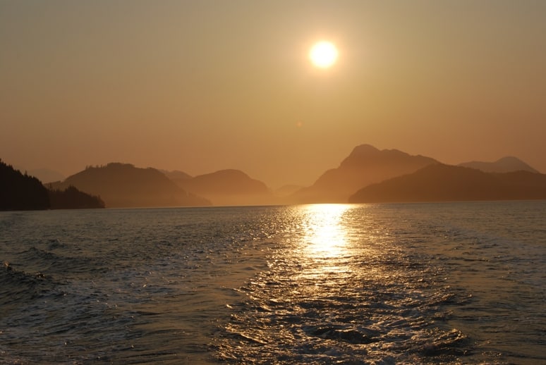
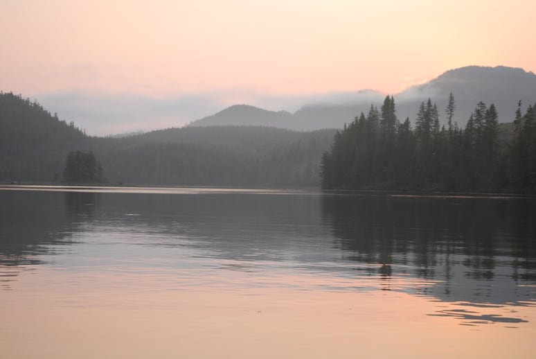
A morning sunrise shot from our stern of Mayne Passage, just before turning into Johnstone Strait.
The first half hour is down Mayne Passage for a distance of about four miles. It was almost smooth as glass, allowing me to make our second latte to get wide awake. As we approached Johnstone Strait, Kap thought she could see different color water – meaning it might be rougher – but as we pulled into the mile-wide Strait, it was very calm, and we had a 1 knot push (i.e., the current was in our direction) – not at all the weather and seas we were expecting, but we’d certainly take it!
At this point, Johnstone Strait is running almost due west, and is pretty consistently 1 to 1½ miles wide. I took over the helm while Kap pumped our black water holding tanks overboard (which is legal in Canada provided you’re in a large body of water, with good tidal inflow/outflow). Once that was complete, she got the generator started so that we could run the water maker (the intake for the water maker is aft of the overboard discharge thru-hull, and you don’t want to foul the water you’re making). At the western tip of West Thurlow Island, Chancellor Channel enters into Johnstone Strait, and we could hear a couple of cruisers reporting fog ahead. Nevertheless, we passed the Helmken Island group, passing on the Current Passage side which is standard for northbound vessels. Still very calm seas – no more than 1’ chop – with light winds, and we weren’t seeing any fog.
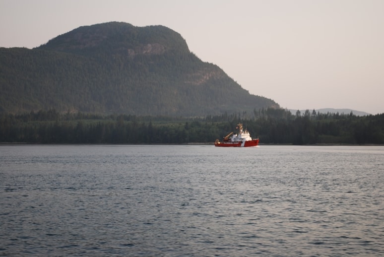
Out on Johnstone Strait with Canadian Coast Guard cutter reporting he was doing some fish surveying along the shoreline.
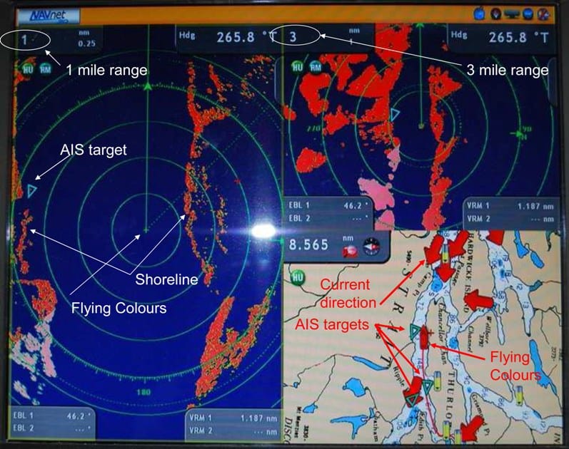
A screen shot of our radar images. This screen is split 3-way, with a large - 1 mile range - radar image on the left, a small - 3-mile radar range on the upper right, and a small Furuno chart plotter image on the lower right. AIS is our vessel tracking information that we get, identifying ships over 65' in length that are nearby. The shoreline, shown in red on the radar image, is along Johnstone Strait. On the 1-mile image, the rings emanating out from Flying Colours are 1/4 mile apart, so we're 3/4ths mile from the shore to our left, and 1/4 mile from the shore to our right - and therefore, Johnstone Strait is just a smidgeon over 1 mile wide at this point.
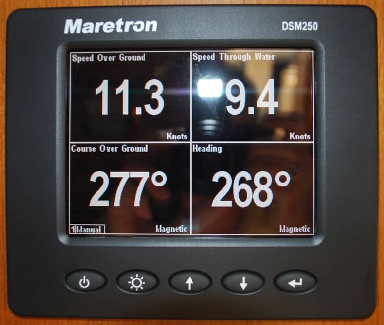
One of our really handy instruments - a small 3"x4" screen above the helm station that gives us (in the top two boxes) our "speed over the ground" and "speed through the water". The speed over the ground is measured by GPS. The difference between the two numbers gives us the water current speed - in this case, speed over the ground is faster, so we have a current "with us" - or helping us - of just under 2 knots. The bottom two give us our heading and actual course over the ground (as measured by GPS).
Just before we got to our normal turnoff at Savannah Channel – that takes you to Lagoon Cove – we could see fog ahead, a low-level band that stretched all the way across Johnstone Strait. From a distance it’s impossible to tell how dense it is, or how long you’ll be in it.
This is another logging operation on the shore of Johnstone Strait. This time, the "camp" is supported - most likely for offices, housing, and feeding - by the old retired B.C. Ferries ferry that's tied up on the shore. We saw this same ferry deep in Teakerne Inlet last year on our way south, and we wondered what the heck it was doing in such a remote area - now we know.
We heard one cruiser named Tiger Lily calling Lagoon Cove on VHF CH 16, but he apparently never reached them as we never heard a response. My ears perked up, as there’s a Fleming 55 named Tiger Lily on the Fleming Owner’s Forum web site that I’ve created and manage. A few minutes later I noticed a familiar-looking boat profile heading south and hugging the shoreline. I put the binoculars to it – sure enough, it was a Fleming 55 – and I figured it had to be Tiger Lily. I grabbed the VHF radio mike and called. It was Larry Achtemichuk, an artist from Vancouver, B.C. who’s a registered member of the owner’s forum. Larry indicated he was on his way south from SE Alaska and they’d had a wonderful cruise since departing Vancouver on June 28th.
Shortly after that encounter we ran into the fog. That brought both of us to the helm, one to drive the boat and concentrate on watching ahead for hidden logs, and more importantly other boats coming our way. The other hunkers over our two radar screens, one set for 1 mile range and the other for 2 miles (and alternating it out to 3 miles from time to time to get a longer view). Traveling at 9 knots doesn’t seem like it could get you into very much trouble, but these are pretty busy waters and there aren’t any lane markers to keep other boats separated. The closing speed with opposing boats will be at least 20 knots, and with quite a few planing-hull boats (and people who don’t care how much fuel they burn) cruising at 20 knots, the closing speed is over 30 knots. In ¼ mile visibility fog, you can have a collision before you know it if you aren’t carefully watching with both eyes out the window and on your radar screen. Luckily, the band of fog was very narrow, and we passed back into 15 mile visibility and sunny skies within about ten minutes.
We know a vet in Port McNeill who has treated both Raz and Gator before – at the North Island Veterinarian Clinic. The clinic operates three days a week in Port McNeill and four days a week in Port Hardy, 30 miles to the north. The question was, could they get us in, and would they be in Port McNeill on Friday? As soon as they were open I telephoned and was told that, yes, they could see Raz at 4:30PM, which gave us sufficient leeway if the cruise in Johnstone Strait turned out to be slow. I was sure the woman on the phone told me the vet was in Port McNeill that day.
Next, we needed to find out if one of the two marinas in Port McNeill had overnight moorage room for us. At just under 62’ overall length it’s a bit more difficult for us to get moorage now, so we usually plan further ahead. This time we hadn’t. I called the Port McNeill Marina where we’ve stayed in the past and got the news that they didn’t have room for us – and suggested we try the Fuel Dock Marina. Our good cruising friends, Jim and Christie Caldwell on Nordic Tug NOETA had earlier told us “the only place to stay now in Port McNeill is the Fuel Dock Marina”, so I gave that a try next. A young woman named Maddie answered the cell phone call, and she was very accommodating – yes, they definitely had room for us, and to call them on VHF CH 66A as we approached their breakwater. Having those two uncertainties resolved made the rest of the cruise a log more comfortable.
First Nation’s village of Alert Bay near Port McNeill. We visited this last year and toured the very good museum. It reportedly has the tallest totem pole on the West Coast.
By 12:30 we were passing the First Nation’s village of Alert Bay on Cormorant Island. This is always a good sign that Port McNeill is close. At that point, Johnstone Strait has become Broughton Strait, and it’s less than 4 miles into Port McNeill. Kap checked the fuel tanks – we have four, two forward tanks that (combined) hold 655 gallons of diesel and two aft tanks that hold 370, for a total of 1025 gallons. The two aft tanks were each down to about a quarter full, so we decided to stop at the fuel dock to fill up before going to our slip. It only took 281 gallons total, but at $3.93/gallon it cost $1,104 to fill up.
After much-needed showers, we headed up to the veterinary clinic for Raz’appointment – only to find them closed – it must be a Port Hardy day. A quick call confirmed that, and after trying to find a groomer in town who could do the nasty deed, we booked an appointment for Saturday morning at the vet. We’d now have to figure out how to get to Port Hardy, 30 miles away.
Grumman Goose taxiing
Next morning, the sound of some really throaty engines brought us both to the deck to see what was coming in. The only planes you see in these parts are on floats, but this one was an old pre-WWII-era Grumman Goose, an amphibian with two Pratt & Whitney Wasp radial engines, flown by Pacific Coastal Airlines. A few minutes later, a group of about six guys came out to the end of the dock, with musical instruments in hand and their luggage on a cart being pushed behind them. They were apparently a band being flown out by charter to someplace in the Broughton’s that was having a party over the weekend. They were really stuffed into that Goose!
Sinbad, owned by Joel Diamond
A while later, a large 90′ private yacht named Sinbad arrived at the fuel dock – the stern of Flying Colours was facing the fuel dock from the other side. We see it in the Broughton’s every year, and it’s owned by Joel Diamond – so next time you pay your parking fee at a Diamond Parking Lot around the Pacific Northwest, you’ll know that your money is going towards the upkeep of this boat.
Saturday morning, when I asked at the fuel dock for advice on available transportation to get Raz up to Port Hardy, they said, “oh, we have a courtesy car – go see the counter guy at the CAB Auto Parts store at the top of the dock and he’ll arrange it for you!” Sure enough, I went to this very friendly and helpful auto parts store, and the guy handed over keys to a van parked outside – without even knowing who I was, or looking at my driver’s license, or making me sign anything. All he asked was that I bring it back full of fuel. (Turns out, the Fuel Dock Marina, the nearby Laundromat, the auto parts store, and a movie theater in the shopping mall are all owned by the same family.) Kap helped me get Raz into a collapsible crate from the boat, and off I went. The anal gland problem was resolved in about two minutes, and I was back at the boat by 12 noon.
Since we were heading into the Broughton’s the next day, we needed fresh vegetable and milk provisions so we walked to the very good Market IGA store in Port McNeill that’s about 4 blocks from the marina. When we returned to Flying Colours, there was a note stuck to the transom – from Doug and Melinda Rella of the Admirella, who live in Edmonton and keep a 40’ Californian (it’s a brand of boat) in Sidney. We buddy-boated off and on with them during our trip to SE Alaska in 2008, and had met up a couple of times since. They had just arrived and were on their way south from a fishing trip to Prince Rupert and wanted to get together for a drink. A while later they came over to Flying Colours and since it was 5PM in Chicago by that time (i.e., Happy Hour time), we broke out a couple bottles of wine and caught up on news.
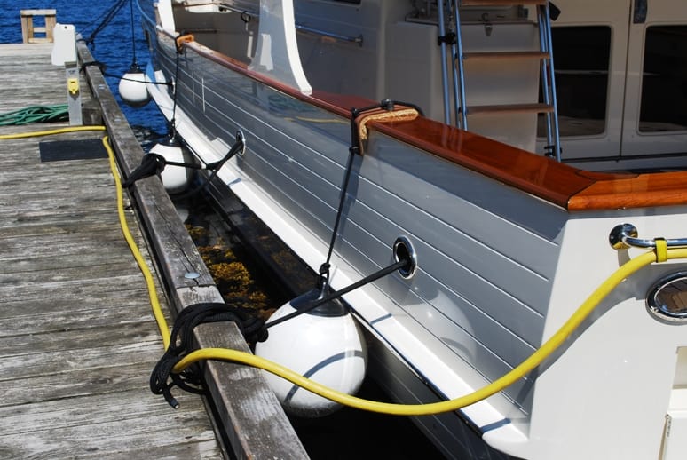
Flying Colours against the dock, with fenders holding us off about 16” – plenty of room for ZuZu to land in the water.
While we were standing in the cockpit of Flying Colours, ZuZu was out with us. To keep her from jumping off onto the dock, we had an elastic harness on her, with a 5’ lead that I had wrapped onto my wrist. At one point, I had my back to her and didn’t notice that she’d jumped onto the cockpit teak rail behind me. Suddenly, the lead on my wrist jerked and when I looked around I saw that she was jumping onto the dock. The lead had gone tight, though, and just as she landed it snapped her back and she went straight into the water between the boat and the dock. That jerked the lead off my wrist. I immediately ran to the side door halfway up the boat and ran back on the dock to see if I could scoop her up out of the water. Before I could get there, she swam at lightning speed to the stern of the boat, turned around the swim step, and just as I got there she propelled herself straight out of the water and onto the swim step. In one movement, she then leapt onto the teak rail 4’ above her, then shot straight into the salon, throwing off salt water as she went. Kap ran in after her and found she’d gone straight to the pilot house and jumped up on the instrument panel. Kap grabbed a towel, put it around her and brought her back to the cockpit. I already had the fresh water hose out, ready to wash her down as soon as Kap brought her to me (licking herself dry with all that salt water would really make her sick). But this little 7 lb bundle of muscle had other ideas. She fought and clawed like crazy, and there was terror in her eyes. It took Doug, Melinda and me to hold her as I washed her down. I had blood running down my arms when we finished, and Doug had at least 10 scratches on his arm. That’s twice now that she’s gone swimming next to the dock, so Kap immediately nicknamed her Dippin’ Dots – after the super-cold frozen beads of ice cream that we get at Seattle Mariner’s games. ZuZu didn’t think it was funny!
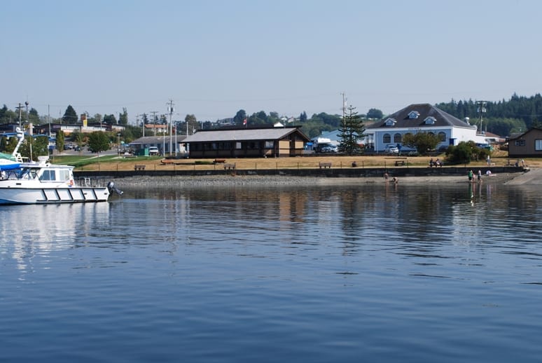
Downtown Port McNeill and restaurants at the waterfront. In this part of the world, scenery is scenic; towns and villages along the waterfront are mostly working towns.
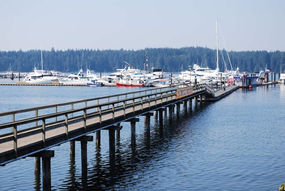
A view of the Fuel Dock Marina from shore – because of the tide flats, there's a long pier leading out to the first dock. At low tide, it's stinky gooey mud all the way out to the hinged ramp that allows for the floating dock to rise and fall with the tide.
There's a large fishing fleet based at the Port McNeill’s government dock.
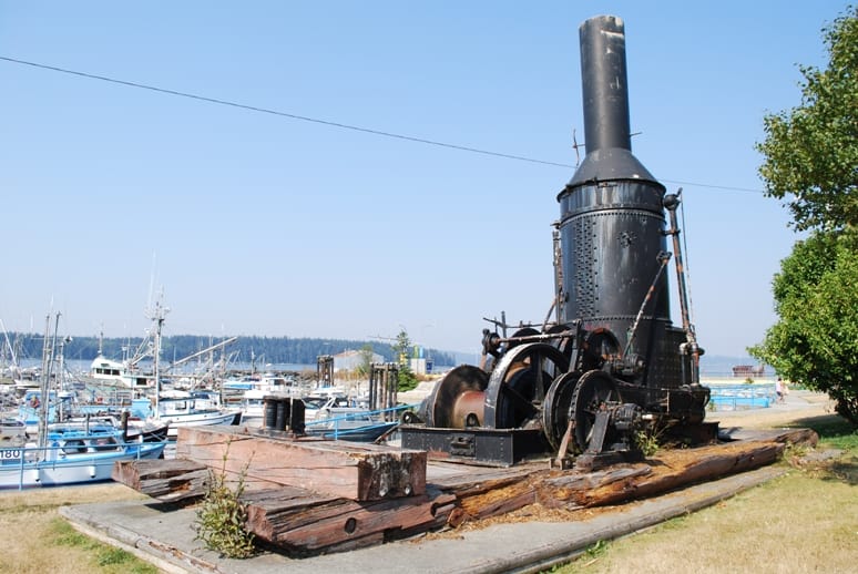
An old relic of a steam donkey at the shoreline park. The name donkey dates back to the old seafaring days when an engine like this was used to load/offload vessels. For the past 100 years, it's been a typical logging engine used to skid logs.
With that excitement over, we headed up to the Sportsman’s Steakhouse on the shore for a nice dinner. Dick and Melinda left the following morning before we were up, but with the time seeing them, Kap and I decided we needed another day in Port McNeill to get ourselves caught up. We managed to get our moorage reservation extended another night.
By the time we got back to Flying Colours it was dark – and that’s a problem for Raz going ashore one last time for the night, as her night vision is almost gone. Nevertheless, the trip ashore was necessary, so we got both dogs in the cockpit to get their leashes on. With Kap’s wrist still not able to take much weight, our procedure is for me to lift both dogs off the boat – using the side door that’s almost level with the dock – and then Kap takes Gator and I take Raz. On some docks, Gator can easily jump from the open door to the dock, but at B.C. docks where there typically are bull rails – 6”x6” wooden tiedown rails – he usually knows it’s difficult to jump and he waits in the open doorway for me to pick him up. This time, though, just as I took the weight off his stomach to lift, he jumped – but because I had already lifted a few pounds of weight, he didn’t get a good jump and went straight into the pitch black water between the boat and the dock. Kap was at my side and she quickly reached down and grabbed his lead, then while he was flailing around in the darkness (almost certainly terrified), she lifted him back aboard.
Geez! What’s going on? This is twice in one day that a cat or dog has gone into the water! Kap later developed a conspiracy theory – she went for the unintended nocturnal swim off the dock at Sullivan Bay last year, ZuZu’s gone swimming twice, and now Gator’s had his dunking. Only Raz and I remain – and Kap is warning Raz to watch out for the nudge from me…….
That’s all for now.
Ron