
From the Broughton’s to SE Alaska, this month is known as Fogust (as in “fawg-ust”). This morning certainly lived up to it.
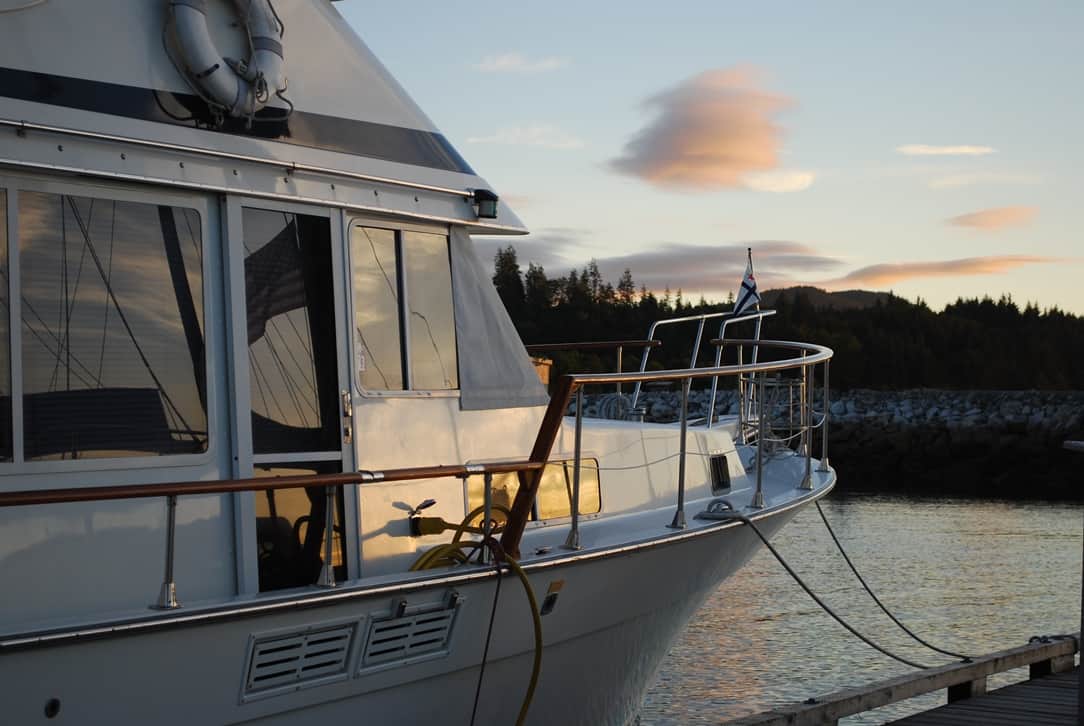
The evening before our departure was a bit troublesome. To the untrained eye, it looked very nice, but the stacked lenticular clouds above the bow of the boat across the dock from us indicated high winds on the west coast of Vancouver Island. Lenticular clouds (named because of their lens shape) are well known to soaring pilots, as they're orographically produced when high winds are blowing against a perpendicular mountain (or mountain range). The deflected winds carry moisture, which turns into cloud when the atmospheric temperature reaches the dew point. Seeing stacked "lennies" is very unusual.
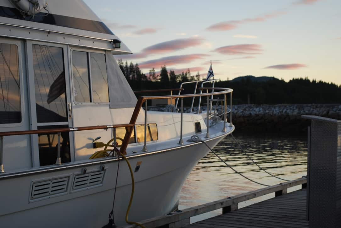
Six minutes later when I snapped this photo the lennies had separated - not dissipated, as you can still see all of them - but had moved apart. Stacked lennies are the result of moisture layers at various altitudes of wind, all hitting the mountain (or mountain range) from the same direction. When they separate it indicates the wind direction at the various altitudes has slightly changed direction, but still the same force.
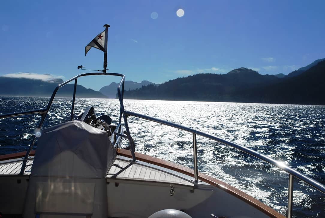
We departed Port McNeill just before noon. After last night’s display of lenticular clouds to the west that usually portend high winds, it looked like a perfectly nice cruising day – clear blue sky, light winds, although a bit on the cool side.
(Remember, you can click on any photo to enlarge. Also don’t forget that the formatting of this blog entry is better – and the captions line up with the photos – when you can better read it online at www.ronf-flyingcolours.com – click on this link to go there.)
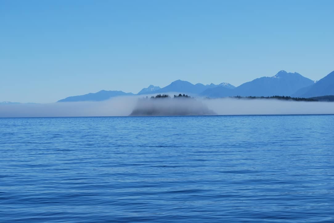
The fog bank ahead of us was visually imprenetrable, although you could see bits of the small islet ahead of us. The challenge with these is, it's impossible to know until you're in it how dense it will be, or how wide the band of fog will be.
Caution: If you see any links in this blog post (other than the one above for the blog site), do not click on them. For some unknown reason, malicious links are showing up in this post.
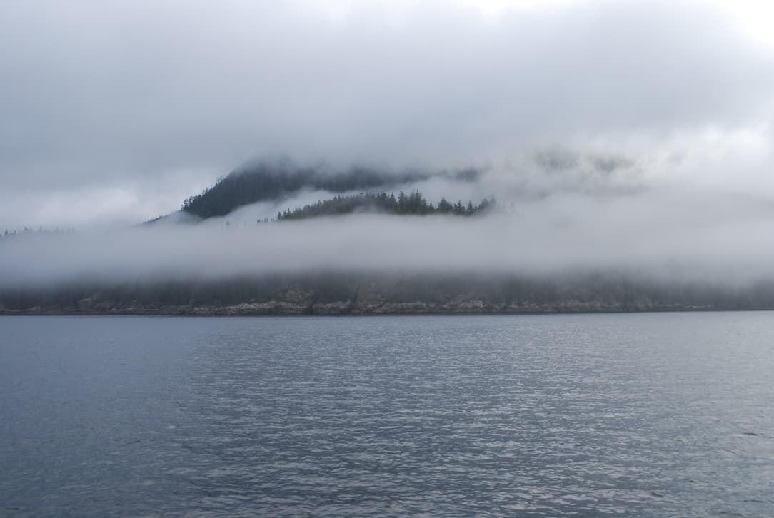
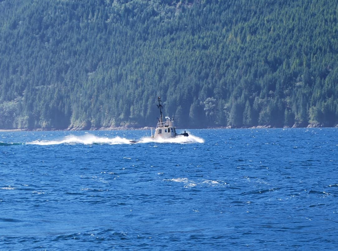
The initial cruise south on Cormorant Channel took us to Blackfish Sound. There, Kap’s course turned NE to take us around the north side of Swanson Island. Ahead we could see a low band of surface fog that was less than 100’ tall – we could see the treetops on the island above the fog. Usually when we hit this type of fog it might be thin enough that you can still see ahead and to the side once you enter, and if it’s a lucky day, it’s just a narrow band that you pass out of in a couple of minutes.
This time, though, it was dense and the visibility once you entered it was almost nil. At first, I was at the helm, and couldn’t believe it when I saw a 40-50’ cruiser appear out of nowhere aiming head-on for us. We each did a quick turn to starboard and cleared with no problem. Moments later, a small fishing boat going way too fast in the fog almost T-boned us. It was time for serious radar watch, so Kap and I exchanged positions and she took over the helm as I got in close on the radar. Before we did that, Kap pushed the buttons on our VHF radio to initiate our automatic foghorn, but for some reason it wouldn’t start the 5 second underway blasts to alert other boats of our presence. The more pressing matter was to ensure we didn’t have any collisions,
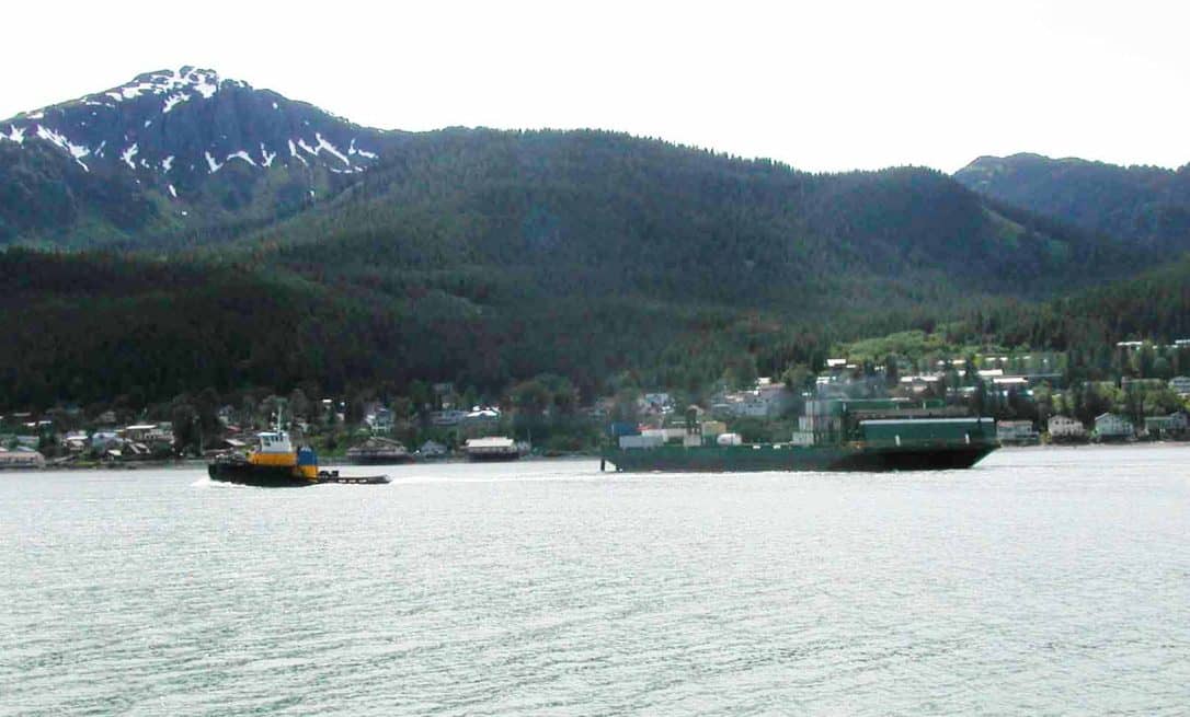
This is the tug and tow that we heard, but could not see, off our port side - the Pacific Titan - at 105' - towing a 380' barge from SE Alaska. This would not have been a pretty rendezvous between metal and plastic, and it's why we're so careful whenever we're in fog. The Pacific Titan was the tug and tow that I went to SE Alaska on in 2003, and this photo was taken from the shore on the south side of Juneau after I'd been dropped off. It was heading south, with maybe 100 containers aboard the barge, rather than the 700 she came north with.
Not more than two minutes later, Kap heard a foghorn off to our port side. Searching for what it might be, we soon spotted an AIS triangle symbol on the radar, with a direction arrow that was aimed directly at us. It was still a mile away, so we put a radar EBL line on it to see if it would pass in front of us or behind.
I ran the cursor over to the AIS symbol to pick up the data box and was surprised to see that it was the Pacific Titan, the 105’ tug/towboat that we went to SE Alaska on in 2003 and 2005. The data box indicated a speed of 11 kts, and as we watched, she was coming right down the EBL line to intersect with us – in other words, on a direct collision course. We cut the speed, but we were so close now that it stayed on the EBL line. Kap stopped dead in the water, then cranked the wheel over hard, goosed the engines, and we did a 180º turn to get the hell out of there. The Pacific Titan, towing a 400’ barge passed within ¼ mile. We never saw them, and I presume they never saw us – but if we hadn’t seen their AIS symbol on the radar we might very well have had a metal and plastic rendezvous in the pea soup. This is the reason Kap and I never travel in fog – but sometimes there isn’t a choice, as the conditions can go from unlimited visibility to a dense fog bank in a matter of minutes at this time of the year.
[After we got through the fog bank, I sent a text message to Captain Doug Myers, the skipper of the Pacific Titan – who has become a good friend of ours since our two cruises on his tug to SE Alaska – asking if he’d seen or heard us in the fog. From a radio call position report to Comox Traffic a bit later, we knew his First Mate was at the helm, and we knew Doug was probably asleep at the time. A few hours later, he sent back a text reply – “Oh @#$%! That’s scary in the fog! R fears are that non-pro’s don’t react properly (& u did) when we have a close quarters situation. Thanks for checking in with the other cap! Fair weather and following seas.”]
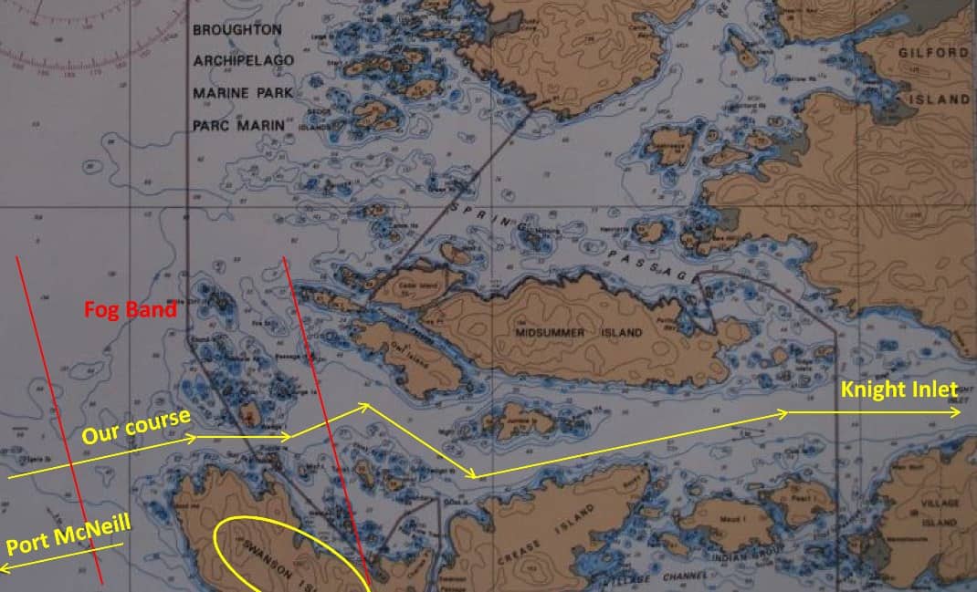
Here's our route through the Puzzle Islets, showing the approximate location of the fog band that we approached from the left side of the image. The S-curve through the small islands in fog was not our idea of a fun morning, and luckily the fog band lifted just minutes before we got to it the second time, and our cruise through the islets was fog free.
After that near encounter with the Pacific Titan, Kap fiddled some more with the VHF radio to get our automatic foghorn set up, and started to get really frustrated when it wouldn’t work. My thought was, to hell with it, let’s keep ourselves safe with the radar and we’ll worry about the foghorn later. She would have none of that, and for some reason became fixated on getting the foghorn to work. In further frustration, she elected to turn 180º to exit back out of the fog, where she could have a look at the problem. It’s times like this that we have our disagreements, but our pact is that she’s the Captain, and after discussing our differences we go with her decision if it’s one that affects safety.
Once back in the bright sunlight and cloudless blue sky, Kap searched around for about a half hour, punching the VHF radio setup buttons over and over again to make sure she was doing it right, and when she was satisfied with that, she started tracing the wires from the back of the radio, across the upper dashboard, and to the foghorn mounted above the pilot house roof. Nothing was loose, and there was no indication of where the problem could be coming from. The loudspeaker hailer wasn’t working either, so the problem was either in the radio itself, in a bad wiring connection, or the foghorn had failed. A quick call to Mike Radding in Southern California didn’t provide any other ideas. [It later turned out to be a simple switch setting on our dash panel that wasn’t set correctly for the horn to operate, and the problem was quickly resolved. Of course, after that, we didn’t see fog again!]
As I idled Flying Colours in circles, I could see that the fog bank was either receding or dissipating. After a quick discussion, we decided to head into it again to see if we could punch through. Somewhere in the murk was the Puzzle Islet group that we had to wind our way through to reach Knight Inlet, and Kap wasn’t keen at all on going through this area dotted with small islands and rock outcroppings that could jump out and bite us at any minute. She has a healthy fear of inaccurate GPS positions, and the last thing you want to chance is a 50’ position error (or worse) when you’re going through a narrow passage.
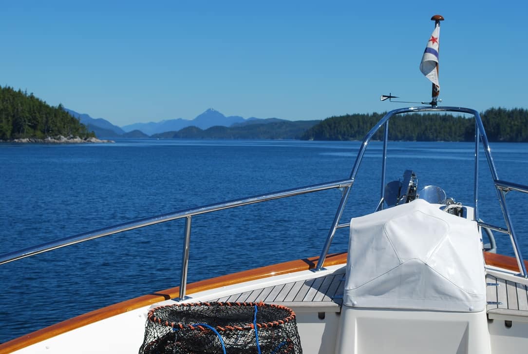
Once out of the fog bank it was again clear blue skies, light wind, calm seas, and we were slowly cruising up Knight Inlet.
Our luck held this time. The fog bank was slowly moving west and our cruising direction was to the NE. A mile or so before we entered the Puzzle Islets we had reasonably good visibility. The fog bank had cost us upwards of an hour, but we were now safely through it.
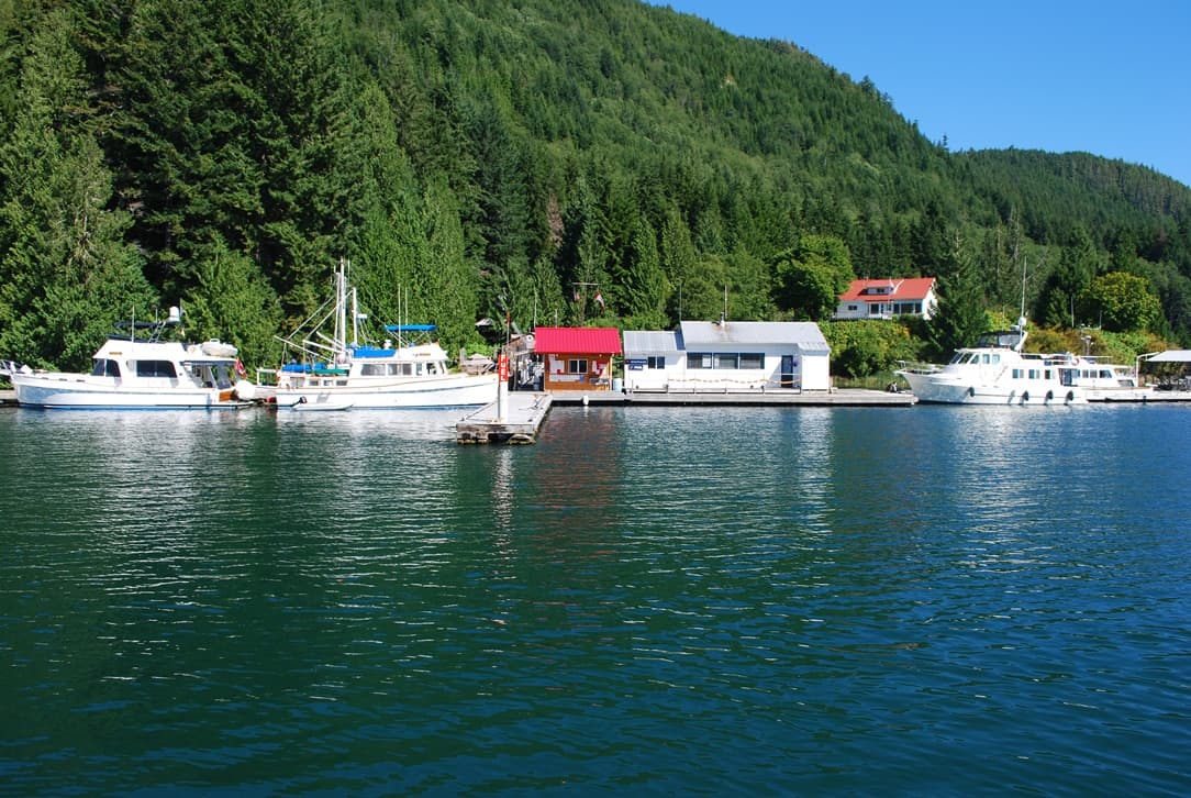
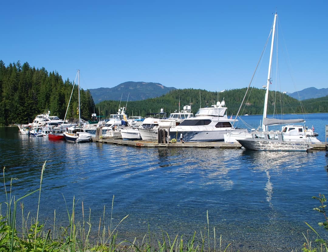
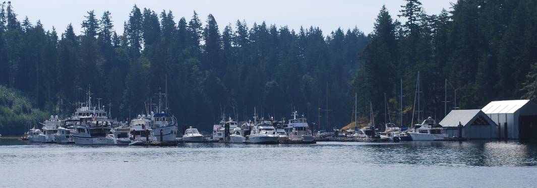
The rest of the 15 nautical mile cruise eastward on Knight Inlet was without incident, the waters were calm, and at the east end of Turnour Island we turned south into Clio Channel for the last two miles into Lagoon Cove. By now it was 3PM, which is later than we like to get into Lagoon Cove, as this is the obligatory stop for every cruiser on the way north or south between Desolation Sound and the Broughton’s. Bill Barber, the owner of Lagoon Cove, can really pack the boats into his small marina, but the later you arrive, the less desirable the moorage spot can be.
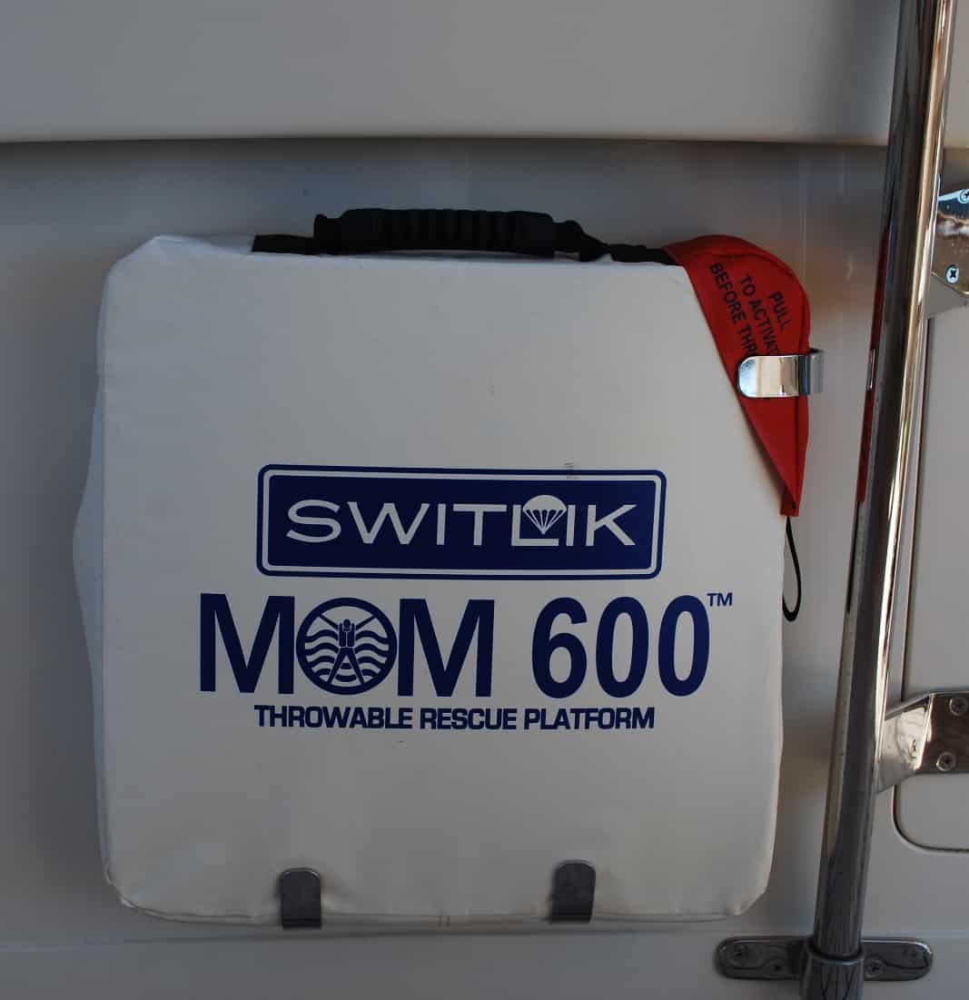
After all that drama with the fog, maybe this is a good time to talk about the latest safety gizmo we have aboard Flying Colours - the Switlik MOM 600 - which stands for "man overboard module", and it's function is exactly for that. Kap gave it to me for my birthday last year, and the reason was, while she's at the helm in most close quarters situations - docking, undocking, anchoring - I'm out on deck handling the lines and fenders, and maneuvering the anchor - so therefore, I'm the most likely to be the one who goes overboard. Once a person is in the water - and it's water that's usually around 53°F, and a human lasts but minutes in it, and with wet clothes on it's virtually impossible to climb back on the boat - some fast action is needed for recovery.
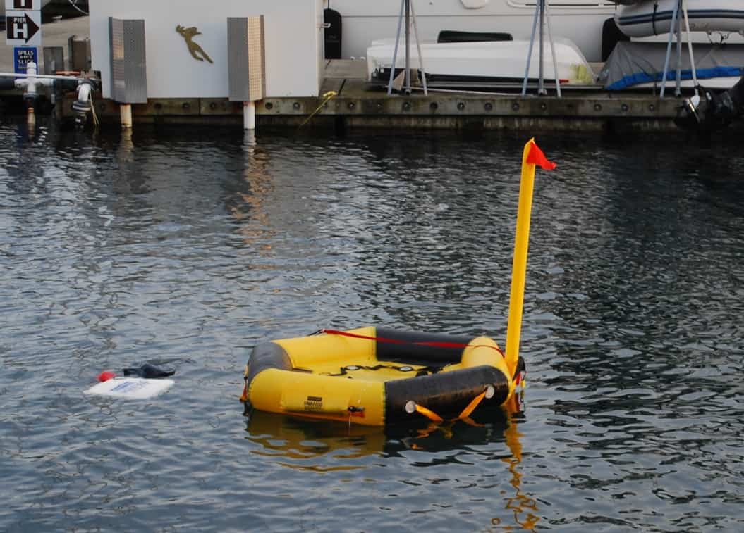
If a man overboard situation arises, the person still on the boat runs to the aft cockpit, pulls the MOM 600 from the cradle and simply throws it in the water in the direction of the person. It automatically inflates as shown in the photo here, and at the very least the person can cling to the side of it, or if he/she still has the strength, can attempt to climb aboard it.
Along the way, I did prep work in the galley on a great stuffed mushroom recipe (sautéed mushroom stem bits, cream cheese, and bacon, then broiled after the mushroom caps are stuffed) that I got from Judy Stark of the Pigeon Hill Ladies Group. This would be our better-than-the-rest offering for the night’s cocktail hour at Lagoon Cove.
When I called Lagoon Cove on VHF channel 66A, Bill’s familiar raspy voice responded, obviously pleased to hear from us. At our request for moorage, he came back with the good news that there’d be no problem getting us into a good moorage spot and to call again when we had the marina in sight.
The familiar sight of Lagoon Cove as we approached.
Just outside of Pearly Island we called again, and Bill told us we’d have the side tie spot on his fuel dock, with our stern directly in front of the marina office building (the building with a red roof in the photo). That’s indeed a good spot, as we can get 50A power just 6’ off our stern, using our two 30A splitter pigtail. Bill also told us there wouldn’t be a cocktail hour tonight, but rather a full potluck dinner on the Happy Hour deck in honor of B.C. Day on Monday. Oh well, my stuffed mushrooms will just have to do as a potluck dinner entrée.
We pulled into Lagoon Cove right at 4PM, and Bill was there on the dock to take our lines and tie us to the dock’s bull rails. Kap jumped off and gave Bill a huge hug, as his expertise in talking us onto the dock makes her boat handling look really good. There’s almost always current running one way or the other at the marina docks throughout this area, and it’s easy to make your boat handling skills look suspect if you’re not careful.
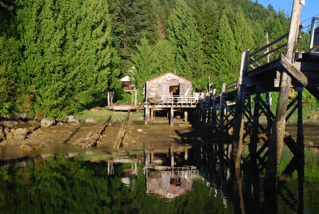
The Happy Hour deck is on the shore, connected by a long dock on pilings that connects with the float docks. The deck is part of an ancient workshop that kept boats in the area alive decades ago. The ramp haul-out tracks look like they're from another era and would never work again, but about three years ago we watched as a local fishing boat was hauled out for a quick repair, using an old diesel donkey engine reeling in a steel cable that looked rusted through. Very little up here ever goes to waste.
At 6PM, Kap and I headed up to the Happy Hour deck with a nice bottle of red wine and my stuffed mushrooms. Every morning Bill sets 2-3 prawn pots somewhere near the marina, and with the day’s catch he provides about 200 prawns for each evening’s cocktail hour. This one was no exception, plus another boater brought a big slow cooker of spaghetti and meatballs, another brought a serving dish loaded with teriyaki meatballs, still another brought a large dish of scalloped potatoes. Others brought salads, someone brought a large peach cobbler, and another a huge plate of brownies. It was a good feast, ending with two of Bill’s famous bear stories that we’ve all heard dozens of times (but never tire of hearing).
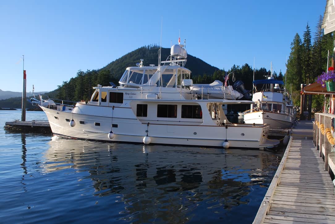
Flying Colours on a side-tie at the Lagoon Cove fuel dock. It's a great moorage spot, as the shore power is directly behind the stern. The only problem with the location is if the marina fills, and other boats are then stern-tied to the left of us and it gives little privacy in our side windows. We have our fenders out just in case, but no one else came in.
Sunday, our plan was to head south to Blind Channel, and that cruise is always dictated by slack time at Chatham Channel, about seven miles south of Lagoon Cove and separating the B.C. mainland from East Cracoft Island. At the bottom of the channel is a two-mile long shallow passage that you must pass through with absolute precision to stay in the center of the channel. At either end are sight markers, and with one of us at the helm, the other watches continuously with the binoculars to ensure the sight markers are perfectly lined up – and if not, giving course corrections to the person at the helm. The current in the passage can run 6-8 knots outside of slack time, so it’s imperative to time your transit for slack.
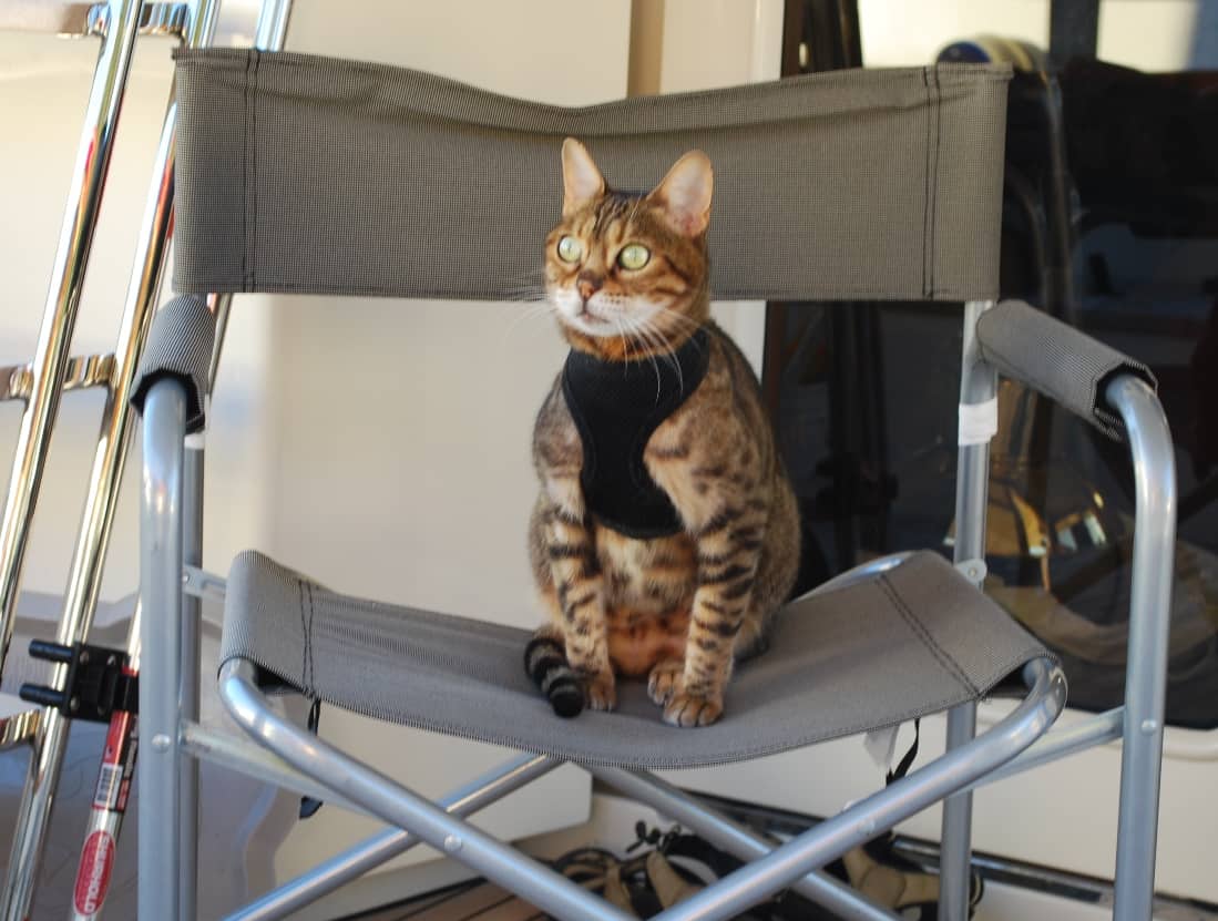
ZuZu is not wild about the elastic harness and leash she has to wear when we take her off the boat. We call the harness her "jogging bra", and that doesn't amuse her either. Frankly, I think she looks pretty buff in it.
Today, slack at Chatham Channel was at 7:10AM, so we timed our departure from Lagoon Cove at 6:30AM. We were the first boat away from the dock, and after slowly winding our way through a passage outside Lagoon Cove called The Blow Hole – which is also very shallow (16’ under our keel at one point) – we continued into the main Chatham Channel.
The big weather concern for the morning was wind, fog and low clouds in Johnstone Strait. It's a busy waterway, but the more pressing problem is the high number of logs floating in the water, and they're hull-punchers.
Once through Chatham Channel, our next big concern was the weather condition in Johnstone Strait. Kap – who is a fanatic about weather – had checked every available weather source, and the forecasts for Johnstone Strait were all over the map. Environment Canada was the most conservative, predicting there would be gale force winds by early afternoon (winds at 35 knots or higher are gale force) – but any cruiser up here knows that, for whatever reason, Environment Canada always seems to over-forecast the winds (five years ago, they were spot on with their forecasts, but now they’re always on the high side). A new Internet service that Kap subscribes to, called PredictWind said the winds would be no greater than 15 knots. She has come to rely more on PredictWind, but sometimes it too is off.
To our surprise, the fog burned off the minute we turned onto Johnstone Strait and a bright morning sun came out. Now the problem became watching for logs in the water when there's a reflective glare from the sun on the water. For me (with my 64-year old eyes), it's impossible to read the instruments in the pilot house with sun glasses on, yet it's hard to look at the water without them. Life on the water is really tough!
Coupled with the winds, though, the current on Johnstone Strait would be against us all morning – which means the current would be on an ebb tide flowing north, and our direction of travel was south, so it’s like flying into a headwind. Making matters worse, whatever wind we’d have would be blowing south (our direction), and whenever you have what’s known as “wind against current”, you tend to get bigger, what are called square-shaped waves, that are uncomfortable. If this indeed proved true, ZuZu wouldn’t be a happy camper, and she’d likely set off our “rough-o-meter” – which means, “get me out of this rough water!”
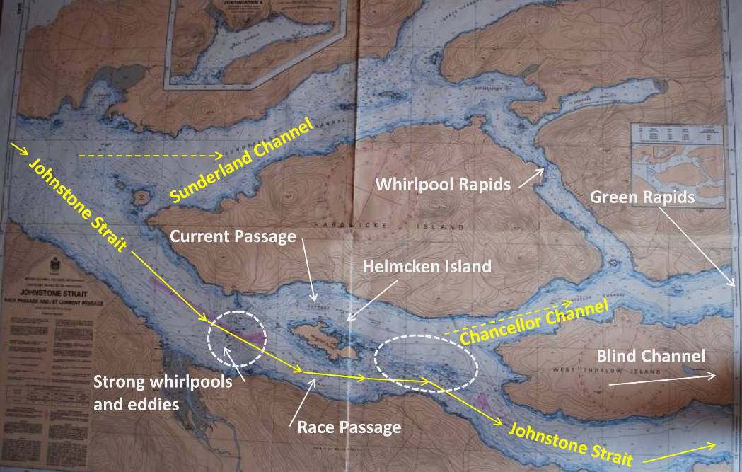
With the current against us, our choices were (1) to stick it out on Johnstone Strait, and face the even stronger current in the passages around Helmcken Island, or (2) turn up Sunderland Channel and have to go through Whirlpool Rapids and Green Rapids, or (3) go through Current Passage and duck up Chancellor Channel and go the back way, but have to contend with Green Rapids. We chose option #1. duck up Sunderland
As we approached Johnstone Strait, a cloud bank was low over the water, but looking ahead through our binoculars we both thought it looked pretty good – good enough, that is, to give it a try. Sure enough, it wasn’t bad at all, and with winds that never topped 20 knots, we had a pretty good ride for most of the way.
At Sunderland Channel, we had the option to duck in and go the back way to Blind Channel, skirting around the north and east sides of Hardwicke Island, then down Cordero Channel to the turn into Blind Channel Resort. The difficulty with that route is, there are two rapids you have to pass through, Whirlpool Rapids and Green Rapids, and particularly the first one has to be navigated at slack tide, which wasn’t scheduled to occur until 2PM. That would delay us at least three hours getting into Blind Channel.
The second option was to pass down the east side of Helmcken Island on Current Passage, then turn into Chancellor Channel, along the south side of Hardwicke Island. That route would bypass Whirlpool Rapids, but we’d still have to contend with Green Rapids.
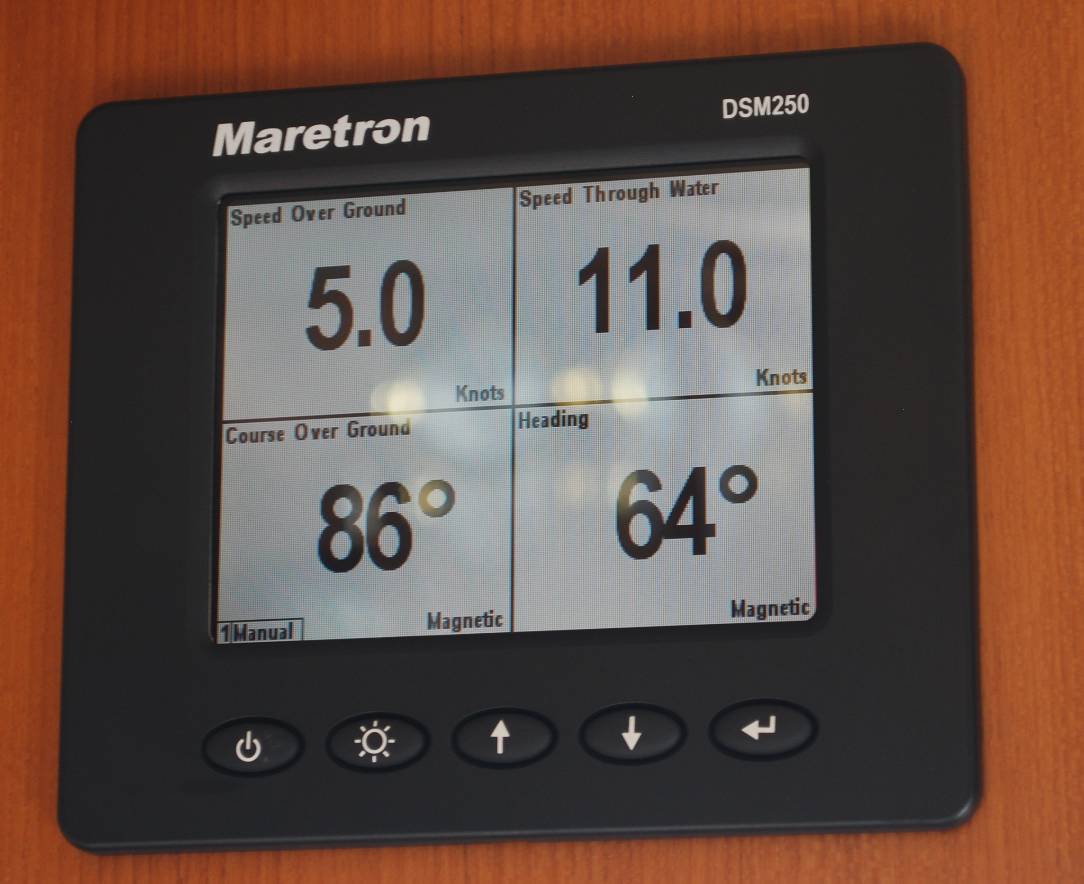
Our dashboard gauge that shows speed-over-ground (upper left) versus speed-through-water (right) tells us how much current we're facing. If we're going 11.0 kts through the water, but our GPS signal indicates we're only going 5.0 knots over the ground, the difference in the two numbers means we have a 6 knot current on our bow, slowing us down. This photo of this reading was taken halfway through Race Passage, and at times the SOG number was down in the 4.x knots area.
By vote of 2-0 (a lot of our votes on Flying Colours are not unanimous, but this was), we opted to stay out in Johnstone Strait and take whatever weather and current we found. As we hoped, the weather never got any worse, and while the current remained against us the entire way, it wasn’t a problem.
At Helmcken Island, we hit the only really serious current of the day – running as much as 7 knots against us. Increasing power to get us up to 11 knots running speed, our GPS indicated we were only doing 4 knots over the ground. It took us what seemed forever to pass Helmcken Island. There are always lots of swirling tidepools in Race Passage along the west side of the island, and whenever we’d enter one of them, Flying Colours’ nose would first sweep 20-30º to the right, then swing back 20-30º to the left. Flying Colours is a 70,000 lb boat, and she was tossed around like a matchstick in these whirlpools, which really gives us an appreciation of the power of water.
From a distance, and looking through our highest-powered binoculars, we thought this craft coming up the center of Johnstone Strait was a submarine. That would be highly irregular, and as it passed by we could see it was a tiny working tug - the type that are typically used for forming up log booms. It must have been getting repositioned for a logging operation somewhere up north.
At 11:30AM, we turned up Mayne Passage and were now within a few miles of Blind Channel Resort. As we rounded the last turn, we hailed them on the radio to ask if they had moorage space for us for two nights. This weekend is one of the big summer holidays in British Columbia – B.C. Day – sort of like our 4th of July – and lots of people from Vancouver come this far north if they have a fairly fast boat. Luckily, we arrived in time, and got a very good slip, available for two nights.
Flying Colours tied up at Blind Channel. We're two boats to the left of the sailboat at the right side of the frame.
Like earlier stops at Blind Channel, the reason for two nights is to spread the wealth in our evening meals. The founders of Blind Channel several decades ago were a German couple named Edgar and Annemarie Richter. By some coincidence, the founders of Cordero Lodge, about three miles away and around the corner on Cordero Channel, were also a German couple named Reinhardt and Doris Kuppers (or maybe they were old friends??). In creating their respective resorts and marinas, they each established sit-down restaurants that serve excellent German dishes, and particularly good schnitzels. As it happens, I’ll cruise a thousand miles for a good German dinner, so the first night’s dinner will be at Cordero Lodge and the second night at Blind Channel. We prefer to moor Flying Colours at Blind Channel because it’s more protected from winds and passing boater’s wakes, so as soon as we arrive we put the dinghy in the water and use it to get across to Cordero Lodge.
Dinner at Cordero Lodge didn’t disappoint us. At their small casual restaurant, I always have the Cordon Bleu Schnitzel (breaded pork schnitzel, with stuffed with Swiss cheese and ham), and Kap has the regular Wiener Schnitzel (plain breaded schnitzel), with wonderful pan-roasted potatoes and red cabbage sauerkraut. We always get a good bottle of wine, and since we have to get home by dinghy, we save half the bottle for after the return to Flying Colours.
One thing we wanted to find out was the For Sale status of Cordero Lodge. Reinhardt is suffering from severe respiratory problems for several years – living down in Campbell River, and we were told he’s on 24×7 oxygen these days – and they’ve been trying to sell the lodge for about five years now, with no luck. The last two years their daughter has come up in the summer to run it, and Doris would get away from Campbell River for a bit to help out. This year, we discovered all new people at the lodge – managers who were hired for the year to run the place, and they’ve promised to purchase it if things work out. We were pleased to see the docks fairly full, and the tiny dining room was busy, so we hope it will work out. These resorts here on the Inside Passage are family lifeblood – and the only possible retirement income is if they can sell it when they can’t work anymore – so we really hope for the best.
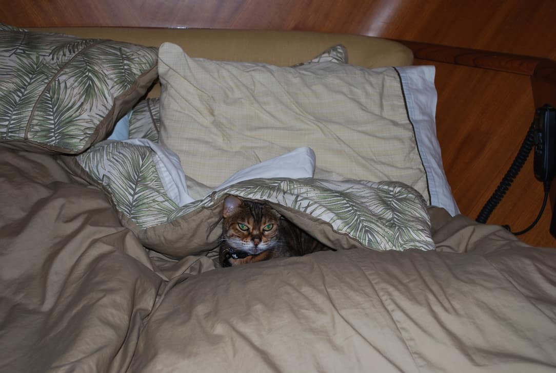
It was a lazy day for ZuZu too, and she wouldn't let us make the bed until after she got up around 10AM.
The next day was basically a lazy day. There’s little or no cell phone reception or Internet access at Blind Channel, so it makes for a good relaxing day. For lunch we like to go to an outdoor patio on shore by the office/store, where a new BBQ shack was built a year ago. They serve a Blind Channel burger, a bratwurst sausage on a bun, or a piece of locally-caught and grilled salmon.
The Cedar Post Restaurant on shore at Blind Channel Resort. It's below the multiple-arched rooftops, with window tables that look out onto the marina. The General Store is at the right, and the BBQ patio is in front of the building.
Dinner that night was at the resort’s Cedar Post Restaurant, a rather elegant city-type restaurant that’s really surprising way out here in the boonies – linen tablecloths, excellent food, and a good wine list. Each dinner plate is topped with edible flowers
There are four generations of the Richter family who run the resort – and although Annemarie passed away in 2003, Edgar (who is now in his 90s) stops by from his nearby cottage at least once a day. The next generation, Phil Richter (and his wife Jennifer) runs the General Store, and she spends most of her day baking a dozen loaves of wonderful whole wheat bread and cinnamon rolls that they sell in the store. The third generation, Eliot Richter (and his wife Laura) runs the restaurant, and both are well-dressed servers for the nightly meal. The fourth generation, 1- and 2-year old sons of Eliot and Laura sometimes put in their appearance, but neither has begun work yet.
By now it was Monday, and our big decision was what to do with our next three days. Our plan was to park Flying Colours at the April Point Marina (across Discovery Channel from Campbell River) for a month, fly home to resume meetings and decisions on the house construction, then return in early September to cruise a few more weeks. It would take one day to get south, and we wanted to have the boat all set up by Thursday at the latest. One option was to go down “the back way”, by Dent Lodge and spend a night at the wonderful Nordstrom-family lodge that’s been turned into an elegant resort and marina – which would be a very long way around to April Point. Another was to run straight down Johnstone Strait, through Seymour Narrows, and into April Point – which would be the fastest and shortest way. After talking it over, we decided to leave on Tuesday morning, arrive at April Point that afternoon, and then have all day Wednesday and Thursday on the boat at the dock.
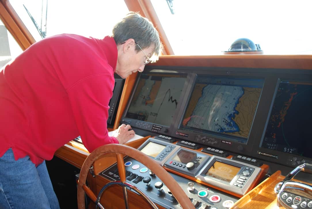
Kap is tweaking our course plan on the chart plotter, in preparation for engine start.
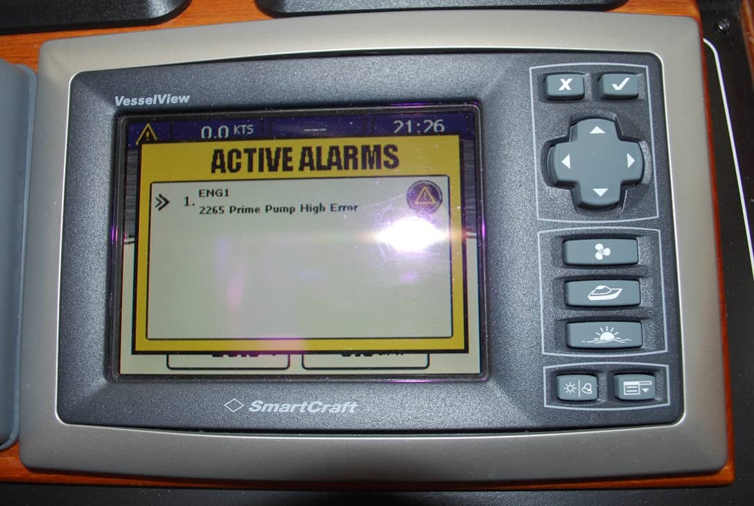
Here's the error warning - Prime Pump High Error - that indicated either pressure or voltage was high on the pump that supplies fuel to the starboard diesel engine during start-up.
After checking the weather forecast for Tuesday, Kap decided we needed to be away from the Blind Channel dock no later than 7AM in order to catch the critical slack at Seymour Narrows.
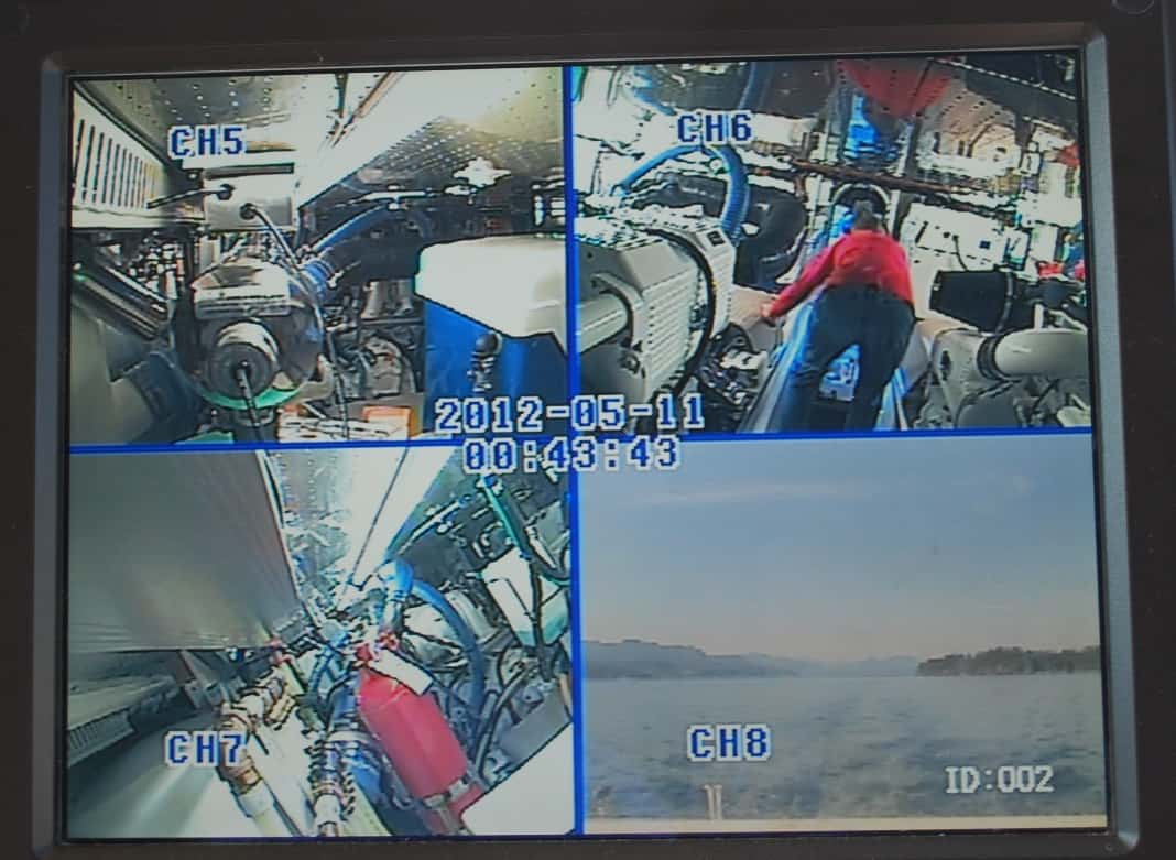
With the fuel pump issue looming, we kept a close watch on the engine room cameras, and Kap took a looksee in the engine room every few minutes to make sure that diesel fuel wasn't spraying from something broken.
Next morning, everything looked OK as we prepared Flying Colours for departure – that is, until Kap turned the ignition key to start the main engines. An alert popped up on the engine control panel for the starboard engine that said, “Prime pump high error”. We looked and looked for the error code in our engine manuals without success, and finally called Mike Radding, our Fleming technical guy in Newport Beach, CA who helps us through any problems. Mike wasn’t familiar with the error either, but told us the prime pump provides fuel flow to the engines during the start procedure. He suggested we try to start the starboard engine, which we were able to do. We then departed the dock and began to make our way south with more than a little trepidation.
As we motored down Mayne Passage, we could see fog in Johnstone Strait, and that too didn’t excite us. It’s a pretty busy waterway, and not the place I wanted my face to be plastered to the radar screen for several hours. Amazingly, as we turned onto Johnstone Strait and headed for the west side where it looked like the fog was less thick, it began to burn off everywhere, and within minutes was a clear day.
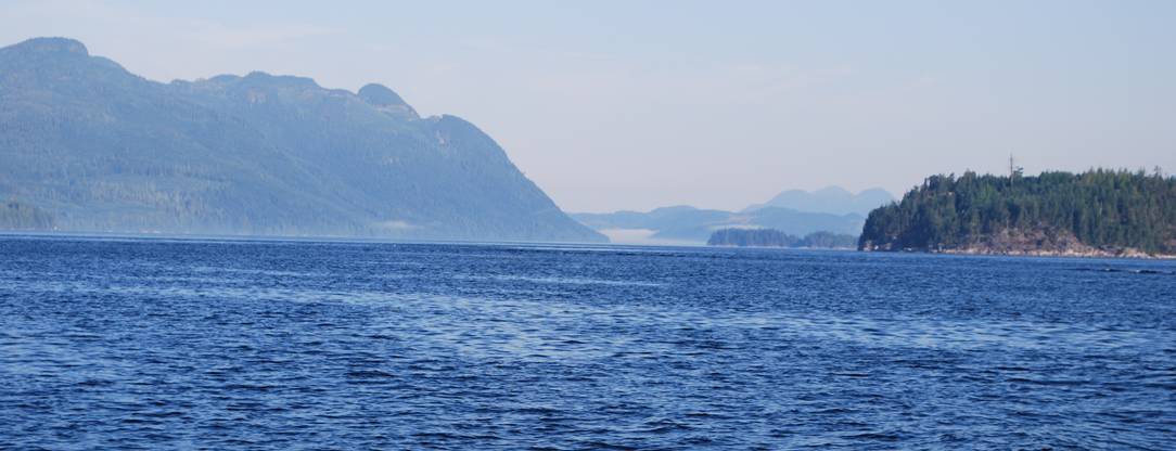
Johnstone Strait on a clear calm day is really spectactular. On a windy, high seas day, it looks terrible. One always hopes for the former.
We also had better current in our favor than expected, and we cut the power back to 1,100 RPM on both engines to lower our speed to 7 knots. When we arrived at Seymour Narrows we were still 30 minutes ahead of slack, but looking ahead with the binoculars we could tell that slack was earlier than the tide tables indicated. I was at the helm going through, and it was the smoothest passage we’ve ever had – in a stretch of water that’s notoriously famous for heavy waves and whirlpools that can suck a boat to the bottom. Smack dab in the center of Seymour Narrows is the infamous Ripple Rock, blasted to smithereens in the 1950s after it caused over 175 ship sinkings over a 100 year period.
April Point Marina as we approached it. The marina is tucked into a protected bay on Quadra Island, across Discovery Channel from Campbell River. It's a good, safe place to leave Flying Colours for a month.
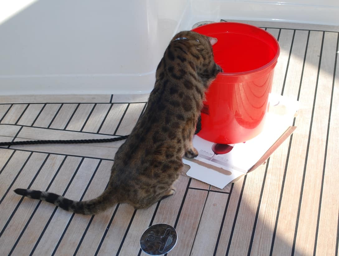
Always the jokester, ZuZu will play with toys that you'd never think to buy in a pet store.
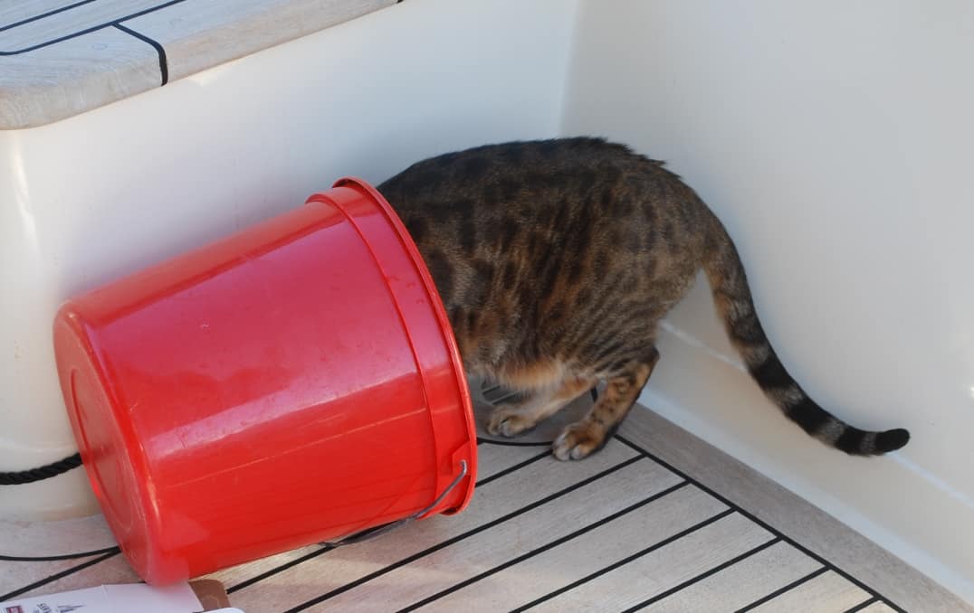
After tipping the plastic bucket over, she's absolutely convinced the smells from here indicate something really good has been in here.
Unfortunately, on our arrival it was too early for a slip to be available for us so we had to idle around outside the bay for about 45 minutes. We finally got a VHF radio call that our slip was available and we motored in. On arrival we called our technical rep at the Cummins Diesel engine center in Seattle to discuss our prime pump issue. He opined that the pump was either bad, or there was an electrical short to the pump. Our next all was to Brian Coverely, our Fleming service rep in Sidney (north of Victoria), who had the same opinion and said he was heading for April Point on Thursday. He’d bring a new pump with him, and if necessary would replace it.
Wednesday morning, Kap and I screwed up our courage and took the dinghy across Discovery Channel from April Point to Campbell River. The waters in this wide passage are often very rough, particularly if the wind is up, but this morning it wasn’t. It’s at least 1½ miles across the Channel, and our 11’-6” dinghy isn’t very comfortable in rough seas, and we definitely weren’t looking for trouble. Once across, we walked to our favorite grocery store – a Sav-On grocery – about a mile from the marina, and provisioned for our next return with a bit of non-perishable stuff.
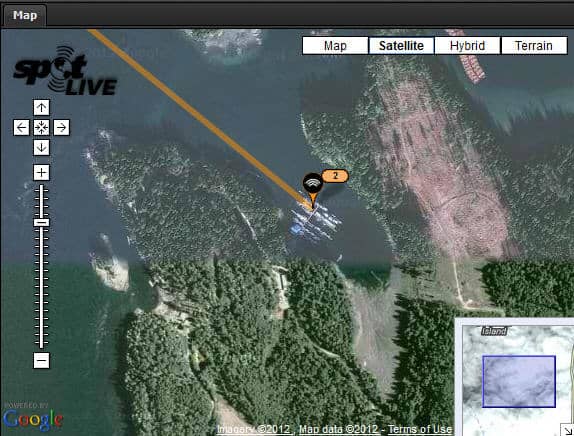
Our SPOT shows where we are at April Point Marina.
Today, Brian Coverley showed up to check out the prime pump, which indeed had failed and he replaced it. While here, he also helped troubleshoot the second head problems we’ve been having, with the result that he managed to overflow the head which caused a nasty amount of spillage that had to be cleaned up. Bad things always come in threes, and just before he left we discovered our water maker had sprung a leak, and when it was turned on it sprayed water all over the lazarette (the storage compartment under the aft cockpit deck). That’s the way it is with a boat – always something!
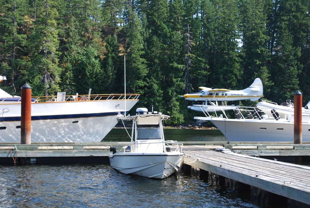
At noon on Friday (August 10), I managed to catch our Kenmore Air aircraft just before it touches down at April Point. Our pilot was Gregg Munro, son of the airline's founder (Robert Munro), and he flew us back to Seattle.
We’ll be back on Flying Colours on September 6th, hopefully for two weeks (if not a bit more), and then we’ll be taking her south.
That’s all for now.
Ron