
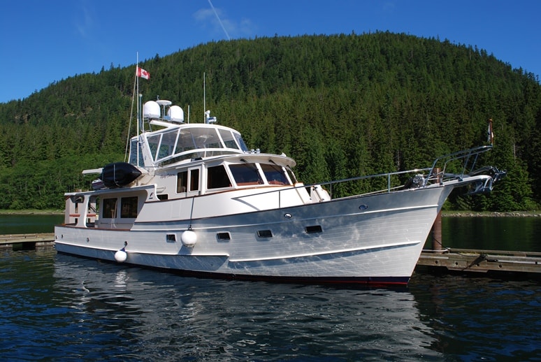
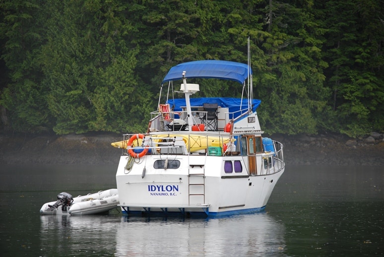
Flying Colours is certainly a dock-stopper, and everywhere we are, other cruisers carefully look her over and drop by to talk with us about her. Here she’s moored at dock 7 at Blind Channel Resort.
For the past two weeks, prawning has pretty much dominated our activity. It’s been very good to us, and if we can get them home safely (i.e., without a freezer malfunction), we should have enough to last us through the winter. But let’s back up and take this in chronological order, starting about 8 July.
For our last night at Blind Channel, we decided we should dinghy over to Cordero Lodge. With the place for sale, and with Reinhardt Kuppel’s health so poor that he’s now living out his last days in Campbell River, we figured it might be our last chance for schnitzel. We knew Doris Kuppel was back for a few days, and she’s always been the chef, while Reinhardt spent most of his time with the guests in the small restaurant, frequently ending the evening sharing a round of schnapps while someone banged out German polkas on a piano in the corner.
Tonight, Doris greeted us at the door and showed us to one of two booths by the window. Another couple was already seated at the booth next door, so we greeted them as we slid into ours. They told us they also had arrived by dinghy, from their anchorage a couple of miles west in a quiet spot behind the Cordero Islands at Greene Point Rapids. They introduced themselves as Buddy and Norma Smith, and we took an instant liking to them. They seemed to be in their mid-70s, and we could tell from the discussion that they’ve been cruising around here for many years. They have a 51’ Tollycraft and keep it at Coal Harbour Marina near the Bayshore Hotel in Vancouver.
Within minutes another couple arrived, Americans aboard a tiny C-Dory cruiser that was moored at the lodge’s dock. We learned they are from Whidbey Island, and recently from some kind of government stint in Washington, D.C. (Kap figured he was a lobbyist, but I have no idea why). Within minutes, the six of us were chatting as if old friends – which is the charm and appeal of Cordero Lodge, where we’ve met and spent the evening talking with other boaters over really good food every time we’ve been here.
I had my standby schnitzel – Cordon Bleu – and Kap ordered Weiner schnitzel. When we ordered a prawn cocktail appetizer – which the menu listed as prawns from Loughborough Inlet – this started a discussion with Buddy and Norma about visiting Loughborough Inlet. They’ve apparently been there many times, love the place, and convinced us we wouldn’t be disappointed. I’m not sure they’ve ever prawned there, as they didn’t have any specific advice for us on where to set our traps. They did, however, know a couple, Dane and Helen Campbell, who live in the next bay over, Sidney Bay, from where we planned to anchor in Beaver Inlet. They insisted we must drop in on Dane and Helen – but first contact them on VHF channel 16 to let them know we’d like to stop by – as they are extremely interesting. Helen makes local jam that we must buy.
Over dinner we talked about how the fate of Cordero Lodge isn’t unique – that a whole generation of people who created these “resorts” for cruisers who wanted to enjoy this incredible part of the world were now being forced out by advancing age – and sadly, at a time when the world’s economy couldn’t give them the prices they deserved for these wonderful places. Lagoon Cove is for sale, Greenway Sound is closed down after six years of trying to sell. At the same time, though, new (and younger) blood has recently created resorts where there were none before at places like Kwatsi Bay and Jennis Bay. Pierre and Tove Landry are going gangbusters at Pierre’s Echo Cove, and the third generation of Richter’s at Blind Channel is ensuring it will remain open for the foreseeable future. Overall, it bodes well for the future of these wonderful cruising grounds.
After our meal, Doris came out from the kitchen to chat with us. In answer to a question, Doris told us that she and Reinhardt were originally from Essen (in western Germany), and that’s where she learned to cook. Their daughter had mentioned on an earlier visit that her parents were “tough old Jews”, and being in their mid-80’s, I surmised they might have been WWII survivors, but nothing was mentioned about how or what.
A few minutes later, Doris ducked out and returned shortly. In her right hand she carried what looked like a large wooden plane – about the length of a man’s arm, painted green, with a vertical hand grip and a flat board about 14” long connected to it. There were 8 pewter shot glasses sitting in indentations, each full of icy cold schnapps. Doris’ daughter followed behind with slips of paper that she handed to each of us, containing the words to the obligatory Cordero Lodge toast song – the old German Proseet toast that’s sung at all beerfests (or whenever a bunch of Germans are drinking). With a shot glass in everyone’s raised hand, we all sang the short refrains, then downed the shot glass in one gulp. I’m sure everyone was toasting to Reinhardt, who with Doris had built this remote lodge by hand 35 years earlier. An era was coming to an end, and Kap and I were glad we’d at least been there for the final 3-4 years of it.
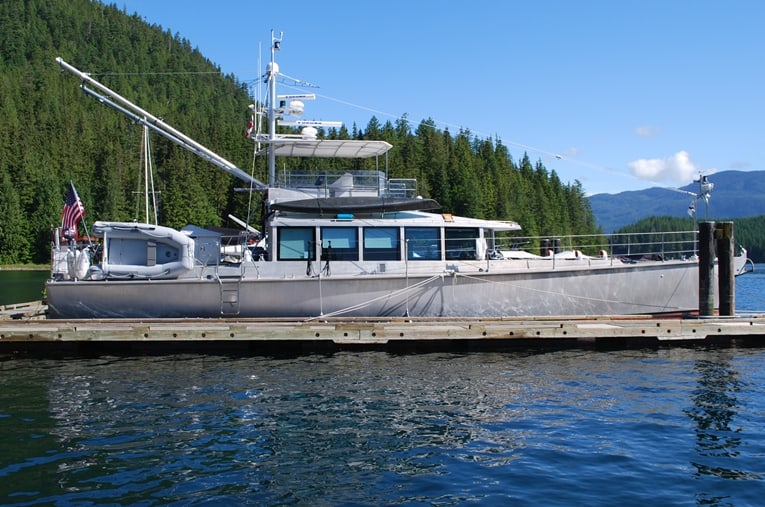 On our second day at Blind Channel, a Dashew FPB 64 all-aluminum powerboat cruiser arrived. It was flying a Seattle Yacht Club burgee, so besides wanting to see one of these up close, Kap and I always make an extra effort to give a hand with lines when people arrive at the dock – particularly at Blind Channel, where there’s always a cross current at the dock that’s either pushing you onto or off of the dock.
The FPB 64 is one of a series of long-distance cruising boats designed by an American from San Diego, Steve Dashew, and built in Auckland, New Zealand. Dashew, who is a long-time ocean sailor and racer – and who is now getting old enough that the rigors of sailing aren’t matched by his physical capabilities – designs on the premise that if you do it right, a powerboat can provide blue water cruising for ocean-going couples.
It would be hard to argue that the FPB 64 is a good looking boat – its lines are simply functional and Spartan – but it makes up for it in lots of other ways. Every aspect of the design is economical (although its price tag reportedly is not), and at the same time, this boat could easily be lived aboard for multi-year cruises around the world. In fact, this boat – named Sarah Sarah, and owned by a couple who live in the Anacortes area – was completed last August and they took delivery of her in Auckland. For their first real shakedown cruise, they brought it across the Pacific to the U.S. West Coast.
By comparison, Flying Colours, with its fuel capacity of 1,000 gallons and a range of 2,000 miles at an 8 knot cruising speed, wouldn’t make it to Hawaii from the U.S. West Coast, let alone to New Zealand, without adding special fuel tanks. Indeed, the Fleming is designed for coastal cruising, whereas the FPB-series boats are specifically designed for offshore cruising.
Kap and I would love to do some offshore cruising, but at our age, a sailboat is becoming more and more out of the picture (but we still talk about various motor-sailor craft that are available). If we ever felt that we’d done all we wanted to do in exploring the Inside Passage – which is undoubtedly one of the best cruising grounds in the world – the Dashew FPB 64 would certainly be on my list to look at.
Finally on Friday morning the weather in Johnstone Strait had settled down, and we felt comfortable leaving Blind Channel for the short cruise to Loughborough Inlet. Kap’s check of the current for Greene Point Rapids – just around the corner from Blind Channel – indicated it would be at slack at 11:45AM, so we settled on a departure time of 11:30. Since we’d be “off the grid” for several days, we loaded up at the General Store on milk for morning cuppas, paid our moorage bill, and got Flying Colours ready to go.
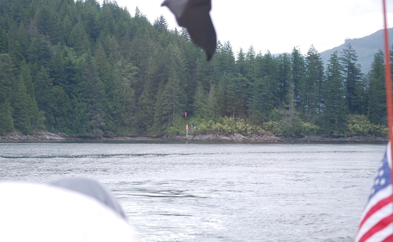
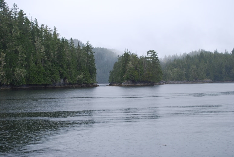
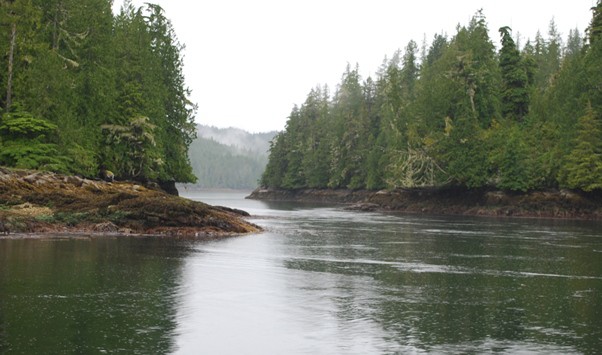
Loughborough Inlet as we turned north from Chancellor Channel. It’s a wide channel, at least twice as wide as Chancellor Channel where they join, and if you didn’t know better you’d think the inlet was the main channel. It’s a dead-end, though, five miles ahead. On our port side and along the shoreline, four tugs were busy setting up a log boom as we entered, but otherwise, there wasn’t any other sign of life ahead.
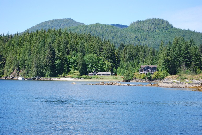
This little complex of houses belong to a couple we know from the Sun Valley area – Dick and Melinda Spring. We didn’t see any sign of life during the three days we were in Beaver Inlet. They keep a fast boat at Campbell River, and use it to get here when they’re here for a vacation.
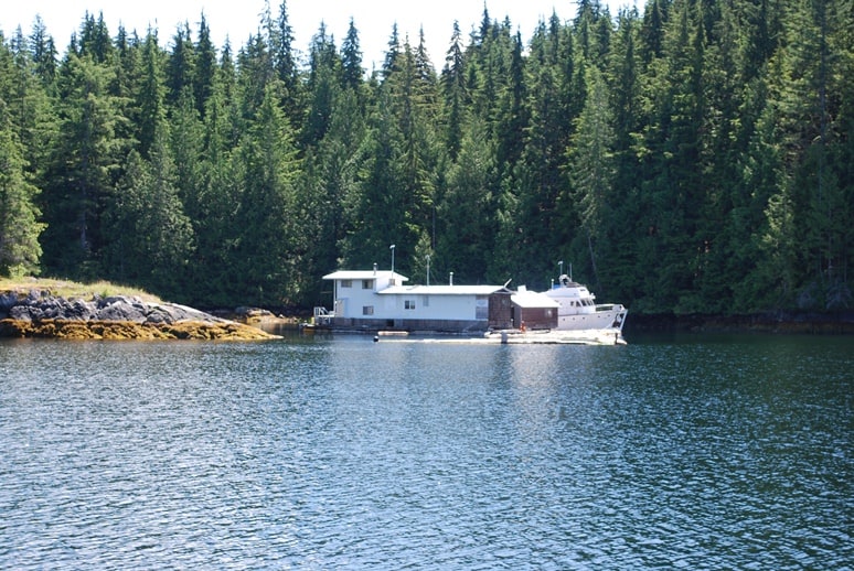
Here’s the reputed curmudgeon’s floathome opposite the Spring’s place in Beaver Inlet. It’s quite a bit nicer than we expected to see, given the description of the guy that we’d been given several years ago. On our third day here we heard from our friend, Bob Gladics, who told us the place is now owned by a retired U.S. couple named Jim and Abby.
We’ve been wanting to spend some time in Loughborough Inlet for several years now, as coincidentally, our friends Bob Gladics and Glenna Doke have some good friends near Sun Valley who own a summer house on Beaver Inlet. In the past, though, we’ve just been in too much of a hurry on our way to/from the Broughton’s to stop here. This year, though, our Internet research indicates there’s good prawning here (plus the prawn cocktail at the Cordero Lodge is Loughborough spotted prawns, and they are very good) – and we’ve declared 2011 to be our year for prawning – and even more so, to be able to spend long carefree periods at anchor, tucked into quiet bays. We hoped Beaver Inlet would be just such a place.
Bob and Glenna’s friends, Dick and Melinda Spring, bear a little discussion, as their background and the background of their property on Beaver Inlet is interesting. We met Dick and Melinda in early 2008 when Bob and Glenna invited us to dinner at a restaurant in Hailey, ID, just south of Sun Valley. Dick is a successful rancher in the Hailey area, and apparently has quite a bit of money. Our recollection is that he’s widowed, and a few years ago while searching for a new bride there was something unique enough about how he was searching that he wound up on Oprah’s TV show. As you can expect, that got lots of results and he was inundated with offers from women all over the country. Based on whatever criteria he was using, he selected his new bride-to-be, but first invited her out to his ranch to gauge if she’d work out – well, she didn’t, and he dumped her. The second one was Melinda, and they’ve been happily married ever since. They were a really nice couple, and we thoroughly enjoyed the evening with them. They told us all about their summer place on Beaver Inlet, and invited us to use their dock if we dropped by and they weren’t there. Bob and Glenna had been there as part of a fixer-upper project on their summer home, and raved about the area.
According to Dick, the summer house was built by a young Microsoft retired millionaire who was a bit tiched in the head – and was totally convinced that Armageddon was coming at the moment Y2K rolled around. He bought the place to be totally off the grid when that occurred. When the world didn’t end, he gave up on the place, Dick somehow found out about it, and bought it for a song. The place had sunk into serious disrepair, and that’s where Bob and Glenna came into the picture – making several trips there in previous summers to help fix up the place. They raved about five different types of oysters that could be found on the small stretch of beach on their property.
Bob and Glenna regaled us with stories of an old hermit curmudgeon who lives in a floathome directly across Beaver Inlet, and who does some caretaking for them when Dick and Melinda aren’t there. He reportedly also shoots across Beaver Inlet with his shotgun or rifle at anyone who stops by that he thinks might be poaching oysters from their beach.
After we met Dick and Melinda, the upcoming summer was only our second year of boating, and we were hell-bent for SE Alaska. We stopped at Blind Channel on the way north, but were in too much of a hurry to make the detour on Loughborough Inlet to have a look at Beaver Inlet. Ditto on the way south. That’s the way it was for the next three years, even though Bob and Glenna urged us to take a look at it. This year, and now that we’re into prawning, is the time to check it out.
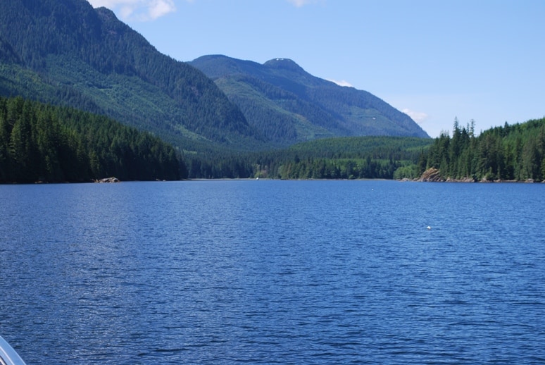
This shot is looking west towards the head of Beaver Inlet, with the Franklyn Mountain range on the left, and if you went overland straight ahead you’d run into Johnstone Strait. This is on a peninsula of the Canada mainland jutting towards the south. In the distance you can see one boat at anchor, at the exact spot Kap had marked for our anchorage. The house-looking object on the left shoreline isn’t a house, but rather, as stone face along the shore.
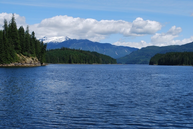
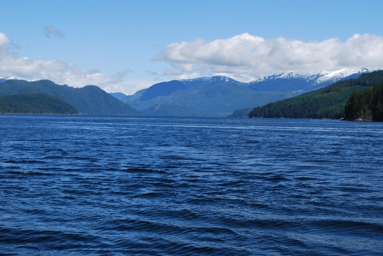
This shot is looking down Beaver Inlet the other way, towards Loughborough Inlet. The snow-capped peak in the background could very well be a glacier, or at least snow that won’t melt until the very end of summer.
As we cruised deeper into Beaver Inlet, we could see one boat already at anchor at the head of the inlet – and it looked to be right at the “sweet spot” anchoring position shown in the Douglas cruising book. Never mind, it’s 500 wide here and a flat mud bottom at around 40-50’ deep, so there’s plenty of room. After cruising around for a bit we selected the spot we both thought looked best, leaving lots of swing room from the other boat as well as the shore. With Kap at the helm and me at the windlass, we dropped the anchor in 42’ of water.
We have an “anchor sentinel” – a small white buoy on a 50’ line and tied to our anchor. Kap made it up for our anchorage in Desolation Sound last summer – where we were worried that it might be overcrowded and a high risk of someone laying their anchor down over ours – and it’s proven great for knowing exactly where our anchor is. When the only visual reference points are trees and rocks and “stuff” on the shore, there’s no way for it to be very accurate, and besides, your visual reference points are quickly forgotten. Marking the GPS position is pretty sure-fire too, but it means you must have your navigation system or a laptop up and running to “see” it on an electronic chart. A white buoy in the water, though, is something you can see any time you look outside – and it’s also something that other boaters can see when they’re deciding to put down their anchor near to you.
Being our first anchoring of the year, we’re always rusty, and somewhat nervous that we’re going to forget some small detail. What we’ve been taught to do is drop the anchor to the bottom, then drop at least an amount equal to two times the depth as we back down (laying anchor chain on the bottom in the direction we’re backing), and then stop. We then pop the engines in and out of reverse to get a bit of reverse motion, to “set” the anchor. If you feel a sharp pull when the chain becomes tight, you know the anchor is set. Once you’re satisfied it’s set, you then back down again, laying more chain to get the ratio of scope (i.e., chain to depth ratio) that you figure will hold you in the forecast wind and current conditions.
In our case, we figured 3:1 scope would be just fine – which means letting out 3 times as much chain as our depth – particularly since the bottom here is reported to be mud. The water depth was 42’, so 3:1 scope would require approximately 150’ of chain. Using hand signals from the windlass at the bow, I let down the appropriate amount of chain as Kap slowly backed the boat downwind from where the anchor lay. When we were at 2:1 scope, we stopped and made certain the anchor was set, then backed another 50’ and let out that amount of chain. We typically then do some tidying up around the deck as we watch to see if it looks like we’re staying put without dragging the anchor.
An hour later, we felt comfortable with our anchoring and decided it was time to put the snubber on. This is nothing more than a rope tied to a deck cleat on either side of the bow, and hooked into the anchor chain. The anchor chain is then lowered so that it falls within the V formed by the two ends of the snubber, to the point where the rope snubber is carrying the weight of the chain, and not the bowsprit of the boat/windlass. The purpose of this is, chain going down from the boat’s bowsprit has no “give” to it, so as the boat rocks a bit it will put constant strain on the bowsprit, as well as the windlass. It also means that the chain will make noise throughout the night as we swing on it in the wind, and it’s very close to where your head is in the V-berth bed. Since the snubber is line (rope), it has a bit of stretch to it, providing the all-important “give” that makes being at anchor much more comfortable.
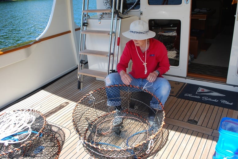
Kap readies our prawn traps for the first soak at the mouth of Beaver Inlet. We still don’t quite have a routine down yet, but it’s getting closer.
By the time we got the dinghy down and in the water, the prawn bait all set up, and our traps ready to go, it was 3PM. With our orange foully gear on, we motored out to the Beaver Inlet opening to locate where we’d set our first prawn pots.
This would be our first time ever to locate totally on our own where to drop our traps, as this was a new spot to us, and we hadn’t gotten any local advice from anyone who has ever been here. In general, our advice has been to locate a “hole” on the bottom at 300’, with upward sloping sides around it – apparently the little prawn guys live in areas like this, or the hole helps keep the scent in the area . . . or whatever.
Well, cruising around in our dinghy we couldn’t find any holes on our charts – just narrowly-spaced contour lines that more or less followed the shore contour, from 100’ down to about 500’ – and these lines indicated a steep bank. The contour lines were so close together that Kap worried our traps would tumble, and not find a flat surface to land on. We searched for upwards of half an hour to locate what we thought was a shelf at the appropriate depth. We finally settled on a spot that was around 290’ and as I kept the dinghy in position, Kap loaded the bait cans, bungeed the nets shut, added weights to each trap to help keep them in position, and then dropped our two pots over the side.
We had hoped to pull up our traps after a couple of hours, so we could drop them again for an overnight soak – but since everything this first time took longer than we’d planned, we had no choice but to let them soak overnight. We headed back to Flying Colours and a well-deserved Happy Hour. I whipped up a Kentucky Crusta for Kap, and a Sidecar for myself, and we sat in the cockpit looking at what has to be one of the most beautiful and peaceful places in the world.
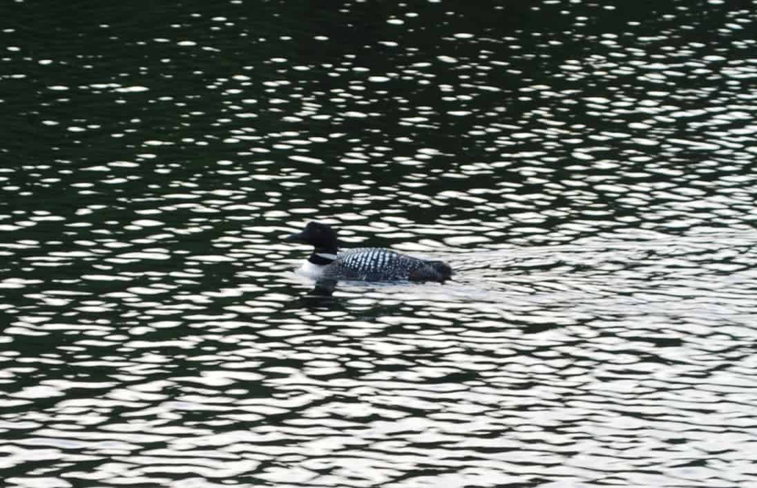
A loon swam past us just as the sun was setting. Something about the way she cocked her head made us think she was looking us over – sure enough, when she got past us she turned around and came back for a second look. Then she did another 180° turn and headed for the end of the inlet. An image of the loon is on the Canadian dollar coin, and Canucks everywhere call it a "loonie".
This was our first night at anchor this year, and in such a wonderful place –we decided to fix Flying Colours Scampi for dinner, with a salad and a bottle of Okanagan Valley Rigamarole label Sauvignon Blanc.
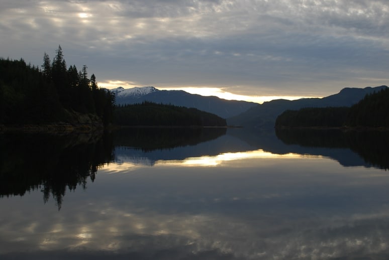
Sunrise is our favorite time of the day when we’re on the water, whether it’s cruising up a channel or sitting at anchor. The light is so spectacular, particularly when the water is glassy smooth and creates a perfect mirror image. This shot is looking east down Beaver Inlet towards Loughborough Inlet and the mountains on the mainland peninsula.
Skunked! The next morning we motored out with our dinghy to pull our traps. When the first trap reached the surface, we had a sense of Yogi Berra déjà vu all over again – it was empty. So was the second trap. Either this spot had been prawned out entirely by the commercial prawners (the commercial season had just ended last week, and we’d heard reports that they were prawning heavily in Loughborough Inlet), or we hadn’t set at the right spot. Regardless of which it was, we decided not to reset at the same location, and motored off to the other side of the inlet mouth.
Next door to Beaver Inlet is Sidney Bay, with just a small tip of land between them. At the opening to Sidney Bay, we found two areas that had flat shelves on the bottom at 300-400’. We again drove around and drove around looking for just the right spot in that area, and finally decided to drop the traps where there were narrowly-spaced contour lines indicating we were over an upwards sloping wall. Kap re-baited our traps and after marking the location with our GPS, we dropped them. It was mid-morning, so we figured a 4-hour soak should do it. If we were successful, we could then set again for an overnight soak.
As we cruised back to Flying Colours, we met the couple from the Bayliner named Gecko anchored near us and we stopped to say hello. They told us they are on their way south in a few days, having spent the last eight weeks in the Broughton’s. We mentioned that we’d just been skunked on our first trap pull, and they told us their experience is you have to get down to almost 400’ in Beaver Inlet for the prawns. They don’t have a pot puller on their dinghy, and pulling traps by hand from 400’ would be murderous, so we figured that’s why they are crabbing and fishing here. And it may also explain why we came up empty handed this morning, and since we’d set our traps at about 340’ the second time, it might not be a good sign for getting any prawns this time either.
We lounged around on Flying Colours for several hours, catching up on some reading, fixing lunch, and taking naps – then headed back in the dinghy at 2PM to pull our traps.
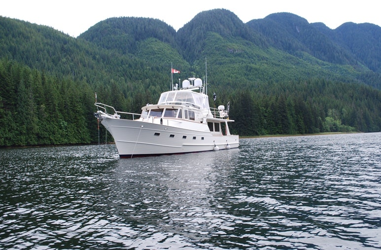
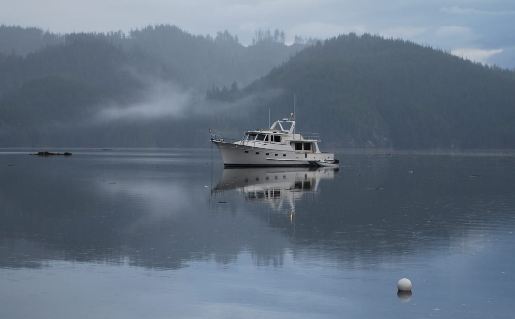
Flying Colours at anchor in Beaver Inlet, with the Franklyn Range in the background.
This time we were pleased. There were good-sized prawns in each trap, for a total of 38 on the pull. We decided this spot was looking good, so Kap re-baited and we dropped the traps near the same spot – but in 25-30’ deeper water. As we slowly cruised back at idle speed, Kap rinsed the prawns several times in salt water to get them to purge as much waste as possible – i.e., poop – and then one-by-one snapped their little heads off, rinsed them off alongside the dinghy, and deposited them in a clean bucket.
We probably should have returned to pull the traps after dinner, but we’ve found that with a good bottle of wine with dinner, plus a good movie on our entertainment system, we’d rather stay put in the comfort of Flying Colours’ salon. We decided to let the traps soak overnight and get back to them early in the morning.
Next morning (Monday), as soon as we’d had our first latte we suited up in our now-standard orange “prawning suits” – I’m sure you can see us coming a mile away! – and made the 2½ mile trip in the dinghy. The catch wasn’t quite as good – 28 total prawns this time – but that’s 28 better than zero! We pulled and reset twice more throughout the day, for a total of 84 prawns for the day.
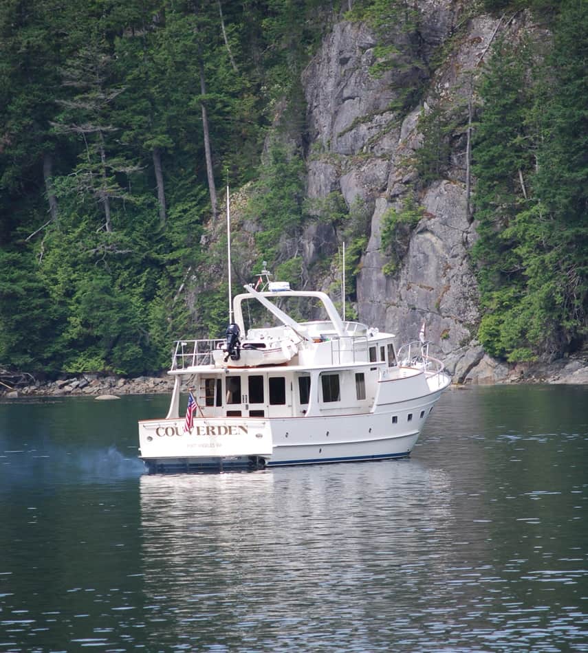
In mid-afternoon, Kap heard our neighbor’s dinghy going by, so she popped her head out of the pilot house window to give them a friendly wave – and spotted another cruising boat in the distance, slowly moving into Beaver Inlet. She put the binoculars to it, and then called me, “Hey Ron, if I’m not mistaken it’s another Fleming coming in.” Sure enough, it was, and we could soon tell it was the Couverden, with Steve and Shirley Clark aboard. The last we’d heard from them, they were down in Desolation Sound, heading to a place called Waddington Bay for oysters – and we didn’t even know if they knew where we were. Before leaving Blind Channel (where we had Internet access), I’d sent an e-mail message that we were heading into a known area of no communication – no cell phone coverage, no WiFi anywhere around, and no Internet access from our Verizon broadband data cards.
The Couverden anchored near us, and after our last prawn trap check we stopped by for Happy Hour. Steve had other ideas – he whipped up a big batch of deluxe nachos, and over two bottles of wine during the evening we caught up on their news. (Steve’s biggest news was a dinghy accident two weeks earlier in Garden Bay, an hour after seeing Shirley off on a Kenmore Air flight home to watch over her aging mother for a week. He was slowly idling back to the Couverden at the Seattle Yacht Club dock when a crazed heroin addict in an inflatable dinghy rammed him head-on at top speed, almost killing the guy. Steve wasn’t injured, and only minor damage to their dinghy, but the guy was hauled away unconscious with head injuries to the hospital. There were plenty of witnesses who agreed that it was definitely the other guy’s reckless handling of his boat.)
Tuesday morning, July 12th. Turns out, we do have very weak cell phone coverage here. I managed to check messages on my cell phone, and this morning I was able to connect to the Internet with my Verizon broadband card – but with a very weak signal I was only able to pull down 82 of 97 e-mail messages before it dropped. I won’t try again, as it will have to resend the 82 messages I’ve already received, and it’ll probably just drop again at some point. Oddly, one cell phone message was from the Sitka harbor master (and the area code of 907 is correct for Sitka, AK), with the message that he has a box addressed to Cosmo Place – our old Nordic Tug that we sold two years ago, and we haven’t been back to Sitka since our visit there in Cosmo Place in 2008. It makes us think that the new owners of Cosmo Place might have ventured to SE Alaska this year, and somehow the harbor master has our old telephone number in his guest boat sign-in records. That’ll give me something interesting to check out today – in between shelling, vacuum sealing, and freezing the 84 prawns from yesterday.
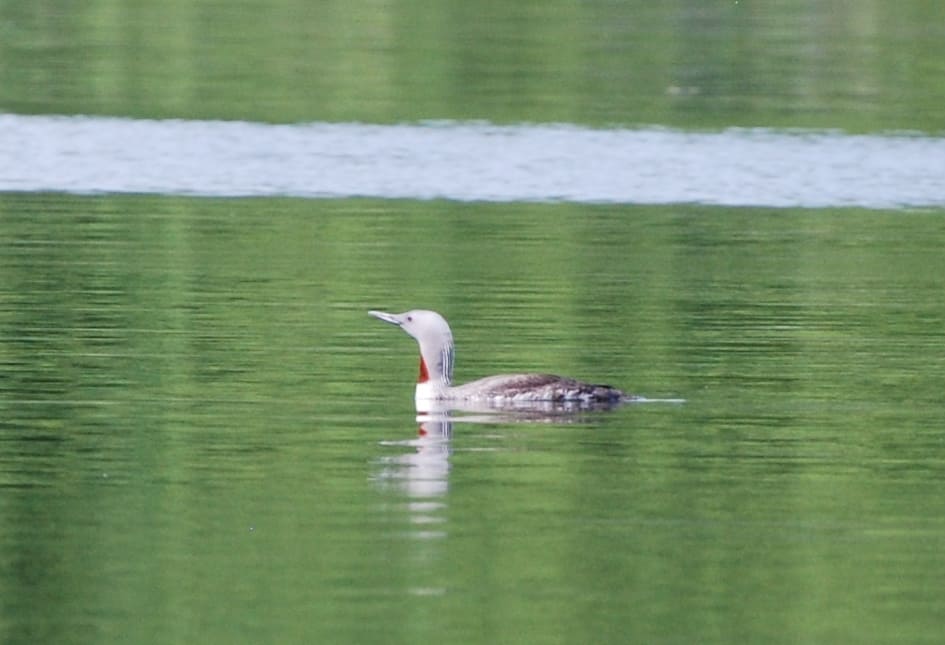
Kap thinks this is a grebe, but since we don’t have Internet access it’s difficult to check it out. Whatever she is, she spent long periods paddling back and forth about 100’ off our stern, making plaintive calls that sound almost identical to ZuZu’s meows. We think the grebe might have thought ZuZu was a mate, or a potential mate, nearby. I shot this photo with a 300mm zoom lens, the longest one I have for my camera, perched on the transom of Flying Colours to steady it.
The next day, Monday July 11th, was our best day yet at prawning. In three sets we hauled in 84 shrimp. Tuesday was even better – 106 shrimp. We’ve now caught 355 shrimp since we began down in Cortes Bay, with 303 of them shelled, deveined and sitting in our freezer. In the afternoon, Steve and Shirley headed out to Loughborough Inlet in their dinghy with their fishing gear, and in 20 minutes they were back with a 9 lb Ling Cod. Fish isn’t my overall favorite food, but when it’s this fresh Kap and I couldn’t resist the dinner invitation. Steve baked it in a foil wrap, with butter, capers, and lemon – it was delicious.
Over dinner, and after Kap and Shirley had been checking the weather all afternoon, we decided it would be best to head out in the morning and make our break for the Broughton’s while we had a favorable gap in the weather.
On the way north, our tentative plan was to stay one night in Lagoon Cove, then one night at Pierre’s Echo Bay Resort to provision (fresh milk for lattes and maybe some fresh vegetables), and then go to Booker Lagoon on Broughton Island for several days at anchor. Prawning was reported to be excellent in the lagoon, and our three cruising guides all gave glowing descriptions of how scenic it was.
From Beaver Inlet, Whirlpool Rapids was between us and Johnstone Strait, so we’d have to time our departure to be at the rapids at slack. Kap and Shirley figured our departure time needed to be 7AM, and it was agreed that we’d raise our anchors at 6:30AM. Dinghies still had to be secured, so we declared an early evening.
Before going over to the Couverden that evening, we started our generator to run a dishwashing load. When we returned to Flying Colours, we found the generator had shut down and an error message – “lack of raw water” – was flashing on the digital readout on our pilot house console. The likely suspect was seaweed sucked into the thru-hull that brings salt water into the generator to cool it. There’s a raw water strainer just above the thru-hull that filters and collects any debris that might be brought in, keeping it from going into the generator cooling system and causing damage. If the strainer is full and clogs up, the generator’s temperature sensors shut it down – and presumably, that was the cause of our problem.
Kap and I both went into the engine room to open up the strainer – which we indeed found to be full of seaweed. Once it was cleaned out, Kap pressed the generator start button and it fired up . . . but it only ran for 30 seconds or so, then abruptly stopped and gave us the same error message. Kap fiddled and fiddled with the strainer, making certain there wasn’t an air bubble in it, but still no cigar. Suspicion grew that the thru-hull intake tube might itself be clogged with seaweed, but try as we might – and without the proper tools – we couldn’t get the tubing off without destroying it (and we didn’t have a spare). We thought about rigging up some sort of Roto-Router-type of snake to run down it, but couldn’t think of anything on board that was flexible and strong enough to go around a 90° bend and be able to push anything out.
After working on it for an hour, we knew it was fruitless to continue. We needed the generator if we were going to be at anchor, and we also have to run it when we’re underway if we want to run the watermaker. We had to get to a mechanic, and the nearest one would be in Port McNeill. We got a message across to Steve and Shirley of our changed plans and went to bed. Both of us spent a large part of the night trying to figure out a solution – the only one I could come up with was to give the generator a try when we’re underway, on the off chance that suction against the thru-hull at 10 knots water speed might suck out the seaweed debris. I gave that idea a 1-in-100 chance of working. Unknown to me, Kap had the same idea, and gave it about the same odds of being successful.
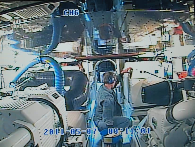
One of the best cameras we have on board Flying Colours is in the engine room. It’s particularly useful when Kap needs to go down there while we’re underway and I’m at the helm. This is a place and time where a hundred things can go wrong, and I keep a close eye on her when she’s down there. Note that she’s wearing good ear protectors – the noise is deafening, and you’d have hearing loss in no time if protectors aren’t worn. The main engines are towards the front of the camera, and she’s facing the generator in the white square-ish boxy thing – it’s a 17.5KW diesel motor that burns about 1 gallon per hour when running. I snapped this photo just as she was pushing the starter button to see if it might have cleared the debris in the raw water strainer (there’s also a remote starter unit in the pilot house). The date and time stamp on the camera isn’t correct, as we’ve never bothered to set it.
Kap and I were up at 5AM. I made a latte and we ate a breakfast of cereal. After that we stood around on one foot, then the other, waiting for the 6:30AM agreed-upon time to raise anchors. The plan was, we’d head for Port McNeill and they’d go to Lagoon Cove, and hopefully we’d meet up as soon as our problem was resolved.
Anxious to get underway, we started the anchor raising process 15 minutes early – and it’s a good thing we did. During our 3-day stay in Beaver Inlet, Flying Colours had been floating sort of aimlessly almost over the top of our anchor – which we knew because the anchor sentinel buoy always seemed to be right next to the boat. This seemed strange, as we had backed down at least 100’ and laid out that much anchor chain, so normally we’d expect to swing at anchor about that distance from the buoy. With the chain solidly mired in the mud on the bottom, though, we must have drifted with an outgoing tide back to the buoy, and then just stayed there.
As we began to raise the anchor, the line from the sentinel buoy was wrapped a dozen times around the chain – indicating that we’d also circled . . . and circled . . . and circled the buoy without even realizing it. Kap spent at least 15 minutes leaning half on/half off the bowsprit untangling the mess, as I slowly raised the anchor chain. Hmmmm, maybe that idea needs some re-work.
We cruised down Loughborough Inlet and then turned into Chancellor Channel. Steve kept up a running commentary with us on the VHF, discussing ideas for how to resolve our seaweed-compacted thru-hull problem. One idea was to blow compressed air into the generator side of the tubing to see if it could dislodge the debris. We have a tire inflator on board, but it’s 12-volt DC only, and our nearest DC outlet is in the pilot house. Couverden has a 110-volt AC portable inflator, but it still left us with the problem of how to create a seal between the inflator head and the tubing. It was a good idea, but with some big unknowns on how to actually make it work.
While this discussion was going on, we decided to fire up the generator as we were cruising. To our total amazement, the generator continued to run without problem, even when we put a heavy electrical load on it with the watermaker, definitely getting it up to operating temperature. Our least practical idea had worked! We let Couverden know of our success, and changed our cruising plans back to the original.
We hit Whirlpool Rapids at slack, which means there weren’t any whirlpools of consequence, then continued out into Johnstone Strait. It was just as we like it – benign. Except for a bit of ground fog, the 11 mile cruise to Fanny Island where you turn into Havanna Channel and wind your way around some islands towards Lagoon Cove.
At the east end of East Cracoft Island there’s a long, narrow, and shallow channel called Chatham Channel. To navigate safely through it one has to align very carefully on range markers on the shore ahead and behind you. Range markers are two signs, spaced one behind the other, and when the painted vertical bars line up you are correctly positioned in the channel. The channel is long enough that you can’t see the range markers ahead – even with binoculars – as you enter, so you first use the markers behind you, and when you’re about halfway through you switch to the markers ahead of you. To make it work, you need one person with binoculars to watch the range markers and giving steering directions, while the other person drives the boat. In this photo, the closer (lower) range marker is very near to the shore, and the further (higher) range marker is behind it, maybe 100’ (and you probably won’t even see them unless you enlarge the photo). We were driving from the fly bridge, and I took this photo from inside the fly bridge enclosure. The orca tail at the top of the photo is a blow-up plastic whale that we use to keep eagles away when we’re at anchor or moored – it doesn’t matter what it is . . . it just needs to flap in the wind to be effective.
Couverden hadn’t ever been down the narrow, shallow channel called The Blow Hole into Lagoon Cove, so they pulled off to let us go first. They don’t have electronic charts on board – using paper charts for their navigation – so getting through tricky channels and inlets isn’t quite as easy and safe.
The Blow Hole is safe enough to go through, provided you know which side of the channel to follow, and you stay away from the seaweed and kelp along one side. Just ahead of Flying Colours’ nose the channel shallows up – as indicated by the darker blue – and the depth is only about 20’ at the deepest part of the channel. We’ve gone through here at least a dozen times now, so it doesn’t hold any terror for us.
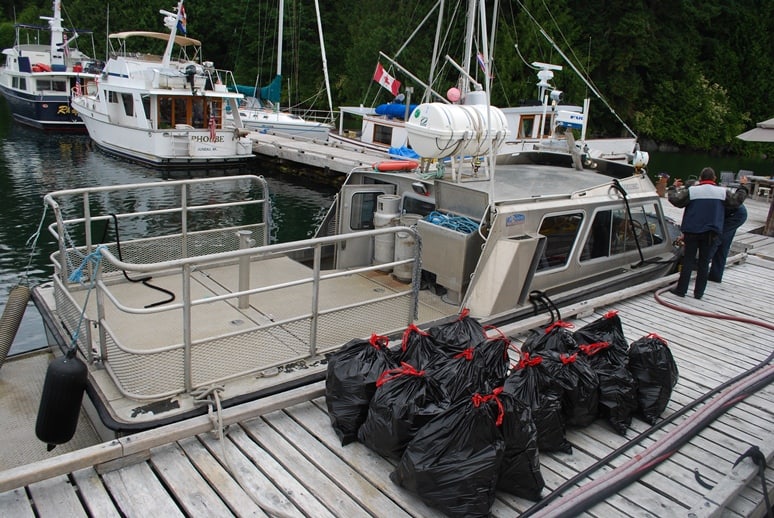
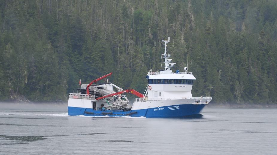
When you’re on an island that has no access other than boat and floatplane, just the day-to-day necessities require effort. This fast service boat stops by once a week to collect garbage – it looks like about 15 garbage bags – and hauls it away to Port McNeill. On shore is a large generator that runs 24 hours a day to supply electricity, and there’s an incinerator to burn all garbage that will burn. As we departed we saw the fuel barge approaching – two large diesel tanks on shore hold a total of 42,000 gallons of diesel, so the bill must be huge when it’s refill time.
Our obligatory overnight stop at Lagoon Cove was fun as usual. We both needed 50A shore power, so Bill directed Flying Colours in first along the fuel dock and stern tied us to the dock perpendicular to it. He then had Couverden back in next to us and was rafted up tight to our port side. We’re not wild about this type of moorage, as you have no privacy whatsoever unless you lower all of the window shades, but some nights you just have to put up with what you have to put up with.
It rained cats and dogs while we were here, but nevertheless, I cooked up some hamburger pinwheels in puff pastry and that was our appetizer for the Happy Hour that had to be held inside the workshop on shore. As usual, Bill told his bear story for the umpteenth time that we’ve heard it. Next morning it was still raining, and Kap talked me into fueling Flying Colours – with the completely sound argument that being tied up to the fuel dock is the closest we’ll ever be to it without having to make a special stop. We pumped 427 US gallons of diesel, and at US$5.11/gallon, it came to (sit-down-when-you-get-out-the-credit-card) US$2,182.62. This isn’t a fuel bill you want to face very often. I’m sure the price would be lower if we’d waited until Port McNeill in a couple of weeks, but our philosophy is, we really need these places to be here for us in future, so helping them stay in business is good for us too.
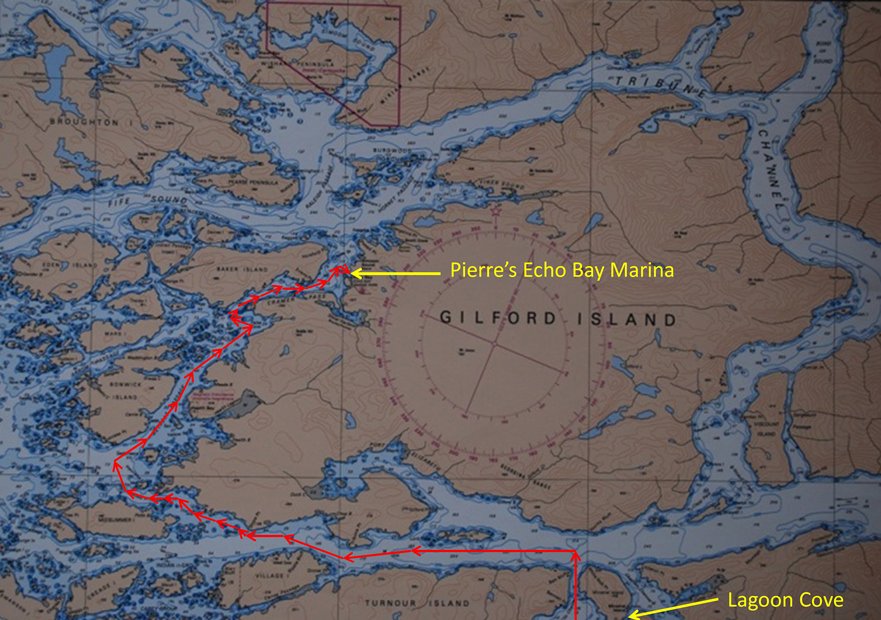
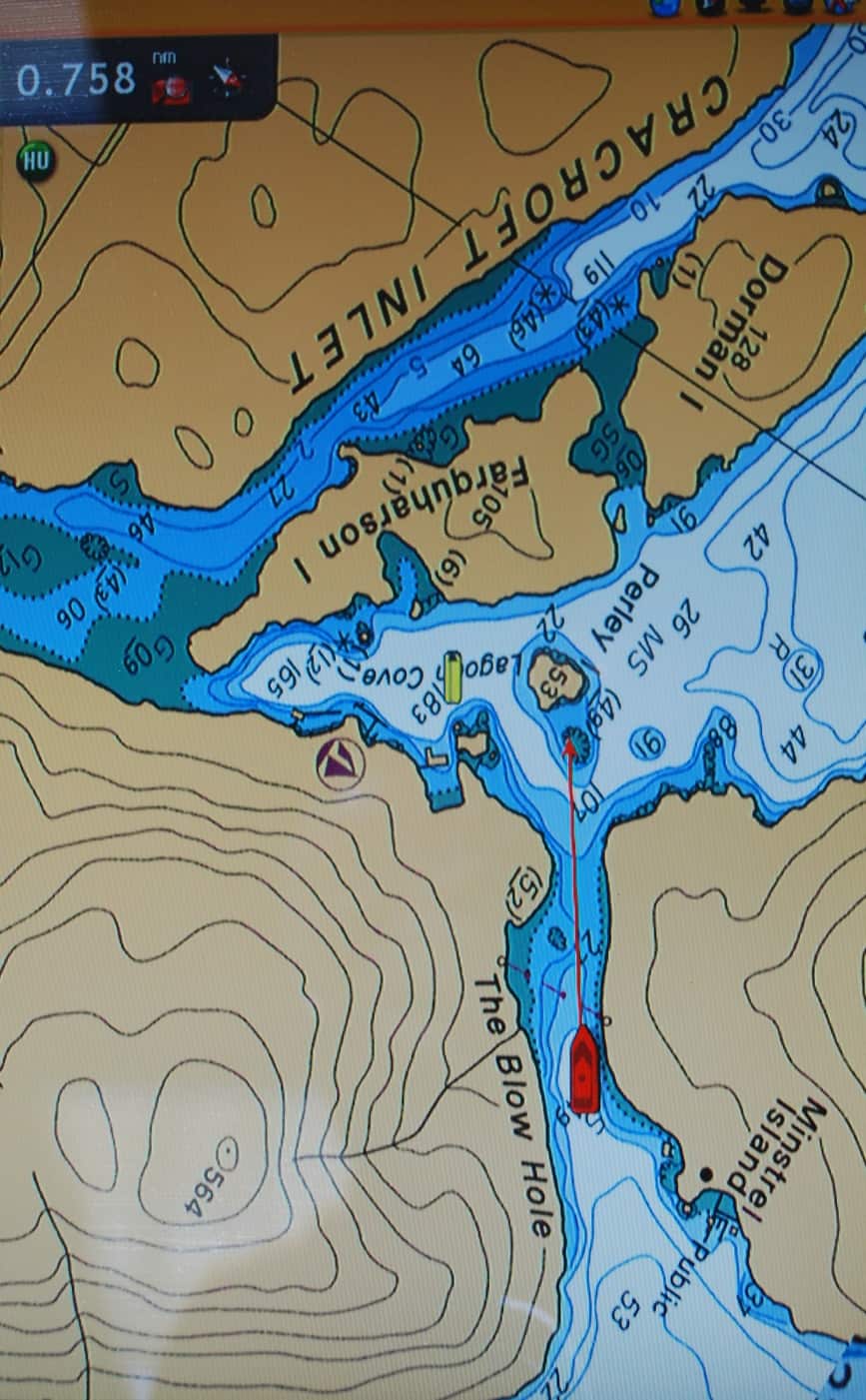
This chart plotter screen shows our route (in red) from Lagoon Cove, around the west end of Gilford Island and through Spring Passage, Retreat Passage, Cramer Passage, and into Pierre’s Echo Bay Marina. Spring Passage reputedly has some uncharted rocks, so we were very cautious there, with Kap at the bow in the hopes that any danger lurking there could be seen in time to avoid it.
Steve and Shirley and Kap pow-wowed quite a bit over cocktails about our best route from Lagoon Cove to Pierre’s Echo Bay Resort – the long way or the short way. The long way is around the east side of Gilford Island on Tribune Channel, and it’s nice, easy, and safe (and the way we’ve always gone in the past). The short way is around the west side of Gilford, and requires transit through Spring Passage, which is full of islands, rocks . . . and ominously, we were asked by the people at Lagoon Cove to be on the watch for the body of a fisherman on board a commercial vessel who somehow fell overboard during the transit of Spring Passage a week earlier (the comment was made, no trace was discovered during the search, and it’s about now that a body tends to rise to the surface).
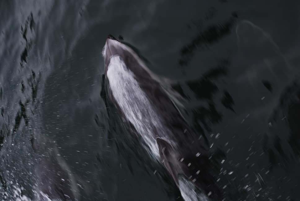
No sooner had we entered Knight Inlet than Kap spotted a dolphin surfacing about 10’ off to the right of our bow. That usually indicates they’re going to bow surf on the boat, so I immediately headed for the bow with my camera. Leaning far over the railing and looking immediately to the right of our bow, I could see five Pacific White-Sided Dolphins surfing along, about 2’ beneath the surface. Body movement was almost imperceptible, indicating they were matching our speed of 10 knots (11.7 MPH) almost entirely by our bow wake. They were barely inches apart, and would swap places every minute or so as one would surface for just a fraction of a second – presumably to gulp a breath of air. Kap and I took turns watching them and driving the boat in a constant speed, knowing they were doing this for sheer pleasure, or to catch a free ride for a few miles to their next feeding ground. While we were watching them, Couverden radioed to us from about a mile ahead that they too had a dolphin pod bow surfing on their boat. What an amazing sight!
We’d never been through Spring Passage, and after plotting the course on our electronic chart plotter, Kap agreed that we should try this route. It might not be all that much shorter, but it definitely seemed more interesting. We set the departure time for 7AM the next morning.
Spring Passage indeed requires careful threading through the narrow and shallow passages, around islands and rocks that are seemingly everywhere. We followed Couverden, and were really glad to have electronic charts to navigate by, with three different screens that we could zoom in and out as necessary. I was at the wheel, and in fairly heavy rain, Kap was at the bowsprit keeping a sharp eye out for uncharted rocks that might be lurking below the surface. There were none, and in 30 minutes we were safely through the passage – and to our relief, no sign of a body either.
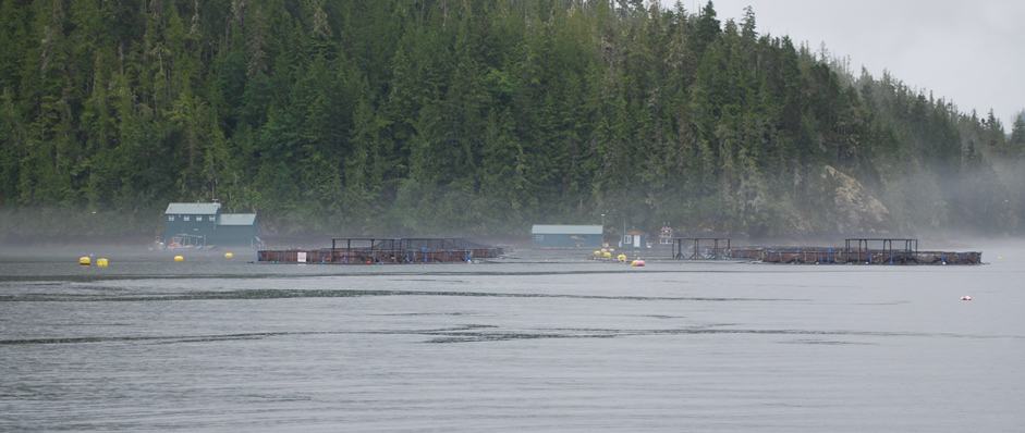
There seems to be no end of fish farms that raise Atlantic salmon, regardless of the scientific evidence that’s building about the harm done by these fisheries (the worst of which is a fish lice that kills off everything around the hatchery, creating a dead zone). For some reason, Pacific salmon don’t farm well, so with the help of a Canadian Fisheries executive (who supposedly came from the plains of Alberta and can’t tell one end of a salmon from the other) they continue to thrive. Most people on the West Coast of Canada and the U.S. boycott these Atlantic salmon, but they’re a valuable export crop. The worst for us is, they need secluded, quiet bays, and those are also the best places for cruisers to anchor.
This fish factory boat was just departing the fish farm as we passed by. As near as we could tell, the grey rigamarole on the aft deck is a huge vacuum suction mechanism that probably unfolds and extends out to the particular pen that’s ready to harvest salmon. They’re scooped into holding tanks, then taken somewhere to process for export.
From there we turned NE, winding our way through another string of islands in Retreat Passage. This part of the route is familiar for us, as it’s one of our normal gateways into the Broughton’s from Port McNeill on Vancouver Island.
There must be a thousand islands along this route, some fairly large, but some about the size of a house (like the one in the center of this photo). It rained for most of the way, and low scudding clouds were at the treetops. The scenery is so beautiful, though, that even dreary weather can’t spoil the day.
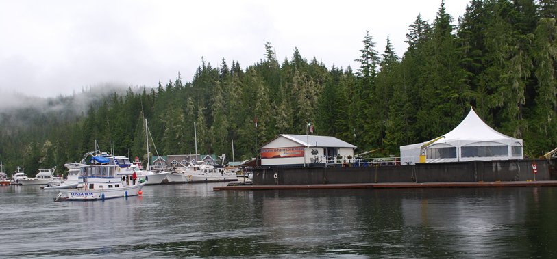
The entrance to Pierre’s Echo Bay Marina. The building and tent sit atop a large section of the I-90 Lake Washington Floating Bridge that was towed up here about 25 years ago when the bridge underwent major reconstruction. The permanent building is a general store that has quite a good selection of groceries. The tent is the evening gathering spot for the various evening dinners that seem to pack crowds in. The fuel dock is just to the left and below the General Store. At the back of the photo is a large lodge that was moved over from the old Pierre’s Resort in Pierre Bay – does this guy like to promote his name, or what? – just around the corner to the east from Echo Bay. We were assigned moorage on the third dock in from the boat that you see on the left side, with Couverden across from us on the second dock.
This is our first return to Echo Bay since 2007, when Kap’s brother, Elliot, and his wife, Michele, flew in to spend a week with us on Cosmo Place. At the time, it was in a bit of a dilapidated state, as the couple who built it up were aging and going through some serious health issues. Pierre Landry had an up-and-coming resort around the corner to the east of it at the time, and with some financial backing from some local float home and shoreline home owners, he bought the place and moved his operation. Since then he’s rebuilt the docks and repowered them for boat shore power, and the place is going gangbusters. Pierre and his wife, Tove, are probably the most successful self-promoters in the whole of the Broughton’s, always attending a booth at the huge Seattle Boat Show each year. They host several hugely successful potluck dinners, where they supply the main entre and the boaters bring the rest – including the Saturday night Pig Roast, the Friday night Italian Night, and a Prime Rib Wednesday night. During the busiest part of the season, moorage is booked solid around those nights, and reservations have to be made a couple of weeks in advance. This is not our forte, and we’ve stayed away – particularly since we’ve heard that the noise inside the tent is so high that it’s hard to carry on a conversation. Pierre and Tove are really great people, and the boaters we’ve run into at Echo Bay are always nice, but dinners on Flying Colours are lots more to our liking.
The most unique aspect of Echo Bay is the large concrete float – it’s a section of the I-90 Lake Washington Floating Bridge, towed up here in the 1980s or 1990s when the bridge underwent major rebuilding. This entire world in the Broughton’s subsists on floating structure, but none like this. At one time, there were entire villages of floating buildings lashed together, made up of whole city block areas, with floating sidewalks in between the main floats. They supported the loggers who, over a century in time, cut down the entire stand of old growth cedar and Douglas fir trees that covered this mountainous and rugged area. When one area was logged out, the entire villages were moved to a new location. The villages had names, and were large enough there was regular B.C. Ferry service to them. The logging is still being done, but on a much smaller scale, and most of the felled logs are dragged to the shoreline and made up into log booms that are towed out by tug boat. The days of permanent settlements are over, and all that remains are the floating resorts that cater to us cruisers.
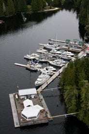
Here’s an aerial shot of Pierre’s Echo Bay Marina (taken from their website at www.pierresatechobay.com). The grey rectangular structure that the General Store and function tent sit on is the I-90 Lake Washington Floating Bridge section. It’s probably 100’ wide, by 200’ long. Towing that thing up from Seattle must have been quite a project.
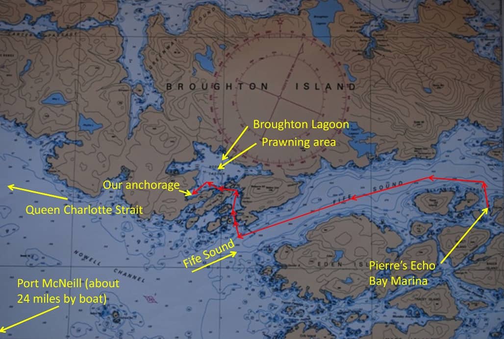
Our route (shown in red) from Pierre’s Echo Bay Marina to Booker Lagoon was only about 16 miles, estimated to take under two hours, with a high tension transit through the narrow, shallow rapids that guard the entrance to the lagoon. Most of the cruise was down Fife Sound, which is another of our regular entrances to the Broughton Archipelago when arriving from Port McNeill.
This stop at Pierre’s was just an overnighter, and primarily for fresh provisions – enough to last us through a hoped-for extended stay at anchor in Booker Lagoon on the south side of Broughton Island. After tying up, we headed immediately for the General Store. I stocked up on enough skim milk to make the necessary two tall lattes each morning while at anchor, plus some fresh vegetables. It was Friday and the evening’s theme dinner was Italian night, with beef and chicken lasagna and spaghetti, which we declined, as I had promised Kap a special dinner on Flying Colours.
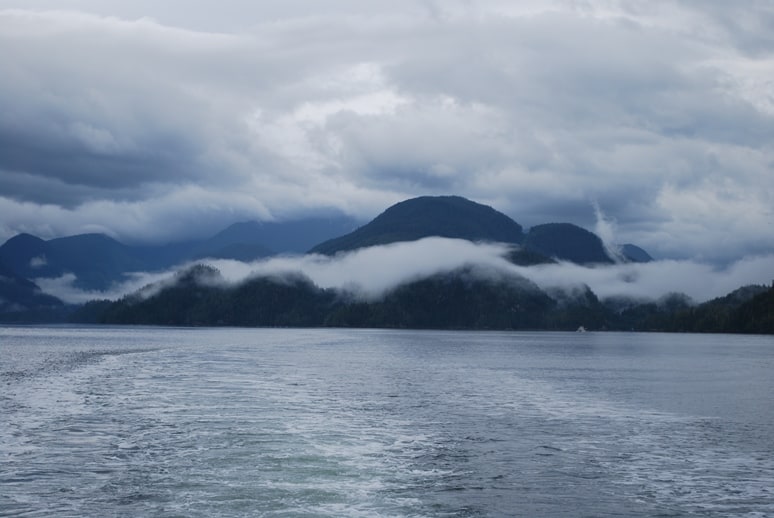
The weather forecast indicated rain for as much as the whole next week, and it wasn’t too far off the mark. As we cruised down Fife Sound early in the morning the clouds still swirled in wonderful patterns along the mountain sides. With views like this, who cares about rain?
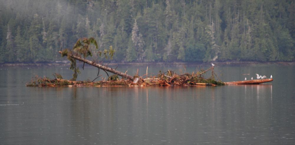
At one point along Fife Sound, Kap exclaimed that there was an uncharted rock outcropping to our starboard side. We both put the binoculars to it, and soon realized it was a huge clump of log, branches, and seaweed that looked large enough to be an island. It made a good cruise ship for the seagulls.
The next morning was again an early one for departure. Kap and Shirley checked, then rechecked their tide charts for riskiest passage yet – the entrance to Booker Lagoon. Because of a current that runs over 7 knots during tidal flood and ebb, timing slack water for it was critical. The published tide charts give a slack time at nearby Alert Bay – the First Nations village east of Port McNeill, and at least 20 miles from Booker Lagoon. Opinions vary on the time difference between slack at Alert Bay versus Booker Lagoon – anywhere from 15-30 minutes after Alert Bay. The cruising guides indicated that trying to make the transit even 15 minutes before or after slack could result in considerable current, as the length of slack is also very short. Kap and Shirley disagreed on their interpretation, and later events showed that Kap was right.
Couverden starts their entrance to Cullen Harbour, a small bay just outside Booker Lagoon. The time is 8:21AM, and Kap figured it’s still 25 minutes before slack.
According to Kap’s interpretation, slack at the entrance to Booker Lagoon should be 15 minutes after Alert Bay, which was at 8:30AM. As usual, we arrived earlier than this, and Kap figured we’d just idle around, waiting until the current was slack. We were following Couverden, and they seemed to figure that slack should be at the same time as at Alert Bay – so they headed into the first entrance, to Cullen Harbour. Kap wanted to wait out in Fife Sound, but after reading the cruising guides again, decided it would be OK to transit into Cullen Harbour to wait.
There were two boats at anchor in Cullen Harbour, including this colorful one – what a kaleidoscope of colors!
As we stood off the entrance to Booker Lagoon, we could see the rushing waters through the shallow, narrow entrance.
As soon as we were inside Cullen Harbour, Couverden moved over to the virtually hidden entrance to Booker Lagoon. They reported they could see a fairly strong current coming towards them, and to our surprise, a couple of minutes later they said they were going through. It sounded crazy to us, but it’s their decision.
The passage is only 50’ wide and 20’ deep, so if the strong current coming towards you pushes the bow to one side or the other, there’s very little margin for error. Our beam is 16’, so that only leaves 17’ to spare on each side of us as we go through.
Five minutes later, Couverden reported they were safely through, and we breathed a sigh of relief. We peppered them with questions on the VHF about how strong the current was, whether it was right on the nose, and whether there were any whirlpools. They felt the current was about 4-5 knots, with a current was funneling down into a definite V-shape that we should aim the bow for.
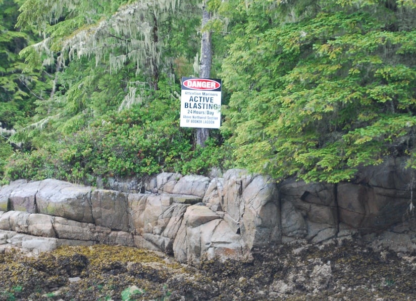
At the entrance to the lagoon stood an ominous sign on the shore – Danger – Active Blasting, 24 hours a day, above northwest section of Booker Lagoon. The only thing we can figure is they’re blasting for logging roads, as we’ve heard there is quite a bit of logging going on there.
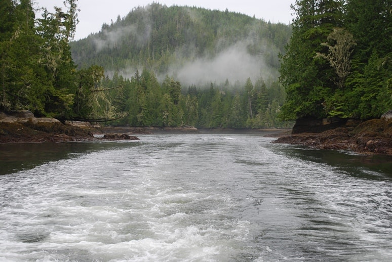
My attention was riveted on the passage, and besides, when you’re in the middle of it there’s very little of interest to photograph. This shot was taken from Flying Colours’ cockpit as we exited the extremely narrow passage. The swirling white water is from our wake, but I can assure you, there was a fair amount of current on our bow.
We’ve been taught over and over again that a boring passage is the safest – if it’s a white-knuckler, it’s not safe. After Couverden went through, Kap decided to hang around a few minutes, and I concurred – which was still only 10 minutes, and several minutes before Kap estimated slack would be. With a fair amount of trepidation, we entered the narrowest and shallowest passage we’ve been in so far in 5 years of cruising, and I know Kap’s heart was beating.
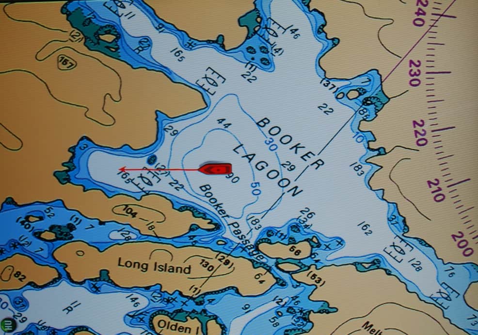
Here’s our chart plotter screen of Flying Colours as we headed into the bay on the SW corner of Booker Lagoon. Except for large logs and other flotsam that came in and went out with the tide, it proved to be a wonderful anchorage.
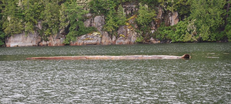
These are the size logs that floated in with each tidal flood, then back out with each ebb. This guy is easily the length of Flying Colours, and while he’d drift along very slowly with the tide, bumping against the hull in the night wouldn’t be good. We drifted into one like this with the dinghy while we were absorbed with baiting our prawn traps, and at a drift speed of about 1 MPH, it was a solid bump.
The next morning, this was our view to the east where Couverden was at an easy anchor, and the sun was struggling to rise and shine through the dense cloud bank on the hills. The white buoy at the lower right is our anchor sentinel – our mascot, and we’ve named him A-Oh, because that’s what’s written on him as a buoy model (sort of like Wilson in the Tom Hanks movie Marooned.
After cruising around the lagoon to find our best anchorage, we finally settled on the bay at the SW corner of the lagoon. Depths were about 35’ there, and figuring a wind from the NW might give us a bit of a problem, we settled on 3:1 scope and dropped anchor. Couverden came in after us and they anchored about 500’ away.
Prawning so far at Booker Lagoon has been fabulous! There’s a “hole” right in the center of the lagoon that’s right at 300’ (295’ at low tide, and 305’ at high tide) – the perfect depth for spotted prawns. We’ve set our traps six times now, for a daytime and nighttime soak each day. In our freezer, we’re just about at our limit of 800 prawns that we can have in our possession – 400 per license, and we each have a license. They are also the largest prawns we’ve had so far.
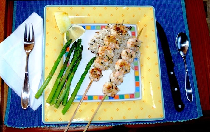
The best part is, the prawns taste wonderful too! Kap cooked Lemon Garlic Prawns on the BBQ, and they were delicious. I marinated them for an hour in a blend of spices, fresh lemon zest/juice, and fresh garlic. They were served on a bed of wild rice, with roasted asparagus (also done on the BBQ). It didn’t quite measure up to our Flying Colours Scampi, but came pretty close.
(In case you’re wondering why we would suddenly spend so much time and effort on prawning? Well, I like prawns, but in all the grocery stores in the Seattle area – including Whole Foods and PCC – the only prawns to be found are from Thailand, Vietnam, or the U.S. Gulf. I’m not enamored with the diligence of our USDA inspectors for international food chain operations, particularly seafood from places like Thailand and Vietnam. As for the Gulf, the BP oil spill is still too recent, and the cleanup not yet complete enough, to make me want to eat seafood from those waters. I’m not so sure I shouldn’t feel the same way about beef, pork, and chicken production in the U.S., but I haven’t yet found an alternative that works for me.)
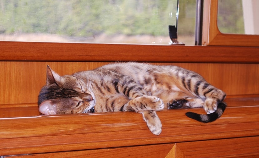 Lastly, should you be curious about whether ZuZu is enjoying her cruise so far – well, the photo of her sleeping on the salon sideboard should give you an indication. She still ducks into her hidey hole the moment she senses we’re about to start the engines and get underway – and doesn’t show herself again until the engines are shut down. But when were at anchor, she’s definitely a contented cat. So far, we’ve seen only one eagle, so our concerns about her roaming the deck are lower than in previous years. ZuZu is definitely a good boat cat!