
Garden Bay – Nearby Forest Fire. The night before departing Garden Bay turned out to be more eventful than expected. We were sitting in the cockpit of Flying Colours enjoying a last sunset when an incredibly noisy helicopter swooped down and hovered about 200’ above the water about a quarter mile from us. Then we noticed it had a large bucket hanging below, and it was slowly dipped into the water. The bucket filled within about a minute and was lifted out of the water. As soon as the bucket was clear, the helicopter climbed a few feet, than turned sharply in our direction and flew towards us. It was so close overhead you could see water dripping off the sides of the bucket as he turned just before us and headed over the low hill to the west of the outstation.

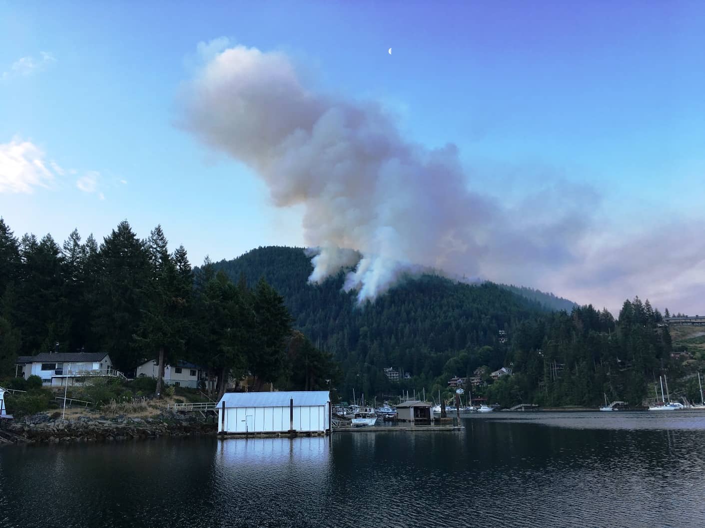
The white wisps rising above the trees behind the Garden Bay outstation are smoke, not clouds. Surprisingly, we couldn't smell it, but combined with the direction and time of travel by the helicopters was a clear sign that it was a very clos-by forest fire. We just couldn't tell how close it was.
Almost immediately another helicopter repeated the water scoop. By the time he flew off, the first helicopter was already back for another load. That gave us an indication the fire was quite near, but we couldn’t see anything due to a low tree-covered hill behind the outstation.
Within a few minutes the first whiffs of smoke rose over the treetops to our right. Not long after that, we heard from a newly-arrived SYC boat that they could see the fire on their way in, and yes, it was quite near to us – maybe a scant mile or so away.
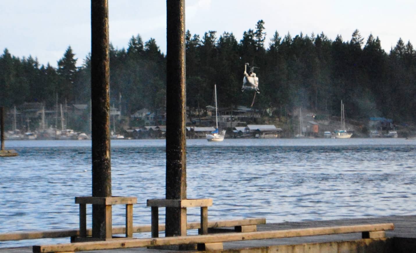
The third helicopter on the scene dropped very close to the water, and we could see what appeared to be a 10'-12' hose, and hovering just above the water's surface, and we presumed it was siphoning water into an internal tank. (You'll have to enlarge this photo to even see the helicopter.)
A half hour later a third helicopter joined the operation, but this one would hover maybe 10’ off the water, and with a hose boom lowered into the water it apparently siphoned water up to an internal tank. Then a fourth aircraft, a 1950s (or 1960s) era 4-engined/prop water bomber joined in. Surprisingly, a small business jet then began circling low and fast over the hill behind us, and we figured it might be a command and control aircraft, but it could also be a news crew aircraft.
This activity continued for two more hours until darkness, and then things went quiet. We could still see smoke rising behind the hill, but we presumed the firefighters had it contained. We went to bed feeling safe that the fire was being held at bay.
Thursday, June 25, Garden Bay – Cortes Bay, SYC Outstations. For our nearly 6-hour cruise north to Cortes Bay (the SYC outstation on Cortes Island), Kap had wanted to leave at 5AM – timed to get there after the morning’s departure of boats and before the subsequent arrival of new boats. I’m not a fan of getting up at 4AM just for this, and I managed to talk her into 6AM. She was reluctant, but agreed.
As we departed the dock the following morning it was immediately evident just how close the fire was, and how much it was still burning. A fire marshal statement mentioned that the fire was burning at ground level and not the trees themselves, resulting in it being a fast-growing fire.
At 6AM, there’s rarely anyone awake on the docks, so we quietly made our preparations, untied the lines, and slipped away from the dock. Within 200’ of the dock, the sight off to our port side was truly startling – a substantial fire still burning on the hillside, with a huge plume of smoke rising.
Don’t forget – you can click on any photo in the post to enlarge it.
Yes, the problem with the Current Location map has definitely been identified as our out-of-date linkage with Google Maps. When we return home this summer I’ll need to have my tech guy update the linkage to the new API that Google is using. Nevertheless, you click this link to see where we are located: http://fms.ws/19EStE/50.06052N/124.93071W, and then zoom in/out to see the detail or overall view.
Also, this post is more readable in the online version, plus you can read any of the posts back to 2010 from the archive – just click on the link above to the blog. Go to www.ronf-flyingcolours.com.
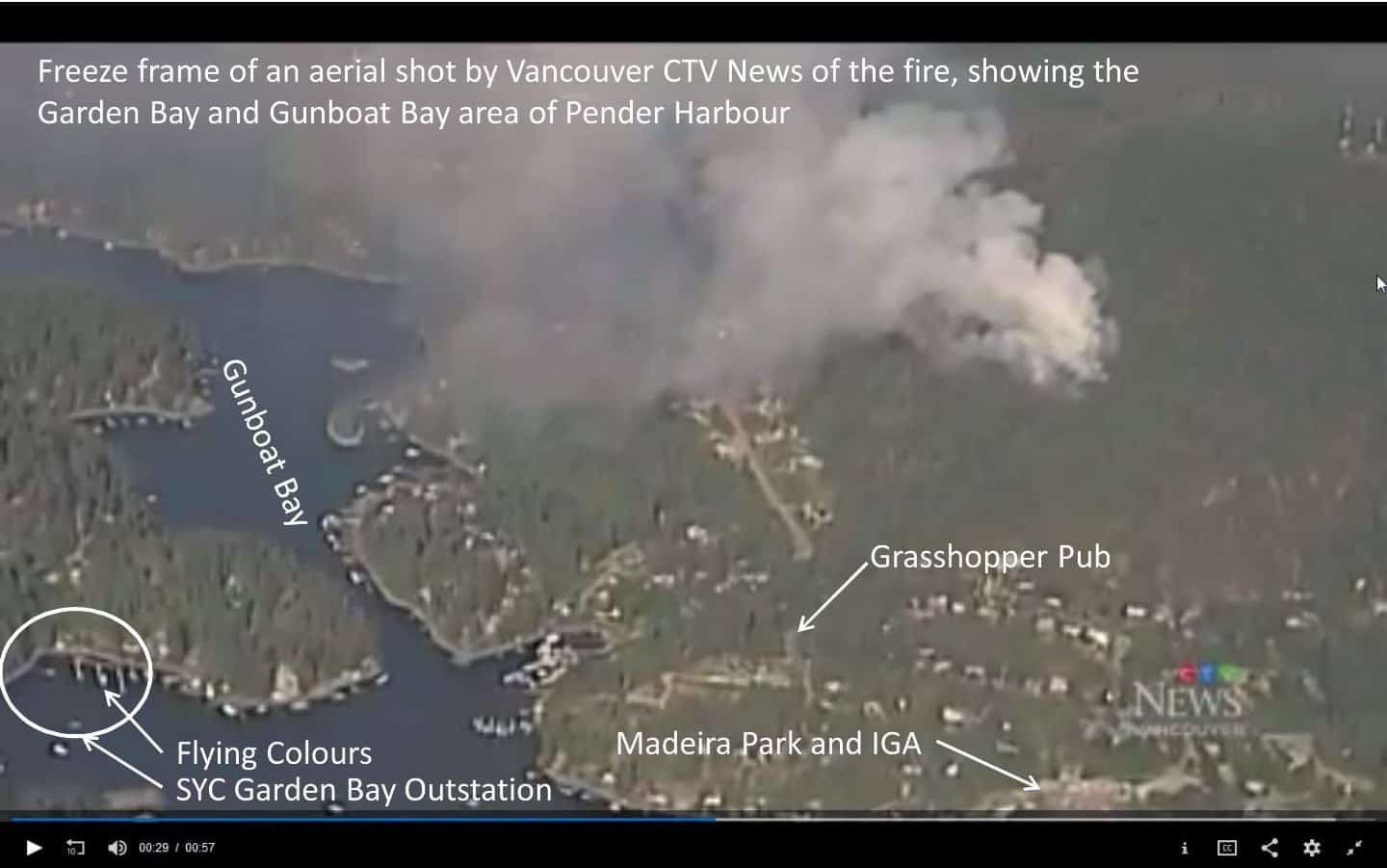
The SYC Garden Bay outstation is at the lower left corner of the Vancouver CTV video. Flying Colours is the white speck at the end of the dock out front.
Later that day, and shortly after our arrival at the Cortes Bay outstation, Kap searched around to find if there was any news about the Pender Harbour fire. Sure enough, it was on the CTV Vancouver News, at https://bc.ctvnews.ca/video?clipId=1714950 – and it’s worth watching. I did a freeze frame from the video of an overhead shot of the area and then created a descriptive photo of it showing the SYC Garden Bay outstation in the lower left of the photo, and Flying Colours is the tiny white speck at the dock.
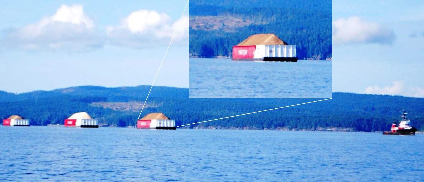
This triple barge tow, going almost the same speed as us, was ahead on our windscreen for the better part of the morning, only passing it at the north end of Texada Island.
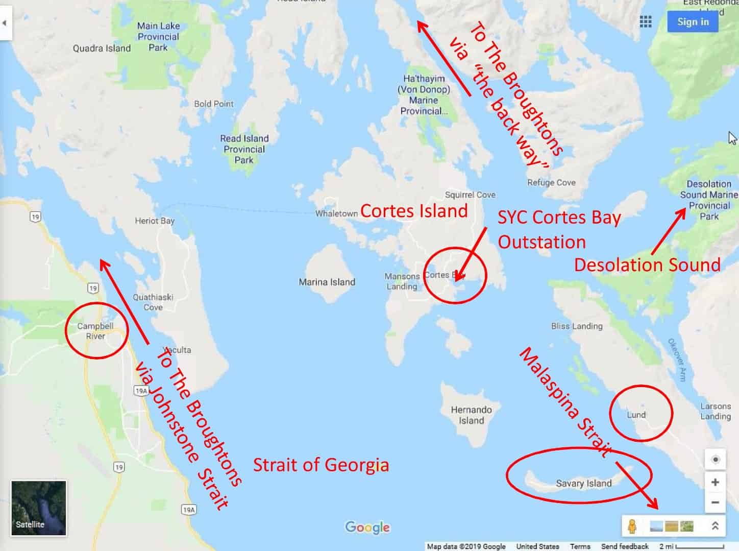
A significant part of our cruise northward was on Malaspina Strait, a mile wide channel that separates Texada Island from the mainland. After Texada (pronounced tex-ada’, with a long middle “a” and a short ending “a”) is the coastal town of Powell River on the mainland side, with a pair of car ferries that run about hourly to Comox on Vancouver Island. Powell River is about halfway to our destination at Cortes, so it’s a good marker for us.
I don’t know what it is about a triple tow that fascinates me, but I can’t pass one without taking a photo. Having been to SE Alaska twice on a tug and single tow – in 2003 and 2006 – I appreciate the level of seamanship required of a towboat captain, but I simply can’t imagine the complexity of a triple tow. Shortly after this photo, we passed the huge lumber yard at Powell River, and I commented to Kap that the three wood chip/sawdust barges all seemed to be pointing askew from the towboat’s direction of travel. “Ah, it’s just your perspective”, replied Kap. I watched it bit longer, and sure enough, the tug had now turned sharply to port to head for the lumber processing plant. We could see clearly that the barges were all three pointed (equally) at a much sharper angle than the towboat. I have no idea how/what the towboat captain does to make that happen, and I also can’t imagine the challenges of bringing a triple tow into port and docking them, one by one.
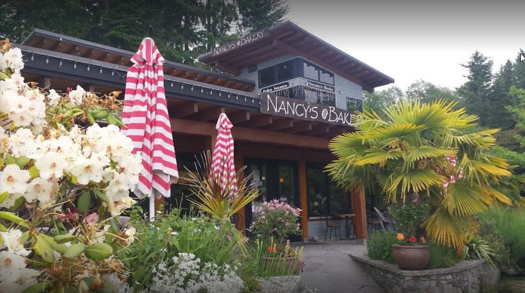
We've never been there, but this photo that I got off the internet shows the well-known Nancy's Bakery at Lund - the end of the road north to Desolation Sound.
Beyond Powell River is the small town of Lund on the mainland. Lund is significant in that it’s “the end of the road” by car from Vancouver, and anyone who lives up here and arrives by car has to make the last part of their trip by boat (in fact, there’s even a parking lot named “End Of The Road Parking” on the north side of town). We’ve always wanted to stop in Lund, as it’s relatively famous and popular for its funkiness, and particularly famous for Nancy’s Bakery. It’s considered a “small boat harbour”, and we’ve never looked into whether we can fit on their docks – and if we don’t, it’s too far to anywhere else, so we’ve just never tried.
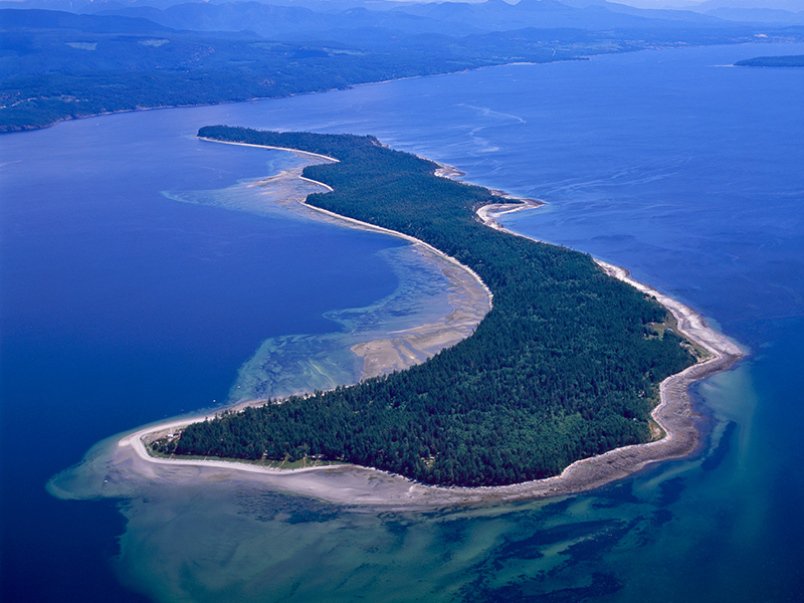
Savary Island from the air. The land in the upper left corner is the Canada mainland, and we pass between the 1/2 mile wide gap with the island on our way north to Cortes Bay. The primary population settlement is on the narrow part closest to the mainland.
About a mile southwest and offshore of Lund is an interesting island – Savary Island. It’s long and skinny, just a half mile offshore, and at its widest, it’s only a mile wide, and five miles long. At first glance it appears to be uninhabited, with seemingly no docks or shore access by boat. On closer look you can make out houses set back in the trees at the SE corner, and on the protected north side is a field of mooring buoys set in shallow water. The island has a permanent population of around 100, but with dozens more summer cabins scattered around the island it must swell considerably in the warmer months. Supposedly it has tree-lined boulevards that resemble a Hollywood enclave. Access to the island is by private boat or a water taxi from Lund.
Prideaux Haven, the heart of Desolation Sound, is far too crowded for us at this time of year. This photo was taken in 2010, in early September, and while there were a bunch of boats there, we managed to get the “Chamber of Commerce anchorage spot. It’s hard to believe this place was “desolate” – in Captain George Vancouver’s words in 1792 when he mapped this area, and hence the name he gave to it.
Once we pass Savary Island we know it’s a short distance now to Cortes Bay – maybe another hour at our typical 8 kt cruising speed. Cortes Bay is a pretty small bay – maybe ¼ mile wide by ½ mile long – and the narrow entrance to it is so hidden that you’d never know it’s there without navigation software.
Of the 10 outstations owned by the SYC, this one at Cortes Bay is undoubtedly the crown jewel. It’s considered the “gateway to Desolation Sound”, as it’s little more than an hour’s cruise to Prideaux Haven, which is the heart of Desolation Sound. The SYC has invested a ton of money in this outstation, and it must be near (or at) the top of member usage for all of the outstations.
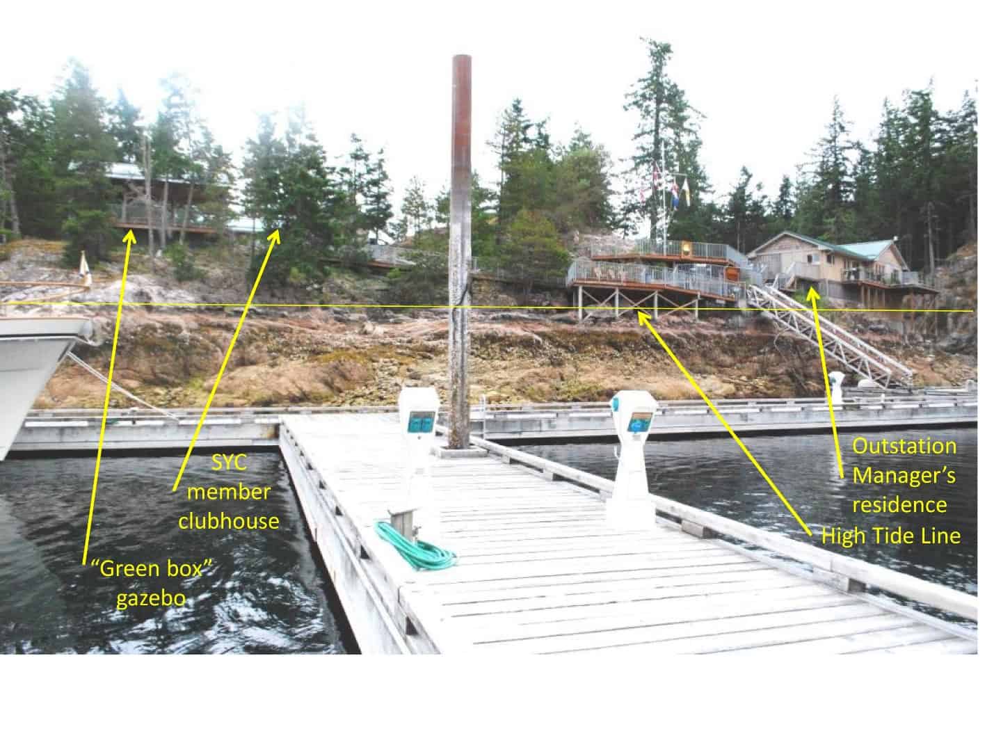
The Cortes Bay outstation has a new (about five years ago) gazebo for Green Box gatherings – a longstanding tradition of appie/Happy Hour get-togethers at any outstation, called by any SYC member on the docks, where everyone brings their favorite libation and a shared appie. The gazebo can hold up to 40 people, and also has lots of BBQ facility at it. Just completed this spring is the new SYC member clubhouse, with a washer/dryer facility, several shower and toilet rooms, and a lounge area. The main house at the right of the accompanying photo has now been taken over completely as the resident outstation manager residence.
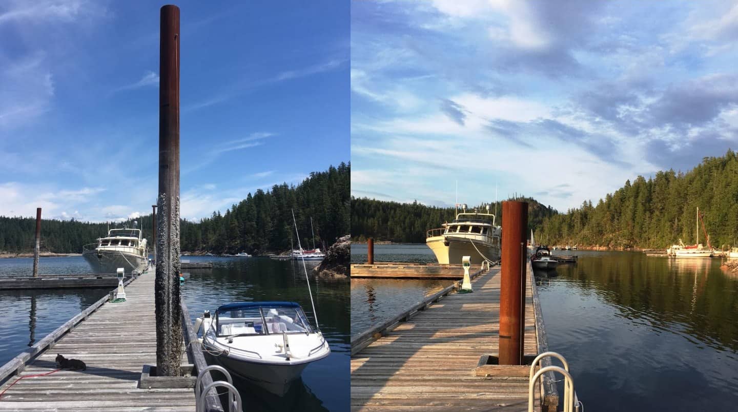
Dock pilings are one of the best indicators of just how high or low a tide is.
The photo at left was taken at 1:19PM in the afternoon, from close to the very steep shore ramp that you can see in the outstation photo above. The photo at right was taken from the same position, at 8:14PM – just seven hours later, at high tide. Looking at the tide book for yesterday at Cortes Bay, the tidal difference was 14’ from high-to-low tide. That number makes sense when you look at where the actual water is on the shoreline, versus where I put the high tide water mark.
I hope I don’t insult anyone’s intelligence, but in tidal waters the docks are always built as floating docks, with pilings sunk into the shore bedrock to hold the docks in place. So, the effect is, the dock is rising in relation to the pilings as the tide “comes in”, and lowers in relation to the pilings as the tide “goes out”.
Like triple tows, tides are a phenomenon that intrigue me, and got me to wondering who and when the connection was first made that tied the Moon phases to tidal differences. Who, what, and when would you guess?
Well, it was a really brainy Greek dude named Pytheas (one of those ancient guys who didn’t have a last name, and actually, he was an astronomer and explorer). In 330 B.C. he made a very long voyage from the Greek end of the Mediterranean all the way to the British Isles. Along the way he hit upon an incredibly startling deduction that the tides were in some way controlled by the Moon. He discovered and documented that there were not only two high tides per lunar day, but also that the amplitude depended on the phases of the Moon. About 150 years later (around 150 B.C.), another really smart Greek guy, Seleukos, worked out that the two tides per day had unequal amplitudes when the Moon was far from the equator (what’s known as the diurnal inequality). Interestingly, neither of these two guys could have worked this out anywhere in Greece, as the tides there are insignificant – (about 2” difference between high and low tide), so the voyage to the British Isles helped the studies for Pytheas, and Seleukos did his studies at the Red Sea.
To our surprise, the SYC outstation at Cortes Bay was almost empty on our arrival – three other boats, and our favorite end dock position was open.
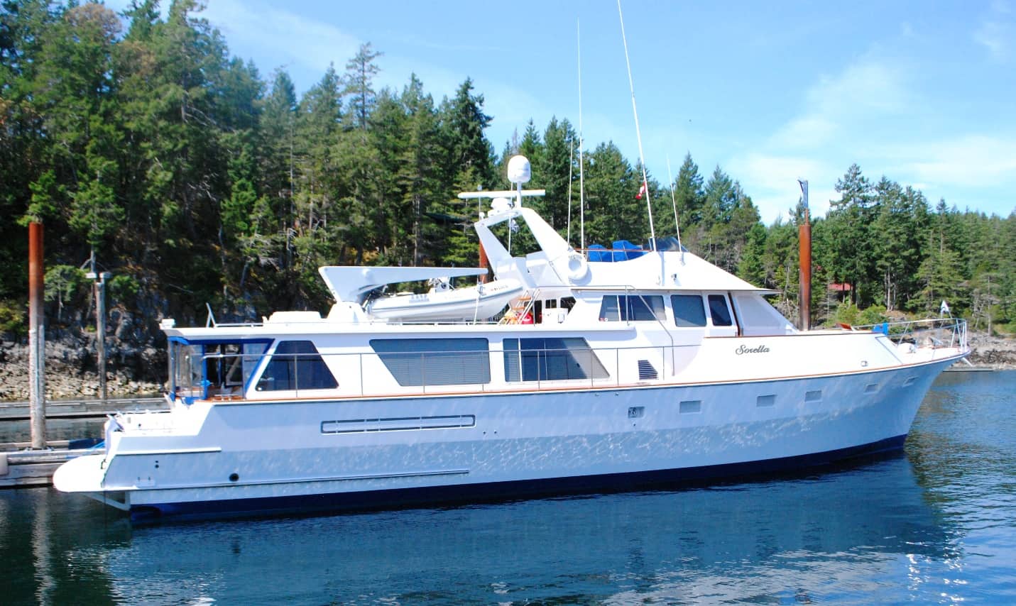
Sorella, the classic Franck/Garden 80' yacht at the dock at Cortes Bay outstation.
Sometimes I feel such a piker! The Sorella, moored just opposite us at Cortes Bay is an 80’ fiberglass yacht, owned by a couple from Yarrow Point (next town north of Clyde Hill where we live). According to the SYC boat registry, it’s listed as a “Franck/Garden” boat – and just those two names speak volumes about the pedigree of this stylish and attractive boat.
Vic Franck was a famous Seattle boat builder (died in 2005), with a shipyard located on the NW corner of Lake Union (in the area called Fremont) – and reputed to be the oldest boatbuilding company in Seattle. In his day, Vic Franck built boats for the Nordstrom family, Peter Fonda, Charles See (of See’s Candy), Jerry Lewis, Dick Smothers, and Bobby Darin (to name a few). His son Dan had taken over the business in the mid-80s, and the yard has now closed down completely.
Bill Garden is just as famous – but as a naval architect, who divided his prolific lifetime of yacht design between the U.S. and Canada. He’s equally famous in both countries, where he did most of his work in Seattle and the Vancouver/Victoria area.
Judging from other Garden designs like this, the Sorella was probably built sometime between the late 1960s and early 1980s. You can see a 1966 scaled-up version of the Sorella – the 107’ Dorothea – in a Seattle Times article from 2007 that, sadly, shows the firey demise of the Dorothea not long after it completed a refit in Seattle – at https://www.seattletimes.com/seattle-news/yacht-burns-sinks-at-sea-after-overhaul-in-seattle/ (make sure you scroll to the second photo in the slideshow). The resemblance between the Dorothea and Sorella is striking.
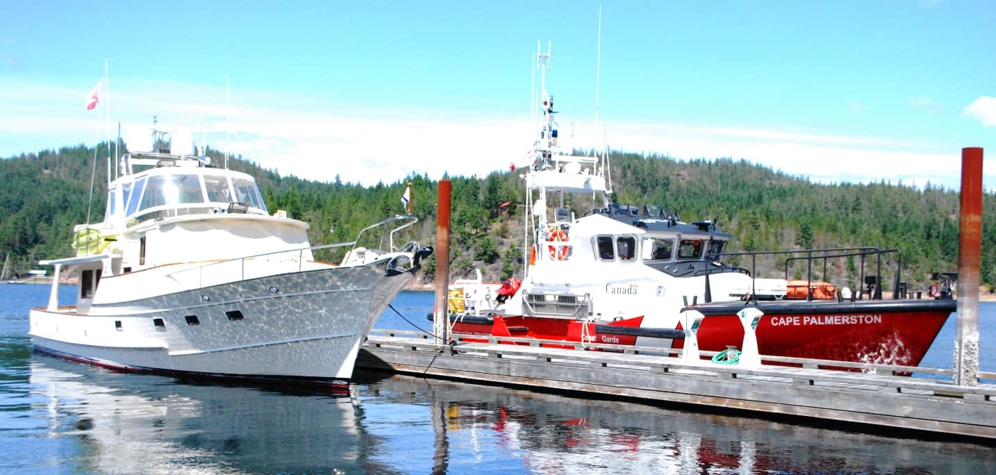
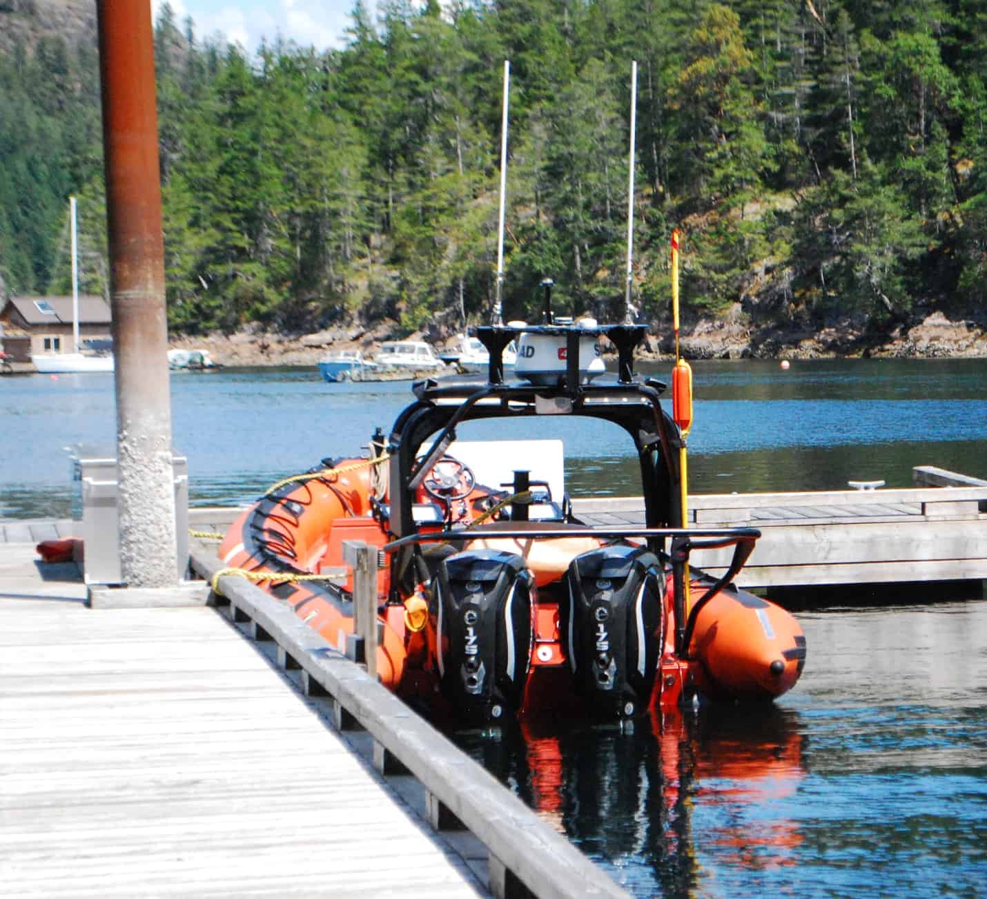
Speaking of cool boats, one afternoon I was banging away at my laptop in the salon of Flying Colours when Kap hollered out, “Quick, look at the boat coming in next to us!” I jumped up just as a brand new-looking Canadian Coast Guard boat pulled up across from us on our dock. It was named the Cape Palmerston and home based in Ottawa, with four “Coasties” aboard – and it looked fast just sitting at the dock! It was the day before Canada Day, and the Coast Guard and Navy typically “do” something to show the colors in many of the ports we visit. As they deplaned I asked the skipper what was up, and he said they were just liaising with their Coast Guard counterparts who are stationed here at Cortes Bay and keep their inflatable boat at the SYC dock. They were finished with their business within an hour and then quickly pulled away.
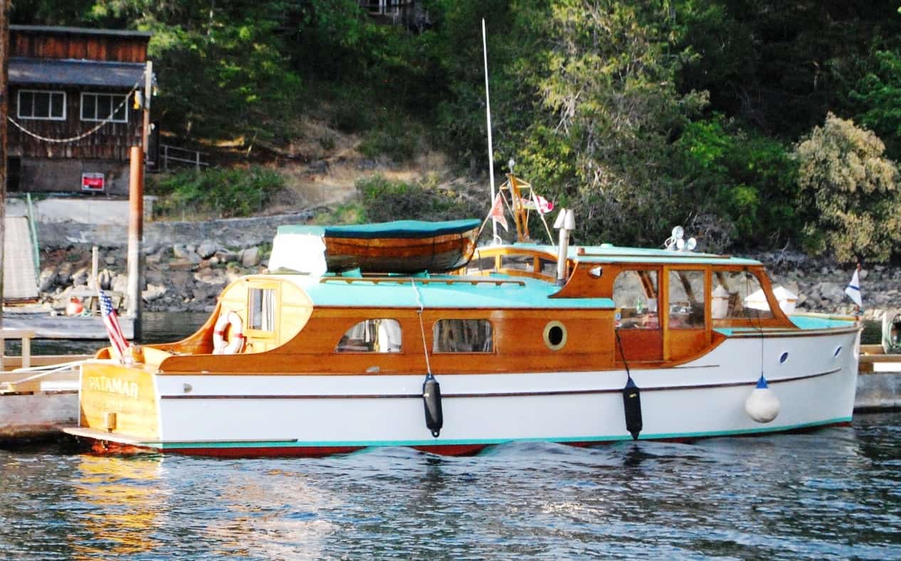
The Patamar, a classic 34' wooden cruiser has been opposite the dock from us at both Garden Bay and Cortes Bay outstations on this cruise. We can look at this boat and never tire of it.
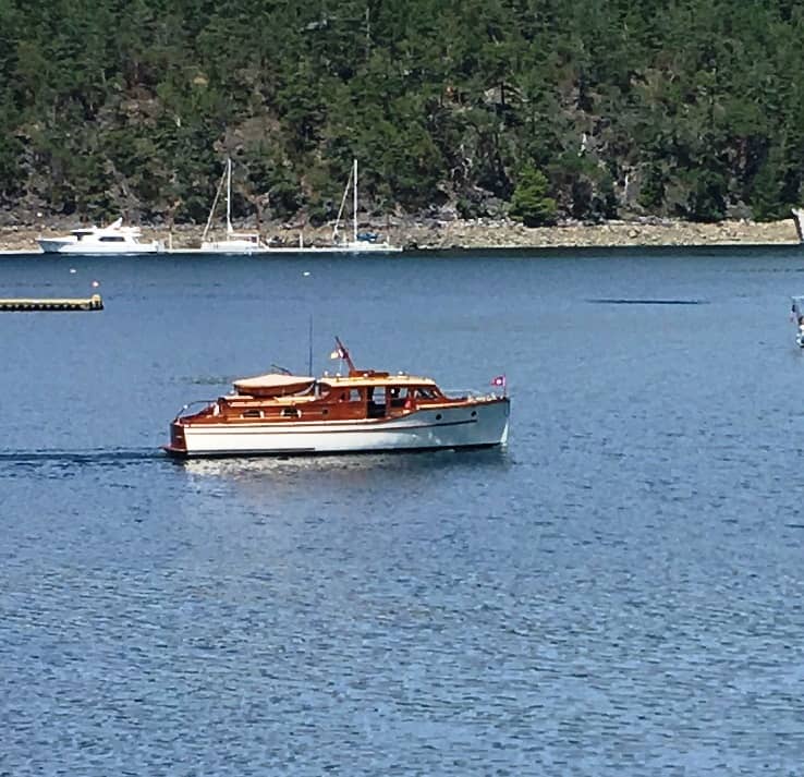
Ditto for this classic too. It was traveling with the Patamar, but not being an SYC member they couldn't be on the dock. On arrival at Cortes Bay, they came in for just a few minutes, then headed off to Desolation Sound.
And while I’m on the subject of cool boats, during our stay at Garden Bay last week a gorgeous classis wooden boat came in, named the Patamar. As we always do, Kap and I went over to their dock to catch their lines. As we ogled the boat, the owner told us it is 34’, and built at home by a Boeing guy in 1937. This guy has owned it for 22 years, and is the third owner. Three or four days after we departed Garden Bay, the Patamar showed up at Cortes. Right after that, another classic wooden boat – name unknown – showed up off the SYC docks. The two boats are cruising together, but the second one isn’t a member of the SYC, and not being able to tie up at our docks, had decided to head straight over to Desolation Sound. Keeping these old boats in working condition is great, and it’s nice to know that some people have the time, talent, and abilities to do it.
We’re stretching out our time at Cortes Bay, and hope that we’ll have another three or four days here before we slowly start working our way south. The plan is to return to Garden Bay, then after that head across to the west side of the Strait of Georgia to the isolated SYC-owned private Ovens Island. Then it’s back to Ganges to get Kap’s winter supply of frozen gelato cake that a wonderful gelato place there makes. Stay tuned.