
Hello all,
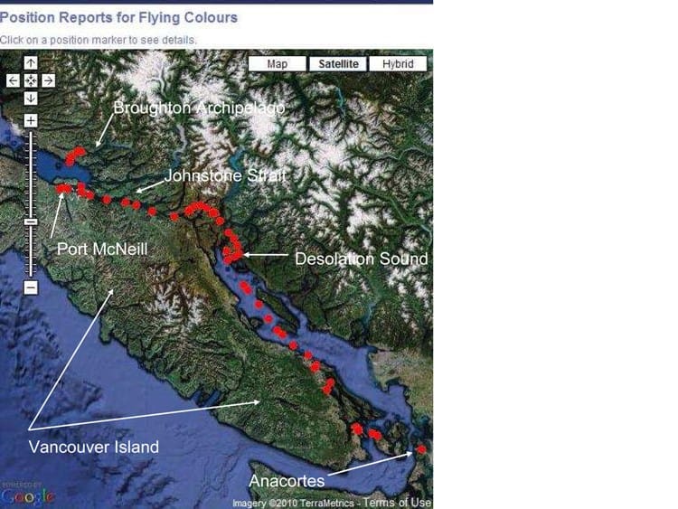
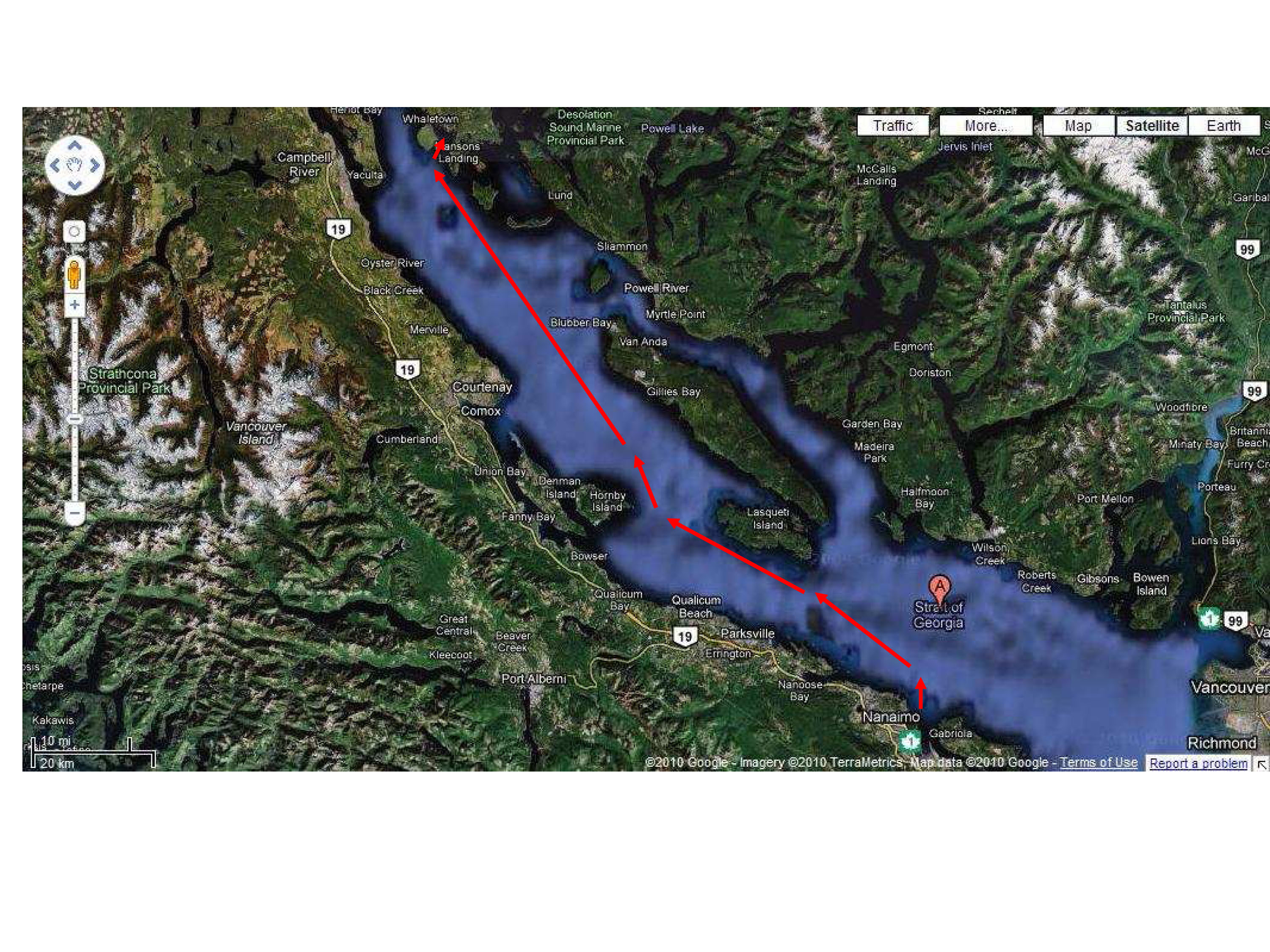
Here's our route to date since leaving Anacortes on July 16th.
It’s way past time for an update. A lot of water has flowed under Flying Colours’ keel since I last wrote. I’ve written notes for everything we’ve done since Nanaimo and have it almost ready to post but the software isn’t being too kind to me – I think I hit some magical size limit on the post and it wouldn’t let me add any more photos. I’ve now broken it up into 2-3 segments. This is the first of those.
We’ve been as far north as Port McNeill, almost at the top end of Vancouver Island – our second time here, for circumstances that we didn’t plan. We’ve traveled a bit under 392 miles in 12 actual days of cruising since our departure on July 16th. Here’s a recap of what we’ve been up to since Nanaimo.
Click on any image to see an enlarged view.
Monday, August 2 – Nanaimo, B.C.
When I left off on the past post, we had just arrived in Nanaimo, planning for a 2-day stopover. We always like Nanaimo – previously it’s been our primary provisioning place for the trip north, but now it’s been replaced by Sidney. McLean’s Delicatessen in Nanaimo, though, is almost reason enough to stop, and we also needed some other boat things too.
A bronze plaque just outside the marina that describes the history of Nanaimo.
Nanaimo is an old coal town, founded in the mid-1880s when (as legend has it), a local – and very intuitive-thinking – First Nations chief picked up a lump of very lightweight black rock as they were digging for clams on the beach in front of what is now the center of the city. Back at his camp he threw it on the fire and was surprised to see it burn rather than just get hot. Later, when he was visiting Victoria, he noticed the same black stones firing the blacksmith’s forge at the fort. Learning that it was a very valuable resource and currently brought at great expense from Europe by ship, he offered – for a reward of course – to show the white men where he’d discovered a similar rock that burned. He subsequently brought a canoe load of coal to the fort and received payment. In 1853, the Governor of Victoria ordered one of his local garrison commanders to proceed immediately to “Wintuhuysen inlet”, commonly known as Nanymo Bay (as it was then spelled), and “formally take possession of the coal beds lately discovered”. It isn’t mentioned whether the chief and his people received any other remuneration, or if the British garrison just took what they felt was rightfully theirs. That certainly would have been the thought at the time.
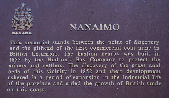
This information came from a very interesting book that Kap bought at a favorite book shop in Nanaimo – which is another reason we like to stop there – a book called British Columbia Coast Names; Their Origin and History, by Captain John T. Walbran. A byline says the book is “A treasury of biography, history, and anecdote”. This information about Nanaimo came from “an old Hudson’s Bay Company dispatch book”.
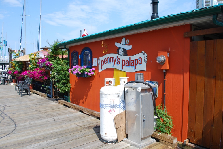
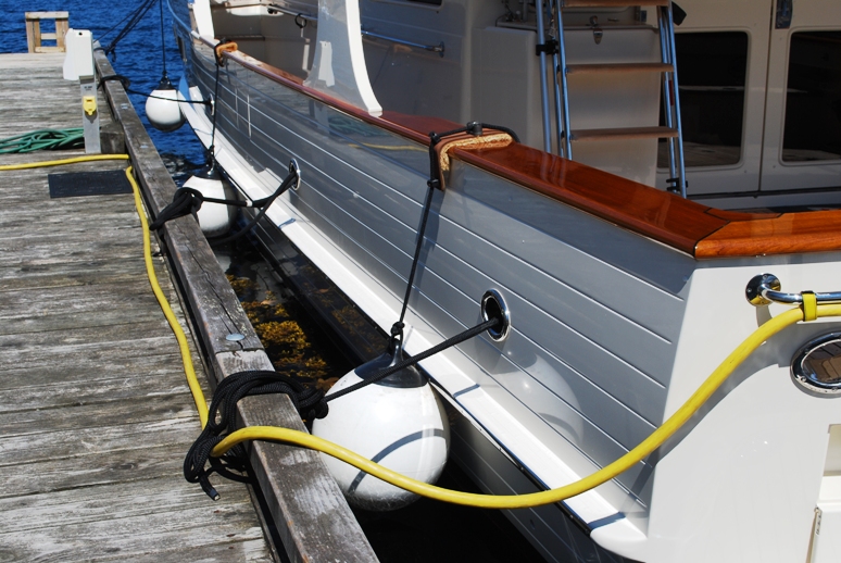
Penny's Palapa, where you can get a refreshing margarita and a light Mexican lunch right on the dock at Nanaimo Port Authority Marina.
Within an hour of arrival at Nanaimo, having gotten Flying Colours safely tied up at the Cameron Island marina facility, we headed over to Penny’s Palapa for our customary arrival margarita and Mexican lunch. There isn’t anything special about Penny’s Palapa, except for its convenient location right on the main dock at the Nanaimo Port Authority Marina. The margaritas are just OK (I make better ones on Flying Colours), and the menu is quite limited, but there’s just something special about sitting at an outside table, under a Corona beer-blazoned sunshade, within a few feet of two dozen cruising and fishing boats.
It was Monday, the B.C. Day holiday, so all government offices were closed – including the local liquor store where we hoped to get a resupply of Pama – Kap’s favorite pomegranate liquor that we were running low on. We were surprised to see that virtually all other shops in the small mall were closed down, and it looked like the entire mall might be closing down – which would be a major problem for cruisers stopping at Nanaimo, as the Thrifty food store at the other end of the mall is very close to the marina and great for provisioning. Thrifty was open, so we loaded up a grocery cart with provisioning, and at the check-out counter asked about the status of the mall. We were pleased to learn that the Thrifty grocery and the liquor store were staying as is, but the entire mall between them was being torn down and a multi-story condominium project was being built in its place. The best part of that news is, it might signal a resurgence in the life of Nanaimo’s downtown. Like a lot of other towns along the Vancouver Island coast, sprawling new housing developments are going up in outlying areas, with the associated continuous shopping centers and big box stores along the highway, leaving the downtowns to decay. The area around the marina in Nanaimo is becoming a homeless and drug-dealing area – maybe this condo project will help get rid of those problems.
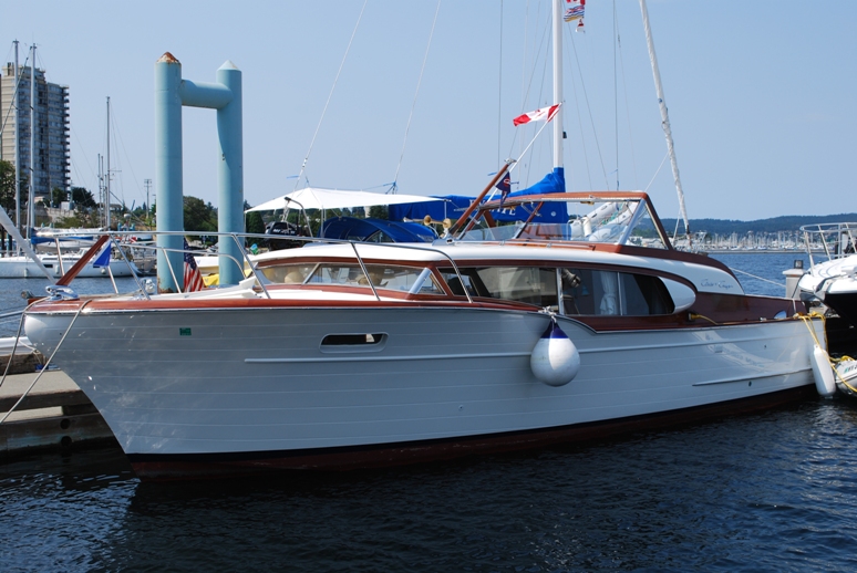
A classic 36' Chris Craft cabin cruiser in front of us on the dock at Nanaimo.
Late in the afternoon we arranged a taxi to take us to a Canadian Tire Store (probably started out as a tire and auto parts store, but it’s now Canada’s equivalent to a small K-Mart) to get a 12-volt battery charger for our dinghy outboard motor battery. It’s located at least five miles up the continuous strip mall area north of Nanaimo, and when we arrived it was 5:02PM – yup, they closed at 5PM. We’ll do almost anything not to have to go to a Wal-Mart, but this wasn’t one of those times, so we went back to a previous shopping center and bought it at Wal Mart.
We can’t tell if ZuZu remembers last year at Nanaimo, and if she does, are there any bad memories of it. Since I never finished my journal of last year’s cruising, maybe I should tell the story of why we jokingly call ZuZu by the nickname, Teabag. We’d just arrived on a hot sunny afternoon in early August, 2009. We’d been assigned to the low dock at Cameron Island (where we are this time too, in almost the exact same position). I was banging away on my computer in the salon, and Kap was doing something directly above me on the dinghy deck. The dogs were with her up there, as was ZuZu. Suddenly, a guy from a boat across the dock hollered out, “Hey, your cat’s in the water!” I raced out onto the dock and the guy pointed mid-ship on Flying Colours where he said she’d fallen into the water. At about that same time, Kap had noticed Gator doing his funny “commando crawl” out from under the dinghy, and she noticed a look on his face that indicated, “whew, I’m in trouble now!”
Out on the dock, I searched frantically in the water between the boat and dock for any sign of ZuZu. We have large round fenders (about 16” in diameter), so that’s how far they stand us off the dock, and she apparently fell from the dinghy deck and dropped straight down between the boat and the dock. She was nowhere to be seen! The water was inky black, and the dock facing board extended all the way down to the water. With a terrible sinking feeling, I just knew that if she’d gone under the surface when she landed and then came up under the dock, we’d never see her again, as I figured there’s no way she would know to swim down and out from under the facing board – and there would no other way to get her out from under the dock.
As I frantically tried to figure out what to do next, another guy on a boat across the dock hollered out, “She’s swimming around your swim step!” Sure enough, when Kap and I got to the stern of Flying Colours, ZuZu was swimming – as well as any dog we’ve seen – around Flying Colours’ swim step. We carry a large fishnet just for dog/cat retrieval if any one of them goes in the water, and Kap had it in her hands in an instant. She knelt down on the swim step, laying the fishnet down with the netting in the water to see if ZuZu would use it to climb out of the water. She’d have nothing to do with that, and just swam on by. Kap reached out with the net and scooped her up – and she was none to happy about that!
Once on the dock, we saw what a drowned rat she looked like, with fear in her eyes like she’d just used up two or more of her lives. Wet to the bone with salt water, Kap immediately scooped her up in a towel, and we carried her to a fresh water spigot. If we just dried her as she was, she’d still lick herself clean, and we knew she’d be sicker than the devil from the salt on her fur. She liked the fresh water bath even less than her recent experience, but we tried to reason with her that it was for her own good. She wasn’t buying any of it.
After that incident Kap nicknamed her Teabag, but we don’t think she’s particularly fond of the reminder.
Our 16" fenders hold us that distance off the dock - plenty of room for ZuZu to fall through and into the water. It's still a wonder she didn't hurt herself by landing half on/half off or something worse.
Tuesday morning after our first latte, we took Raz and Gator for a long walk along the shoreline bulkhead – about a mile northward to the Nanaimo Yacht Club and back. We all needed the walk very much. On the way back, we split up and Kap took the dogs back to the boat, while I walked up the hill to McLean’s Delicatessen – Kap should know better than to let me go there alone! I stocked up on Mizithra cheese (that I’m hoping to try with a Pasta and Browned Butter dish), a block of really nice blue cheese with celery crackers and dried figs, ½ kg of sliced cervelet, and some paper-thin sliced prosciutto (that I wrap asparagus for grilling, plus use in a Penne con Vodka). That deli alone is reason enough to stop by Nanaimo.
On the way back to Flying Colours, I happened by a French bistro in the center of downtown, run by a French man and his daughter, and as usual, I spotted steak au’poivre on the menu in about three seconds. I already had plans for cooking dinner on the boat, but when I told Kap about it, she insisted that I (not her, but I) needed a French dinner before continuing our cruise. The steak au’poivre was excellent (but not enough peppercorns), the pomme frites (French fries) were perfect, and Kap’s Savoury Crepe with Au’Poivre Sauce was also excellent. A really nice (French) bottle of Chateau Lafite Cabernet Sauvignon topped off the dinner very nicely. It was a great way to spend the last evening in Nanaimo.
Wednesday, August 4 – Nanaimo to Gorge Harbour Marina – 75 Nautical Miles; 8:13 Minutes Cruising Time
The weather forecast looked good. The Nobeltec software indicated our best departure time was 7:45AM for the 75 mile, 8+ hour cruise to Gorge Harbour. Our preparations didn’t take as long as we expected, and we pulled away from the dock at 7:11AM.
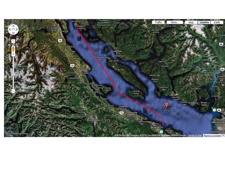
Our route from Nanaimo to Gorge Harbour.
Getting out of Nanaimo is always interesting. There are three small airlines that operate from a floatplane base very close to the marina, and there’s a take-off and landing zone that you have to cross to get out of Nanaimo Harbour. Once clear of that, you then turn northeast in Northumberland Channel between the east side of Newcastle Island and the northwest corner of Gabriola Island. We typically then have to contend with a high-speed B.C. Ferries super-ferry departing from or heading for the main terminal at Departure Bay – but this time the closest one in sight was probably 10 miles away on the horizon.
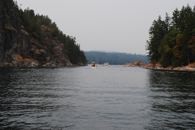
As we rounded Protection Island and headed into the Strait of Georgia, all of our attention was focused on getting successfully and safely around the west side of “Whiskey Golf” – the Canadian Forces Maritime Experimental and Test Ranges, the long name for a torpedo test area that’s used by both the Canadian and U.S. navies. In upwards of 10 passages, either going across to Pender Harbour, or north and south to Desolation Sound, this was the first time Whiskey Golf has been “active”. When it’s active, transit through Whiskey Golf is prohibited. Since the western edge of the area extends into a shallow rocky area full of islands, a safe transit corridor along the western side of the operating area has been established, 1,000 yards wide, running parallel, east of the Ballenas Islands. Vessels passing through are required to communicate with Winchelsea Island Control on VHF channel 10, and they give you a heads-up on the Navy ships operating in the area.
With some amount of trepidation (at least on my part), Kap spotted a Grand Banks-type of trawler flying a Canadian flag that was coming out of Nanaimo around the north end of Newcastle Island. Figuring he probably knew exactly how to cross the transit corridor, so she moved in behind him and slowed down a knot to match his speed. As we approached the corridor, Kap called Winchelsea Control to request permission to cross the corridor and they came back with our clearance and cautioned us to watch out for Navy ships operating in the area. The trawler in front of us was hugging the eastern boundary of the corridor more than Kap preferred, so according to our GPS position, she moved into the center. We figured the trawler was heading across the Strait of Georgia to Pender Harbour and didn’t want to waste any more distance than he had to, whereas we were heading northward up the Strait.
We spotted three battleship grey Navy ships – one off to the west of us seemingly at anchor, another looked like a large tug and it was moving eastward along the north edge of the active area, and another that bristled with antenna that passed across our bow about ¼ mile in front of us and proceeded into the active area. Here’s what our Douglass cruising guide says about what’s going on in Whiskey Golf when it’s active: “The Canadian Forces Maritime Experimental and Test Ranges tests ship and aircraft systems and torpedoes. Torpedoes may be launched by a surface vessel, submarine, or aircraft. No explosives are used; however, a hazard exists due to the possibility of the torpedo homing on vessels and then the vessel being struck by the torpedo on its way to the surface.” In other words, the kind of stuff that makes one really not want to be around there when it’s active!
After leaving Whiskey Golf, we settled down to a long (75 nautical mile) cruise northward on the Strait of Georgia. This wide body of water, almost 15 miles across at Nanaimo, narrows to about 5 miles wide as you approach Lasqueti Island on your starboard. When the winds kick up across the Strait, it can keep cruisers moored to the dock for days waiting for the rough wave-induced seas to calm. We’ve found early mornings to be almost always best for starting our crossing, and this time was no exception. By 8:30 we were almost at Lasqueti Island, and the seas were calm, and while not exactly glassy, the 1’ chop meant that Flying Colours was running very smoothly. Kap and I traded off at the helm, and the three animals slept in the fly bridge almost all the way, snoozing in the sun.
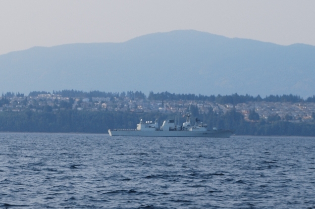
Canadian Forces naval vessel taking part in torpedo exercises in Whiskey Golf.
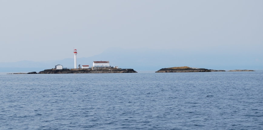
Sisters Islets weather station.
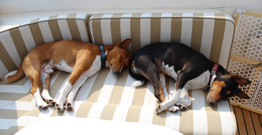
If the water's smooth, this is how Gator and Raz like to spend their time during the cruise.
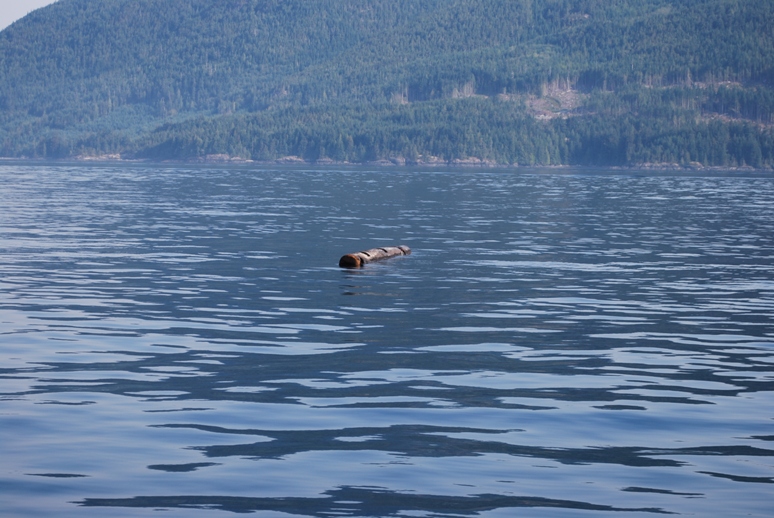
As we approached Whiskey Golf I spotted a deadhead in the water that Kap hadn’t seen – we missed it by about 20′, but just seeing one of these dangerous guys in the water makes you shiver. What’s the difference between a deadhead and a floating log, you ask?
Well, a deadhead is a fully waterlogged log – so much so that it barely floats, causing it to stand vertically in the water with just a few inches of it above the surface. They are very difficult to spot, and if you hit one it will very likely hole the boat.
A floating log on the other hand is one that’s not yet water saturated, so it floats on the surface of the water. They’re hard to see also, particularly when they lay in a wave trough, and perpendicular to the direction you’re traveling. Anywhere in our cruising area we’re on a constant lookout for logs.
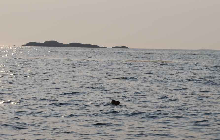
The deadhead that we spotted 20' off our starboard side, with about 8" of it exposed above the surface of the water.
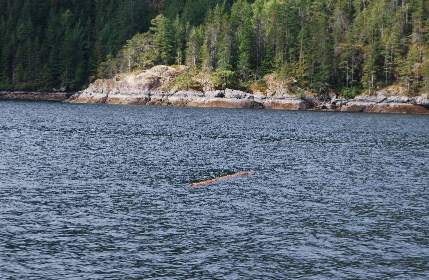
A typical floating log in the water. With constant lookout ahead with binoculars it's probable you'll see this type of log, but when it's rough and they're laying in the wave trough, they can be impossible to spot.
This is a floating log you absolutely don't want to hit! It's at least 24" in diameter and about 15-18' long. From the side cuts on it we figured it was a stray side log from a boom. If you hit this guy you'd almost certainly hole the hull.

In calm water, the seagulls line up on floating logs to rest and watch the world go by. These are obviously easy to spot too, as you usually don't find gulls lines up standing ont he water's surface.
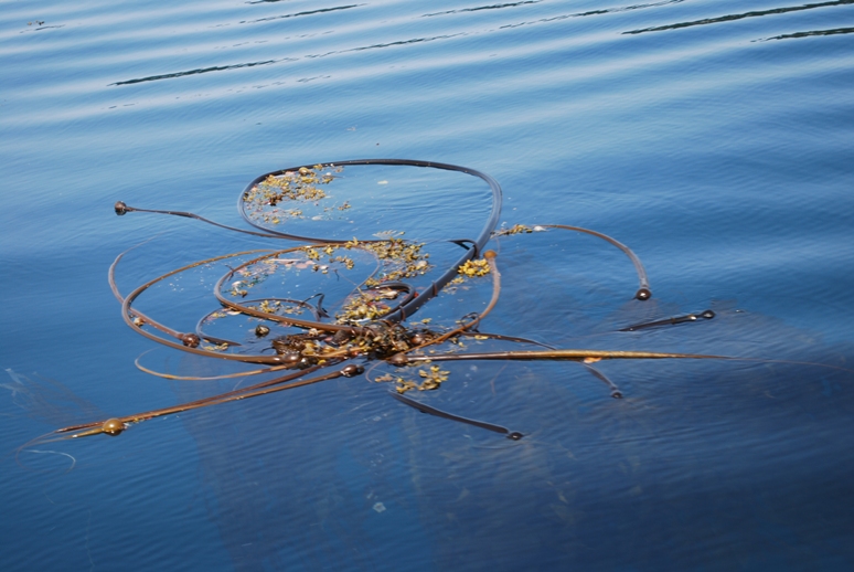
Ahead of you, a tangle of kelp often looks like a log - or worse, has a log imbedded in it - so it's also good to steer around stuff that looks like this.
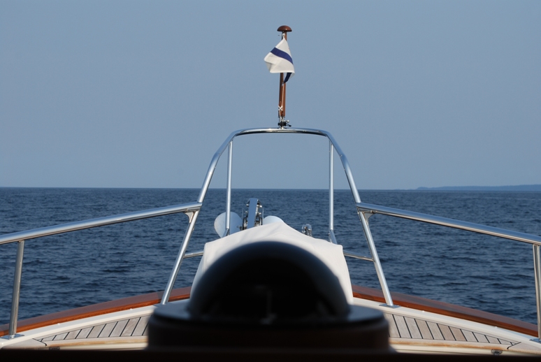
Here's what it looks like from the helm seat of Flying Colours. Straight ahead - which is where dangerous stuff in the water comes from - the visibility isn't all that great, so you need to establish a frequent pattern of sweeping the water ahead of you with binoculars. When there's lots of wood in the water, you need to have a second lookout in the pilot house.
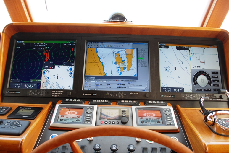
Here's the center section of the instrument panel as seen from the helm seat. The three primary screens are 17", with the Nobeltec chart plotting software in the center screen, and our Furuno NavNet 3D hardware/software running on the two outside screens. The left screen is usually split 3 ways, with a large radar image on the left (set at 1 mile range), a small radar image in the upper right (set at 3 mile range), and a small image chart plot in the lower right. The rightmost screen is also split three ways, with a chart plot image on the left, a visual depth guage on the upper right, and a graphic compass on the lower right. The engine control monitors are in the left and right foreground, and the autopilot control screen in the center.
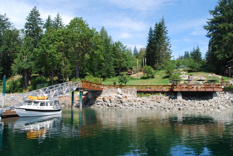
Our goal for the day was Gorge Harbour. It’s a wonderfully protected bay on the west side of Cortes Island, and it’s one of the gateways into the world famous Desolation Sound. We were last here in 2007, our first cruising year on the Nordic Tug 42, Cosmo Place. Then, we’d anchored out just off the Gorge Harbour Marina on our way south from exploring the Broughton Archipelago. We’d had a wonderful dinner at the marina’s Floathouse Restaurant – formerly a working floathouse that had towed into Gorge Harbour years ago, first becoming a shoreline restaurant for the marina, and then it was dragged about 300’ up a fairly steep bank and perched atop a great vantage point that overlooks the entire bay. The next day, Jim and Paula (Phillips/Bamburg), our friends on their Norseman 447 sailboat arrived to raft up to us for a couple of nights, with the plan we’d then buddy boat our way south. The next morning, though, Gator came up lame with a herniated disc in his neck (cervical vertebrae), and I had to fly home with him for treatment after a hurried trip down to Nanaimo, leaving Kap to tend to Raz and ZuZu on the boat.
Since then, the owner of Gorge Harbour Marina has spent a bucketful of dollars on marina improvements, with new docks, new shore power on the docks, and lots of creature comforts on the shore. We wanted to check it out, as we’ve heard great reports about it since we took Flying Colours past there last year.
After a long eight hours of cruising, we approached Gorge Harbour, with Kap at the helm. At the southwest tip of Cortes Island, at Sutil Point, a very shallow shelf that extends offshore for at least 1,000 yards, and it’s necessary to stay well clear of a shallow water marker buoy. This area is called Century Shoal, and from there in to Gorge Harbour the depth is 40-80’, which is certainly plenty deep for transit into Gorge Harbour, but it can set up significant waves to contend with if there’s wind. This time, though, the only rough water we had to contend with was from several inconsiderate Bayliner-types who couldn’t seem to hold down their speed, passing us at 20+ knots and giving off huge bow and stern wakes. Needless to say, behavior like this doesn’t leave Kap in a very good mood.
The view of Gorge Harbour at the entrance.
The entrance into Gorge Harbour is pretty spectacular – sheer rock cliffs on your port side that rise vertically at least 300’ directly from the water. We met two boats leaving as we entered, and a skiff carrying about six teenagers (all without lifejackets on) were hanging around the cliff wall looking at the ancient First Nations hieroglyphs). As the narrow entrance opened up into the harbour, we could see at least two dozen boats at anchor. We called Gorge Harbour Marina on VHF CH 66A to confirm our moorage reservation, and were relieved when they gave us our slip assignment – on the outside of the outermost dock, and that gave us an unimpeded view of the goings on in the entire harbour. It also allowed us to easily get the kayaks down for a quick exploration of the harbour’s shoreline.
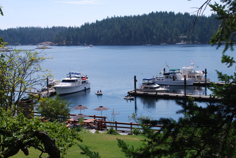
View of Gorge Harbour from the shore. Flying Colours is on the outer dock at the right side of the photo. The BBQ area is in the foreground.
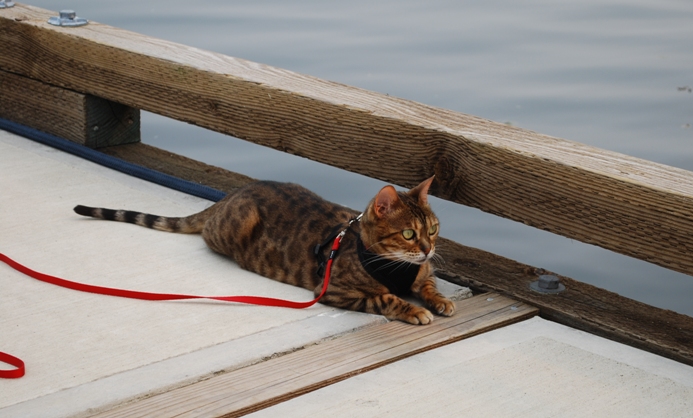
ZuZu enjoying some time on the dock.
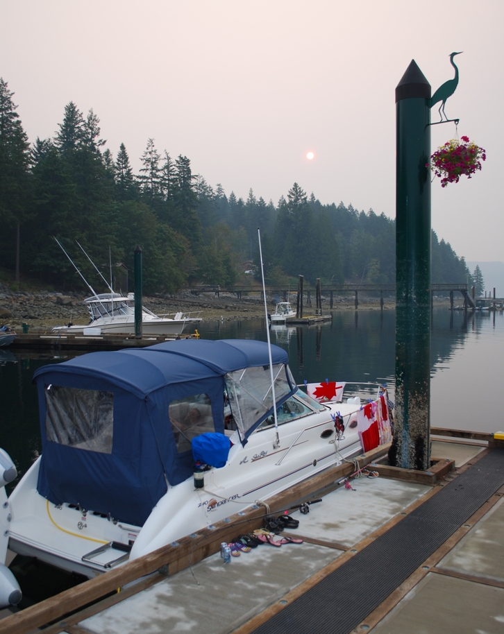
Sunrise from Gorge Harbour. The smoke in the air from the forest fires made it look almost like a harvest moon. The 24' boat next to us was from Campbell River and had four adults and 4 small children sleeping aboard it. We can't imagine where they all slept.
The unfortunate part, our cell phone coverage was nonexistent, on both my iPhone AT&T phone (which partners with Telus in Canada) and my Motorola Razor with Verizon (which partners with Rogers in Canada). Without Verizon coverage, we also didn’t have boat broadband WiFi and couldn’t connect to the Internet for three days. Also, shortly after our arrival a thick layer of noxious smoke closed in on the harbour, turning the air blue and irritating our throats. The smoke was from a far still burning in the forests around Lillooet, about 75 miles north of Whistler, B.C. and NE of us. With the smoke haze, the sun the next morning looked like an autumn moon rising above the trees, and we expected some spectacular sunsets (but didn’t get them).
Thursday, after watching a very interesting (and ancient) Beech 18 floatplane come in with chartered passengers from Campbell River, we got the kayaks down. Gator gave every indication he wanted to go with Kap, so she scooped him aboard and we went out for an hour pedal around the north side of the bay.
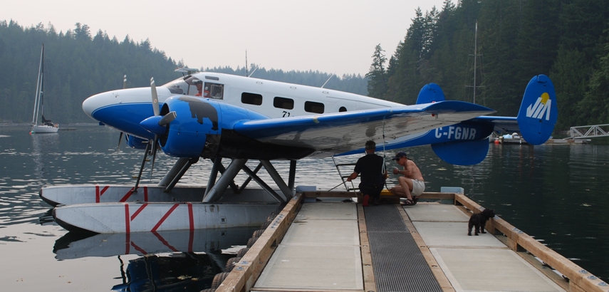
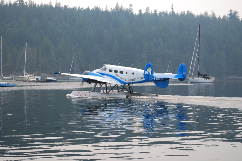
This Beech 18 landed in front of us and taxied up to the dock. It's a charter out of Campbell River, and I'd fly it in a hearbeat.
The Beech 18 taxiing out.
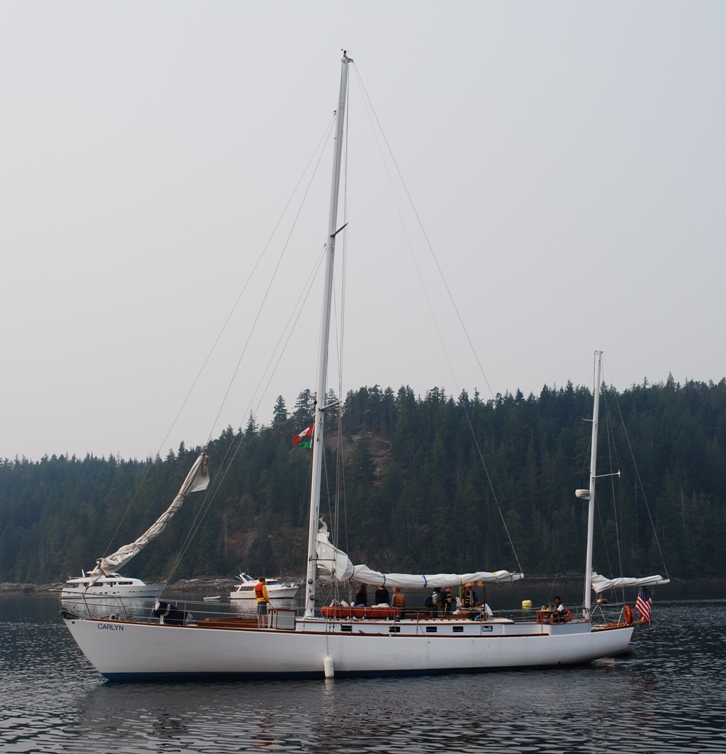
The Carlyn, a 61’ wooden sailboat. There were all young girls on board as crew, prompting me to search on the Internet to find out some background on the vessel. According to a Seattle PI article from May 29, 2001 (http://www.seattlepi.com/local/25084_salish29.shtml); “Girls on the Sound was free to all participants, created through a partnership between two non-profit groups: Salish Sea Expeditions (www.salish.org), which works with classroom teachers and students to offer scientific research trips; and Passages Northwest, dedicated to building leadership and courage among girls and women (www.passagesnw.org). They hope the hands-on work will help girls to develop self-confidence and understand that they can be as good as boys in typically male-interest areas.”
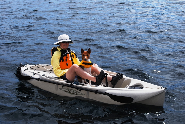
Kap and I went for a kayak cruise around the shoreline of Gorge Harbour. Gator wanted to go, so Kap took him aboard with her.
At the end of the day, our big event was the long-awaited dinner at the Floathouse Restaurant. During our cruise up from Nanaimo the previous day, a friend on another Fleming 55, Jeff Robinson from Bellingham, WA on Daybreak, called with an update on their journey circumnavigating Vancouver Island. When I mentioned that we would be in Gorge Harbour for several nights, he cautioned that the Floathouse Restaurant didn’t live up to his expectations – “mediocre food, and way too expensive” was how he put it. We were hoping that wouldn’t be the case, as we remembered the ambience as just about the best in Desolation Sound, with food to match. It was a nice summer evening, and we ate out on the deck. The new chef’s name turned out to be Ferguson, so that brought up several comments about getting special treatment. I had Pan Seared Halibut with a wonderful cucumber sauce, and Kap had a fabulous Salmon with cilantro chutney sauce. For our tastes, it was as good, if not better, than before.
At the shoreline is the new BBQ deck. Up the sloping grassy area - and almost hidden in the trees - is the Floathouse Restaurant.
A very beamy - 32' beamy in fact - cruise-a-home across the dock from us. This is not the type of vessel for the waters up here, but to each his own.
To our surprise, the smoke cleared up on Friday, with bright sunshine and high scattered cirrus clouds. We were expecting this to be a good omen for the weekend weather, as our plans were to move to the SYC Oustation at Cortes Bay on the other side of the island on Saturday morning. Timing of this was pretty important, as Kap had a flight to Seattle scheduled for Sunday, with an appointment with her surgeon, followed by a physical therapy session.
As Kap watched the weather forecast, though, it began to look worse and worse for the following day. Late in afternoon, a low pressure system came in, bringing with it a wide band of clouds from the north. We had light rain in the early evening as we were fixing a favorite BBQ dinner of lemon-herb marinated chicken breasts, with a rice and asparagus spears accompaniment. . Overnight, the system came in full, with winds above 15 knots from the SE.
Saturday, August 7 – Gorge Harbour Marina to SYC Cortes Bay Outstation – 13 Nautical Miles; 1:37 Minutes Cruising Time
By Saturday morning, there was serious drizzle, and the weather updates about Century Shoal at the point where we’d have to turn east weren’t sounding good at all. At 8AM I checked in with the marina staff to see about staying another night. If we could, and the weather didn’t improve, we could always call Kenmore Air to have them pick up Kap at Gorge Harbour rather than at Cortes Bay. At first there was encouragement that we’d be able to stay – as new boats coming in typically cancel at about the same rate as the ones who can’t depart. An hour later, though, and word came that we couldn’t stay. Now the option was – should we stay put in Gorge Harbour and anchor out, or should we risk the high winds and associated wind-waves going around the south end of the island to get to Cortes Bay. Since I’d be alone on the boat during Kap’s absence, with two dogs that needed to get ashore at least twice a day – and getting them in and out of the dinghy (and keeping them in place during the motoring in/out) isn’t pleasant, the decision was made to depart Gorge Harbour at the slightest sign of diminished winds at Century Shoal.
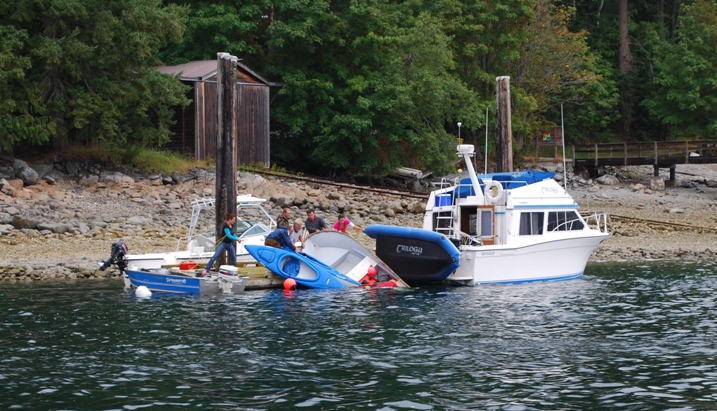
An ignominious start to a day's cruise - to lose your dinghy and a kayak over the side. This boater tried to leave Gorge Harbour at the same time as us, with not-so-good consequences.
Environment Canada was reporting 25-30 knot winds at Century Shoal, and 3-5’ wind waves. At 11AM a Nordic Tug 37 pulled in and we went over to ask how his crossing of Century Shoal was. He said it was “lumpy”, but certainly do-able and that the winds were lower than forecast. We decided to make a break for it, and got Flying Colours ready. We departed the dock at 11:17AM, for a 1½ cruise over to Cortes Bay. As we exited Gorge Harbour, things looked pretty good, and we were starting to feel pretty comfortable that we’d made the right decision.
Halfway out to Century Shoal, we were passed by another SYC boat, a Nordland 65 named Desert Sun, going close to 20 knots, and we figured he was also heading to the outstation and wanted to beat the weather. As the waves increased in size, Kap picked up our speed to 12 knots. The waves continued to increase, and the wind on our bow was blowing a steady 25 knots. Raz and Gator were asleep on the starboard side settee cushions in the fly bridge, and ZuZu was already hunkered down in her covered bed in the pilot house settee. As we pounded through wave after wave, it was only a matter of time before our infamous ZuZu Rough-O-Meter would go off – and sure enough, ZuZu let out a low growl and bounded up the stairs to the fly bridge. She clawed frantically at the canvas door at the back of the fly bridge, letting out wild meows that indicated she was heading into a panic. I quickly went up and scanned the perimeter of the fly bridge enclosure to make certain there weren’t any open areas she could get out. Both Raz and Gator were now up and swaying from side to side as Flying Colours crested on each wave, and I could see the spray coming over the top of the fly bridge as the bow dug into the troughs. I sat down beside both dogs – as much to keep my balance as to hang onto them – and hollered down to Kap to ask if she was doing OK. She said she was, but there wasn’t much confidence in her voice.
As we rounded the buoy at the corner of Century Shoal, Kap hollered up to hang on, as she was timing her turn to port and we’d probably take the next wave hard. Her turn was less than 90°, and the pounding continued. I was surprised at the loud creaks and groans in the boat’s fiberglass structure – and I just hoped like hell she’d stay in one piece.
From the fly bridge I had a better vantage point on the waves ahead, and it seemed to me that we could turn more to port and take the waves at a more oblique angle. She took my advice, and as we came around our ride smoothed out a bit. Now the question was, should we take the long way between the Twin Islands that lie to the south of Cortes Island, or go between the northernmost Twin Island and Cortes Island. The former was about 2-3 miles longer and more exposed, but the latter was in a fairly narrow and shallow passage that might funnel wind down it and risk a grounding on the rocks. Kap opted for the latter, and as she turned further to the north, the waves decreased to 2-3’ from 6-8’, and our ride was very manageable. It was time for me to assess the damage from our pounding, after hearing at least one galley cabinet come open during the worst of the waves. Kap’s computer has bounced off the pilot house settee and landed on the seat cushion without apparent damage – that was a really good thing! I found the cupboard below the galley sink wide open and the sliding steel frame pantry shelf had rolled out, spilling several things onto the carpet, but no damage.
Before buttoning it back up, I got a flashlight and checked around inside it to make sure that ZuZu hadn’t crawled in there to hide from the bedlam – there’s a hot water tank on one side, and a big blower and ductwork for the A/C system on the other side. I was satisfied she wasn’t there, and went through the boat to see if I could find her – nowhere to be found. I searched She’s a master stateroom, both heads, the salon, the pilot house, and then looked throughout the pilot house and fly bridge – no ZuZu. She’s a master at hiding, though, so I figured she had just outsmarted me in finding a place to hide.
The rest of the cruise into Cortes Bay was uneventful, but we were definitely rattled. This was easily the worst weather conditions we’ve seen with flying Colours, and ranked right up there with crossing the Queen Charlotte Strait and Dixon Entrance in Cosmo Place in 2008 – but for a lot shorter time.
Now the question was – would there be room for us at Cortes Bay, and if we had to anchor out what would the weather conditions be like? When we arrived, it looked completely full and no one was rafted up – and we spotted an empty dock spot along the bottom of the U-shaped dock. It would require some really fancy helm work by Kap to squeeze us in there, doing a tight 90° turn at the last minute to slide towards the dock. As usual at SYC outstations, there were 5-6 guys out on the dock to help us land. As I handed a line across to one guy, he said, “looks like you’ve got a trainee at the helm” – meaning he figured I was the Skipper and was “letting” Kap learn how to handle the boat. We get this all the time, as boating is pretty much a man’s world, and they seem to feel that the “little woman” should be the First Mate. In fact, Kap greased it onto the dock (as she always does), and there were several comments from the dock about the great job she did.
While I secured the lines, Kap shut down the engines. As I was stepping back on the boat, she was getting off, and with an ashen look on her face she said in a low voice, “I think ZuZu got out and went overboard – she isn’t anywhere on the boat.” Normally ZuZu comes out from her hiding place as soon as the boat stops moving and the engine vibration stops, but this time she hadn’t. While Kap went ashore, I decided to make one last thorough look. I went first to the fly bridge and searched all of the favorite hiding places there – no ZuZu. Then I spotted three unhooked snaps at a corner of the fly bridge enclosure – and it was easily big enough for her to crawl through. My heart was in my throat when I saw that, and I knew immediately if she’d gone out through that in her panic, she’d have been swept off the boat in an instant. Of all the cat’s we’ve had, this is the one I hated the most to lose.
Just then, I heard the faintest meow, and I knew it was ZuZu’s! I raced down through the pilot house, and then followed the muffled, but clearly frantic, meows right to the galley sink cabinet. Before I could get the double doors fully open, ZuZu flew out in a flash. When I’d found it open during the rough seas, I had searched in it three times, shining the flashlight into all of the recesses, and just knew she couldn’t be in there, but obviously she was. She had probably rolled herself up behind the water heater in such a tight ball that it impossible to see her.
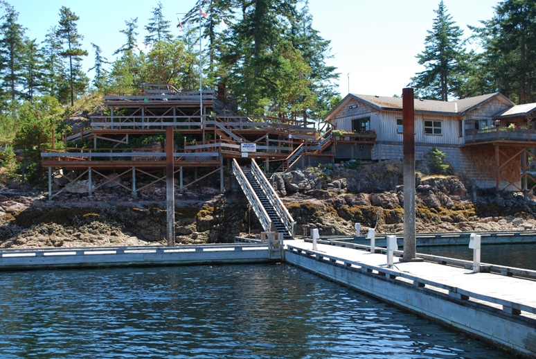
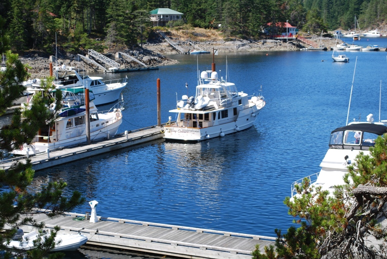
The Seattle Yacht Club outstation at Cortes Bay. This is the crown jewel in the SYC outstations. At upper right is the home of the outstation manager; at left is the BBQ deck.
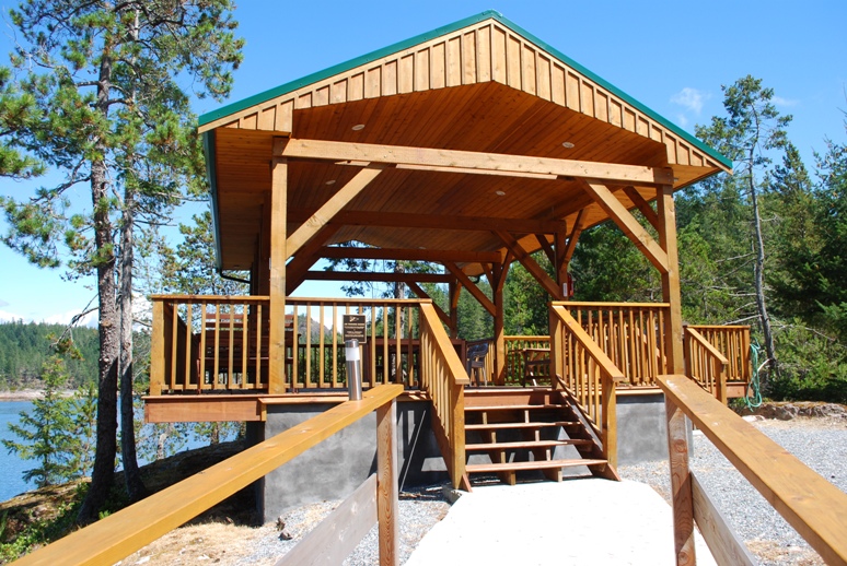
The new "Green Box" gazebo at Cortes Bay - just built in 2007.
Flying Colours at the dock at midday when lots of other boats have departed and others haven’t yet arrived
Our three days at the Cortes Bay outstation were quiet and restful. Kap flew down to Seattle on the Sunday afternoon Kenmore Air flight, while I stayed behind with the dogs and cat. The weather was warm, dry, and just right for some quiet time.
That’s all for this segment of the saga. I’ll have another one soon.
Ron