
Monday, August 16 – Port McNeill Fuel Dock Marina to Sullivan Bay Marine Resort – 35 Nautical Miles; 3:56 Cruising Time
Finally, it was time to head for the Broughton’s. Kap wasn’t wild about the weather reports from the night before, as it was blowing 20-25 knots down Johnstone Strait, and those winds were starting in Queen Charlotte Strait which we’d have to cross to get over to the Broughton’s. In fact, we’d be crossing Queen Charlotte Strait at a very oblique angle, so 16 miles of our total 35 nautical mile cruise for the day. She plotted a course with a best departure time of 8:00AM, and we hoped for no fog and decreasing wind. When morning dawned, the reports had changed dramatically, and our wishes were granted – the winds calmed considerably, and no one was reporting fog. We slipped away from the dock at 7:53AM and motored out around Malcolm Island in calm waters.
It was spitting rain as we followed along the west shore of Malcolm Island, the water a slate gray, with 6” ripples and smooth. By now the rain stopped, but the sky was still a dull gray – and it was cold outside – 56°F – according to our thermometer. The water turned smoother and smoother, and would have been glassy if not for the occasional rain splatters on the surface.
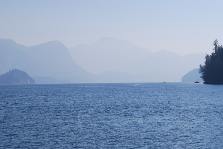
A very hazy view as we started up Wells Passage.
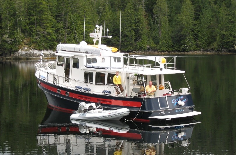
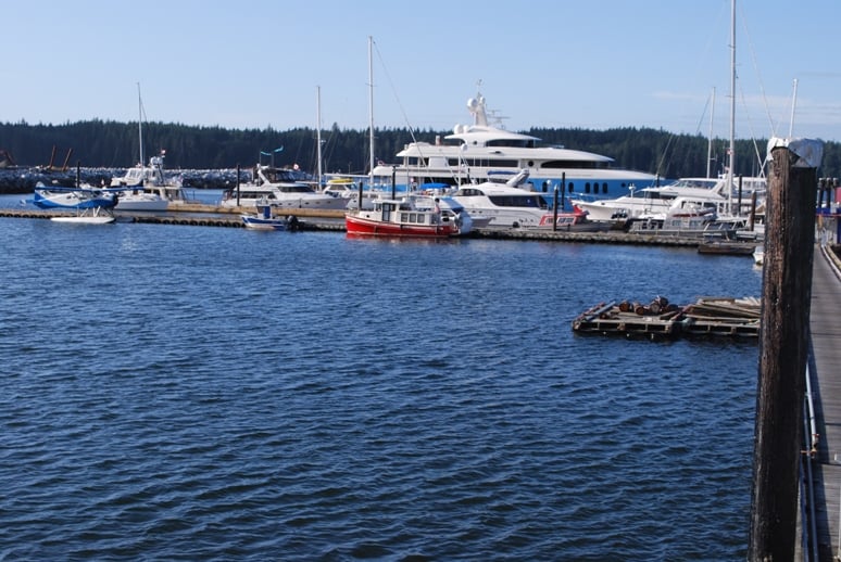
Crossing Queen Charlotte Strait from Port McNeill, the shortest route to Sullivan Bay is around the west side of Broughton and North Broughton Islands, two fairly large islands in this archipelago, and the namesake for the marine park. There, we turned NE up Wells Passage – a 6-mile long channel that was new to us. Along the way, the only hazards to watch for are some charted rocks as you go around Dickson Island, and then it’s a wide channel up Wells Passage. At the top end of it, we swung right around Atkinson Island, and at that point I hailed the resort on VHF CH 66A to confirm our reservation and request a slip assignment. Chris, the very friendly dock manager who lives there with his wife Debbie, immediately called back and directed us to Dock 3 – the innermost dock that has two or three very nice float homes along it. As we pulled alongside the dock, we noticed a familiar Selene 58 already there, Three Wishes, owned by a couple from the Bay Area that we’d met at Blind Channel last year.
The Broughton Archipelago is a B.C. Provincial Marine Park, made up of hundreds of remote islands, most of them unsettled, although First Nation peoples have lived on various islands for generations. The park was created in 1992, and any land-based houses from before that time are grandfathered, so at some resorts there are homes on land.
All of the resorts that cruising boaters can stay at are float-based, most without shore access. This makes the resorts quite different from what one normally thinks of compared to resorts in, say, Hawaii or Mexico – or for that matter, the ritzy Sonora Resort that we’d passed a couple of days earlier. Floats are just that – large raft-type structures on pontoons, anchored to the sea bottom, with floating docks extending out hundreds of feet into the water. These so-called resorts range anywhere from a single resident structure where the owner/operator lives – along with maybe a small general store that’s about bedroom-sized, all the way up to small village-size where there are a dozen floats, each containing a specific structure for the resort – like a general store, a fuel dock, maybe a small restaurant, a laundromat facility, and showers and toilets. The docks are quite often in considerable disrepair, sometimes rocking back and forth as you walk down them.
Tying a boat onto the docks is quite different from what you see elsewhere – a 6”x6” wooden bull rail that’s raised off the dock a few inches, and you tie your lines around it with a loop and tying it off with a double half-hitch (one gets pretty adept at this, doing it at least once a day).
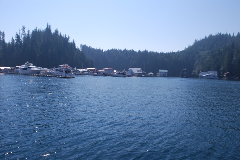
View of Sullivan Bay Marine Resort as we approached it
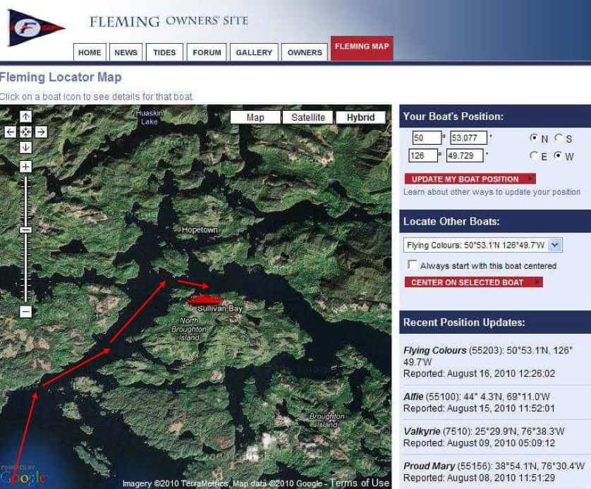
A screen shot from the Fleming Owner's web site, showing Flying Colours at Sullivan Bay on the north side of Broughton Island. Wells Passage is to the left and downward.
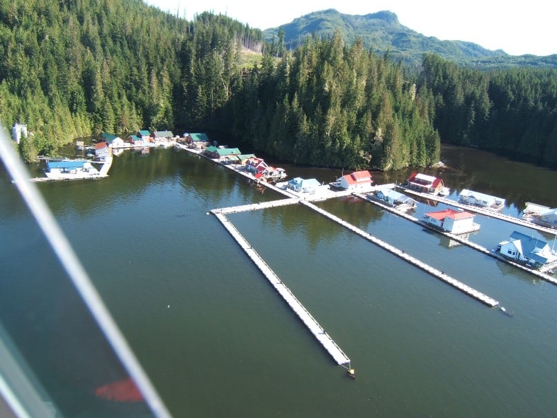
An aerial view of Sullivan Bay Marine Resort (taken from their web site) - obviously at a slack time, as there are no boats on their docks. The cluster of resort buildings are in the U at upper left, and the float homes are on the right. We tied up between two float homes across the dock from us at the middle right edge. There are large fuel tank on shore to the left for refueling boats and floatplanes, but access to the shore is not available to cruising boaters.
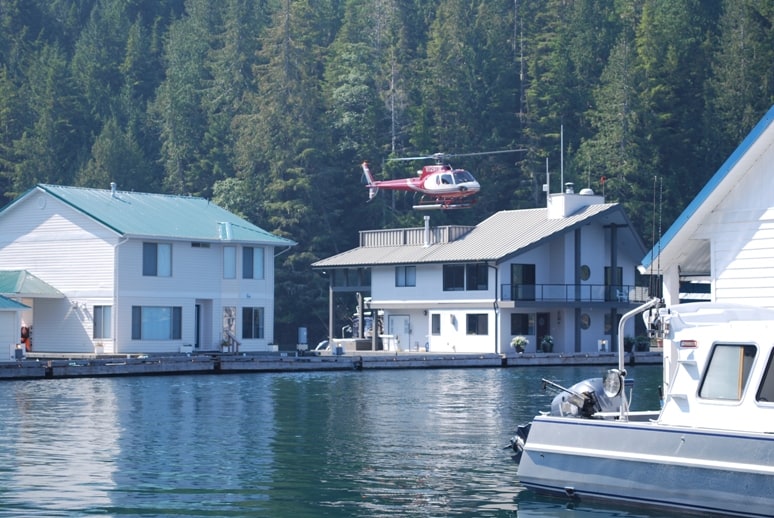
A float home at the “street” behind where Flying Colours was moored – caught at the moment when the owner was lifting off with his Robertson helicopter for the afternoon’s grocery shopping (I saw them return and exit the helicopter with grocery bags in their hands – pretty expensive trip to the store. Some of the float home owners are pretty well-heeled!)
Sullivan Bay is easily the largest – and also probably the oldest – of the resorts in the Broughton’s. It’s sort of kitschy, with the docks named as “streets”, and with over a dozen floats that house various resort facilities – none of them fancy, but harkening back to the motel days when Ricky and Lucy make their cross-country trip on the I Love Lucy show. When the long-time resort owners wanted to sell it a couple of years ago, the well-heeled float home owners associated with it banded together and bought it as a group. Several of the float homes are very nice, including one that has a helicopter pad on the roof.
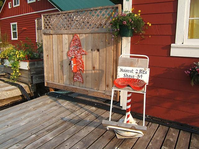
Sullivan Bay barber chair. This probably came from a float community somewhere around here from many years ago. In the first half of the 20th century, there were float communities so extensive that B.C. ferries stopped at them on regular routes. Oftentimes, the float communities were hauled from one spot to another as the logging operations moved.
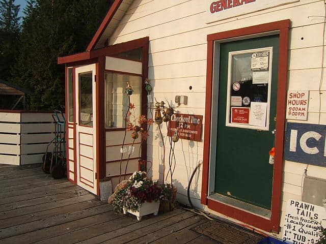
The Sullivan Bay General Store is the best stocked grocery in the Broughton's, including canned goods, fresh vegetables, milk and eggs, ice cream, beer, wine, and spirits. They even have a DVD movie rental rack. When you check in to pay for your moorage, they hand you two golf balls - for the afternoon hole-in-one competition - where you T-off on the end of the fuel dock and if your ball lands (or hits and bounces off) a derelict satellite TV dish anchored 200' offshore, you win a free night's moorage.
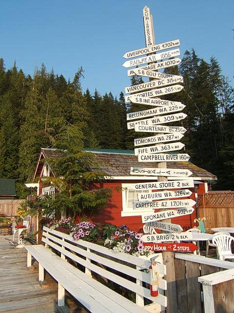
Sullivan Bay mileage sign. Notice the bottom one - two steps to the Happy Hour - just to the right of this is a special float with deck chairs and tables where the nightly Happy Hour is held.
After we got Flying Colours secured, we had lunch at the resort’s restaurant, and there we ran into another couple we met on our way south from the 2008 SE Alaska trip – the parents of our boat’s marine insurance broker – on their way home from SE Alaska.
Within an hour of our arrival, another boat pulled onto our dock, and as is the custom, Kap and I went out to catch their lines. It was Linda Lewis and Dave Parker on the Royal Sounder! We’ve been at this cruising thing for barely four years, and it seems there are friends everywhere we go now. Linda is a 100 ton Master Captain, and runs a boating instruction school in Seattle. She was our instructor in preparation for our SE Alaska trip, and her training on boat handling (not docking, but handling it out in the water) was absolutely invaluable: rules of the road – which includes all of the marine signage, plus how to use our radar – which was by far the most important training we got. It was great to catch up with Linda and Dave!
One aspect of float resorts that the dogs aren’t particularly happy with is the lack of shore access. At several of the resorts, Sullivan Bay and Greenway Sound in particular, they’ve set up “dog park floats” – small floats, typically just a few feet square – with shag-nasty old grass on it, where hundreds of dogs have whizzed and pooped in recent days. They’d much prefer that we somehow get them ashore for their “duties”.
Luck was even more against us this time, though. Within a few hours of arriving, Raz came down with diarrhea, and was making a mess all over the boat. It was occurring so frequently that we’d just get the mess cleaned up in one location and she’d have an accident in another. Needless to say, Kap was getting pretty frustrated. Then, just as we agreed to a Happy Hour on our boat with Linda and Dave before dinner, Kap came down with the same problem, coupled with a very upset stomach. That evening, Kap stayed on the boat to commiserate with Raz, while I honored our dinner reservations with Dave and Linda at the restaurant’s steak special night (somebody has to suffer through this part of the deal…..)
That night, with things not improved, we decided our best option was to head back to Port McNeill first thing in the morning to get Raz back to the vet. Damn! Roseanne Roseannadanna was continuing to control our summer’s cruise!
Wednesday, August 18 – Sullivan Bay Marine Resort to Port McNeill Fuel Dock Marina – 35 Nautical Miles; 3:56 Cruising Time
Again, Kap’s interpretation of the weather forecast was ominous – high winds, and this time, fog. According to Nobeltec’s tide and current prediction software, our best departure time was 7AM – which we hit exactly on time. There was indeed light fog as we pulled out of the marina, but it was never less than ¼ mile visibility, and within a short time we could see the length of Wells Passage. Kap was feeling much better, but we were having to keep Raz confined to the fly bridge where we could hose out any accidents. It was obvious the poor girl wasn’t feeling well at all, and we felt really sorry for her.
Queen Charlotte Strait was smooth as glass, and the winds were almost calm. Sometimes the weather forecasts just can’t be believed. As soon as we were in cell phone range and they’d be open, we telephoned the Fuel Dock Marina and they had room for us. As we pulled around the end of the dock to our assigned slot, a voice called out, “Hey, Flying Colours!” It was Jim Caldwell of NOETA (a cleverly disguised acronym for “no estimated time of arrival”, a 42’ Nordic Tug that we’ve cruised with several times since we first met them in 2007. Jim and Christie are from Southern California – Jim is an ex-Alaska Airlines flight attendant who was based in Seattle where he met Christie. Jim’s parents owned and operated a number of large truck stops in Southern California, and when they retired, Jim and Christie took over the business. They sold the business in about 2006 (same as when we sold Mainstar), and they bought a Nordic Tug to cruise the Inside Passage. We first met them here in the Broughton’s on our first cruise.
This is aphoto from out of the past - Cosmo Place anchored in the very secluded O'Brien Bay in Simoom Sound 2007. After one night in here all to ourselves, another Nordic Tug 42 pulled in - Abacus - and we became friends with Barrie and Ann Graf. Barrie took this photo, probably the best one we have of Cosmo Place.
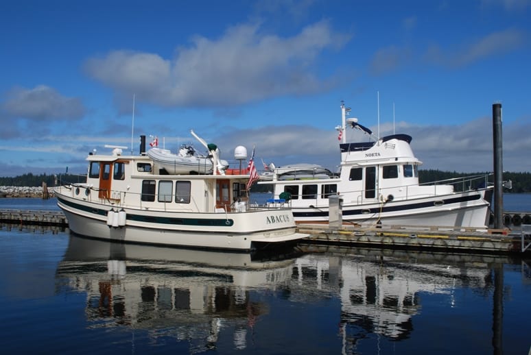
NOETA and Abacus at the Port McNeill Fuel Dock Marina.
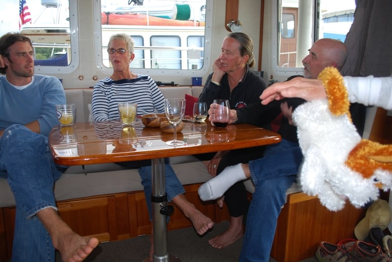
Happy Hour on NOETA before dinner at the Northern Lights Restaurant (the best restaurant in Port McNeill). Christie Caldwell is in the middle; Barrie and Ann Graf on the right. The young guy on the left is the son of the marina owner, and he's one valuable guy to know! Port McNeill is sometimes hard to get into, and having his private cell phone number is invaluable. That's Kap's arm reaching in from the right - with Barrie and Ann's stuffed dog hanging from it. When their dog died, they decided this would be the only dog on their boat from now on.
Jim came over to help with our lines, and that’s when we discovered there was another 42’ Nordic Tug tied up next to them – named Abacus – one that we met in 2007 and became friends of the owners, Barry and Ann Graf of New Almaden, CA. In 2007, while anchored next to them in a very secluded O’Brien Bay in Simoom Sound of the Broughton’s, Barry snapped one of the best photos we have of us aboard Cosmo Place.
We got Raz into the vet at a 4:30 appointment – and after an exam the diagnosis was that she most likely had giardiasis – “a diarrheal illness caused by a waterborne microscopic parasite, Giardia intestinalis (also known as Giardia lamblia or Giardia duodenalis)”. Odds are, both Raz and Kap had it, most likely from handling the non-potable dock water at Sullivan. Everyone back at Port McNeill jokingly accused me of making Kap drink out of the same dog bowl as Raz, but in fact, Raz probably got it from licking up some water on the dock, and Kap probably got it from touching her hands in it, then later touching her mouth. In any case, it wasn’t fun stuff. The vet gave Raz some Flagyl pills (a brand name for metronidazol), a drug that is effective against anaerobic bacteria and certain parasites – including giardia. Within two days Raz was pretty well cleared up, although we carefully watched her for several more days.
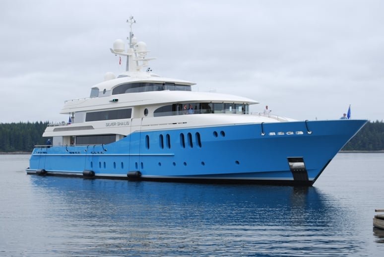
The Silver Shalis pulling into the dock.
Silver Shalis dominates the entire marina – in fact, at 174’ the Silver Shalis took up the entire dock it was on. For perspective, the red and white Nordic Tug in the foreground is 32' long, and it would probably sit comfortably on the bow of the Silver Shalis.
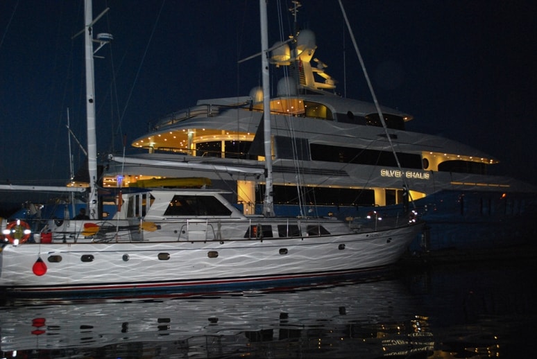
Silver Shalis lit up like a Christmas tree at night – we find this really annoying, but people who can afford a boat like this seem to think it’s chic. It’s typically all about them, and they never give a thought to us “little people”. The lights stayed on all night. Imagine what it must have been like for the poor people in the sailboat across the dock from it.
Late the next afternoon, a behemoth appeared outside the marina. At first I thought it was the Boeing corporate boat, Dadaelus, but then I saw that it was far too large. As it neared I could read the name, Silver Shalis, on the side of the upper hull structure. A quick Internet search told me that it’s a brand new, 174’ super yacht by Westport in Seattle, completed in 2010. From what I could fine, it appears to be out on shakedown cruises – at the same time as possibly flying guests aboard who might be potential buyers. We’d heard of this yacht in Sullivan Bay a few days earlier – that it was for sale at $60M. In any case, the damn thing was at the dock next to us for three days and blocked almost our entire view to the harbour. Worse, we had to contend with the hundreds of lights they leave on throughout the night. A crew of about six has been working on it every day, and it looks like it takes three guys three days just to wash it. It also drew almost everyone from town down to the docks to gawk at it, causing us to lock Flying Colours for safety every time we leave it. As far as we’re concerned, the world doesn’t need yachts of this type, nor does it need people who can afford yachts like this, but then, we’re sort of opinionated about things like this. We call it a FUB – which stands for “@#$%^&* Ugly Boat”. (I guess you can tell I have a fairly strong opinion about boats like this……)
One amazing thing – the trip out to Sullivan Bay Resort took 3 hours, 56 minutes, and the return took exactly the same! Over a 35 nautical mile cruise, that’s an interesting coincidence.
Saturday, August 21 – Port McNeill Fuel Dock Marina to Kwatsi Bay – 41 Nautical Miles; 5:01 Cruising Time
After three days of watching Raz recover – as well as lots of laundry to clean up Flying Colours – we felt comfortable heading out of Port McNeill for the second time. Our original plan had been to visit Jennis Bay – one of the newest family-owned resorts in the Broughton’s – where we had reservations after Sullivan Bay but had to cancel them. We also planned to stop by Greenway Sound, where our friends Tom and Ann Taylor had finally sold the resort after six long years of trying to find a buyer. Both Tom and Ann’s health was failing, and they were almost at the point of walking away from the resort they’d created by sheer will in 1985 (long before we ever came on the scene). Finally, a young couple from Bellevue – members of the Seattle Yacht Club who believed (as I do) that the world needs places like this – purchased Greenway Sound over the winter, and they were now in the middle of their first summer of running the place. We wanted to stop by to show our support and get to know them. We had also tentatively promised Linda and Dave on Royal Sounder that we’d meet up with them in Kwatsi Bay on Saturday – and they were going to give us a lesson in setting and retrieving prawn traps.
By now it was Saturday, and after much deliberation we decided to bypass both Jennis Bay and Greenway Sound in favor of heading straight for Kwatsi Bay – a great little bay that’s deep into the east side of the Broughton’s, run by a hardworking family who created the resort a few years ago. I quickly sent an e-mail to Max (Max and Anca are the owners of Kwatsi Bay Marina) to see if they had room for us at their single 400’ dock, and was pleased to receive a quick reply that they indeed had space for us. Actually, it didn’t matter if they didn’t, as there’s a wonderful tiny bay on the other end of the larger Kwatsi Bay – called Glory Be Bay – and it would be a great place to anchor out.

It was a dull overcast day as we departed the Fuel Dock Marina and looked back at Port McNeill Marina.
At 8:49, after the morning dog walk and taking the garbage up to the nearby dumpster at the head of the dock, we readied Flying Colours for departure. While we think Port McNeill is a really nice little town to visit, we’d visited it too much on this cruise and it was time to say goodbye for the last time – we hoped.
As we approached the SE end of Malcolm Island, Kap called out that we had lots of whales ahead. It looked like 2-3 pods of Orcas, and on the radio we heard the whale watch boats talking about a couple of Minky whales and two humpbacks. Several whale watch boats were following them as they traveled towards us and several hundred yards off our port bow. As we approached the area and just started to turn away from the whales, an inflatable Strait Patrol boat came scooting over to us and as Kap stepped out the pilot house door the young woman aboard called to us about the whales. She was pleased that we were moving away. The migration continued until we were at the end of Malcolm Island. We stayed at 4 knots as long as we could see the whales on either side of us.
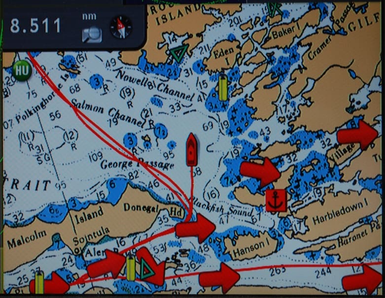
Our Furuno chart plotter screen maps our crossing of Queen Charlotte Strait. Flying Colours is the red boat icon in the center of the screen. The previous week’s course to/from Sullivan Bay is the parallel red lines that snake up to the top left corner, illustrating the difference in today’s route. Queen Charlotte Strait is rather shallow – typically with 2-digit depths, and to the left of our course are some rocks on a shoal that stick up at low tide, and are poised to punch a hole in you if you try to pass over them at high tide. The big red arrows are current directions, giving us a small push as we depart Port McNeill and a side current (which only means we have to crab to correct for it) once we’re out in the strait.
Our route this time would be more familiar than last week’s over to Sullivan Bay. We’d head more to the east on Queen Charlotte Strait, and entering the Broughton’s we’d pass on the south side of Broughton Island, with Eden Island on our starboard side. This would take us up Fife Sound, passing by Pierre’s Echo Bay Resort at about the halfway point (just east of the waypoint at Ragged Island on the associated screen shot of our Nobeltec software. There’s be a dogleg to get around the Burdwood Island Group (which we passed on the south side, whereas the plotted course was for the north side).
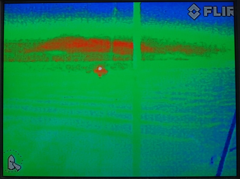
As we slowly cruised past the whale watching boats, Kap played with our FLIR camera – a thermal imaging camera – that we have on Flying Colours. We’ve been looking at this gizmo since 2008, thinking it might be really good for spotting logs in the water ahead – the theory being that the log would have a different temperature than the water it’s floating in. We spent an unspeakable amount of money on this thing, and sure enough you can see logs in the water, but not very far in front of you, and if you’re head is down concentrating on this thing, you’ll almost certainly miss a log that doesn’t show up on it. It’s a pretty cool device, though – so cool that you can tell the sex difference in people on a nearby boat if they’re close enough to you – women show up with different body temperatures than men. In this photo, the camera is pointing abeam of us at a sailboat, but it’s too far away to see much more than a warmer image at the surface of the water. The sailboat is the little red blotch with a white dot in the middle of it.
We were mentally geared up for fog on the crossing, as that was in the forecast, but luckily it lifted. All the way across Queen Charlotte Strait low-level there were scudding clouds in front of us, laying against the island mountains leading into the Broughton’s. The gray morning light made it difficult to see “stuff” in the water ahead. Queen Charlotte Strait is surprisingly shallow, and at slack tide there was considerable kelp and wood debris floating in the water – so much so that it was impossible to steer around it and you just had to aim for the lesser bits.
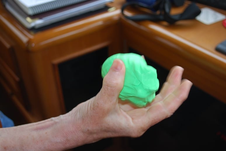
Kap’s Play-Doh-like exercise for wrist strengthening.
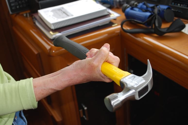
Kap’s hammer for side-to-side exercises (or to keep me in check with staying on course).
Most of the way across I was at the helm, giving Kap a chance to do her wrist physical therapy. She’s still heating it with a rice-filled heating pad in the morning, then exercises to strengthen the wrist. Each visit to Seattle she gets a new exercise regimen to work on, and luckily this cruise is giving her time to do that.
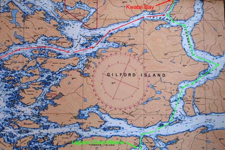
Broughton Archipelago chart. The red line is our course from the entrance to the Broughton Archipelago on the left, to Kwatsi Bay Marina at the upper right. The green line is the next day’s course from Kwatsi Bay to Lagoon Cove Marina – the exit from the Broughton’s. The maze of islands and waterways in the leftmost 1/3rd is the heart of the Broughton Archipelago Marine Park. Gilford Island is probably 20 by 10 miles.
Once into Fife Sound there was surprisingly little traffic – none actually – which shouldn’t be so surprising given this is towards the end of August and many cruisers have already headed south. All the way up Fife Sound we didn’t see another boat, although as we got close to Pierre’s Echo Bay Resort there were a couple of cruisers calling for moorage reservations, and several others were requesting 30 minute moorage for a run into the general store.
We’ve intentionally stay away from Pierre’s. It’s a popular place – too popular for our taste – and we’ve heard stories this summer of Happy Hours when the volume of noise is so loud that you can’t even carry on a conversation. Pierre hosts a potluck dinner and Pig Roast one or two nights a week, and in years past it required 1-2 week advance reservations to get in. We also heard the Pig Roast was as loud as the Happy Hour. Our preference is for more out-of-the-way places, and quieter.
Kap took over the helm just before Pierre’s while I made lunch – named Croque Cortes by us, our version of a French Croque Monsieur, made with good B.C. cheddar rather than Swiss Gruyer. It’s just an open face sandwich, with a layer of good thin-sliced Black Forest Ham, then thin slices of cheese, and popped in the microwave for a minute or so until the cheese is bubbly. They’re a great fork and knife sandwich on a cold day.
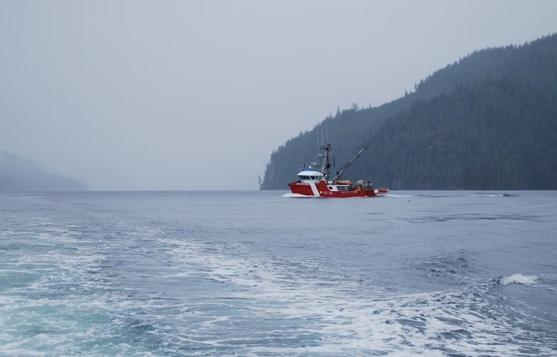
The Canadian Coast Guard fisheries research vessel, Neocaligus, finally alters course to give right of way to us and goes behind us.
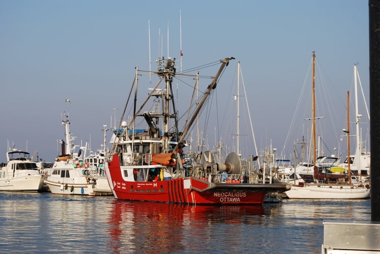
The Neocaligus moored at the Port McNeill city marina a week earlier
As we approached Raleigh and Hornet Passage, Kap spotted a Canadian Coast Guard ship steaming down Raleigh Passage on our port side. Visually, it appeared to be on a collision course with us, so while it was still ¾ mile away she set up an EBL line on the radar screen to plot its course. EBL is an acronym for “electronic range line” – which is fancy-schmancy wording for swinging a sight line from our position on the radar screen towards the target in question. Then as both boats proceed, if the boat you have the EBL on is “coming down the line”, you’re on a collision course; if it creeps ahead of the line it will pass in front of you; if it falls behind the line it will pass to your stern. The Coast Guard ship continued right down the line. Now, marine Rules of the Road (as established by the Coast Guard) dictate who does what when in a crossing situation: “The boat to starboard (right) is the “stand-on” boat and has the right-of-way. It must hold course and speed. The “give-way” boat keeps clear and passes behind the stand-on boat.”. We were clearly the stand-on boat and the Coast Guard boat was the give-way boat – but for a long time he continued right at us. Kap tends to react in situations like this earlier than me – her position was, maybe the Rules of the Road don’t apply to Coast Guard boats, or maybe because he’s bigger than us they don’t apply, etc, so she was contemplating circling in her wake and then going behind him. I put the binoculars on him and saw that it was the Neocaligus, the fisheries research vessel that we’d seen several times in the area, and he wasn’t displaying any emergency lighting. My advice was to stay the course. Sure enough, when he was ¼ mile from us he finally turned to starboard and passed behind us. I think it was a power trip – if he could get us to make the first move it would save him the trouble of yielding the right of way that was obviously ours. Then again, being dead right isn’t too cool either……
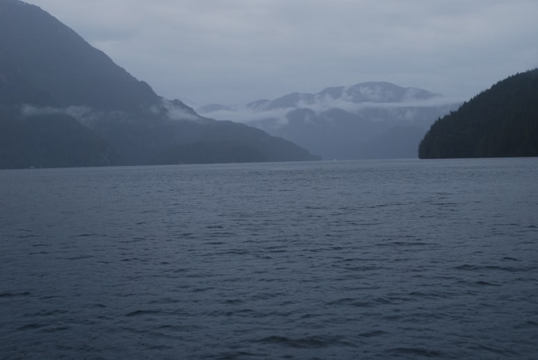
Looking east on Tribune Channel. Sometimes the channels look similar – in this light, Tribune looks much like Lewis and Calm Channels down in Desolation Sound. Tribune Channel is a main link through the Broughton’s at the east end.
Once past the Burdwood Island Group the course turned east to Tribune Channel, a very long dog-leg channel that wraps around the north and east side of Gilford Island. At the upper NE corner is an entrance to Kwatsi Bay, and at the head of that bay is the Kwatsi Bay Marina.
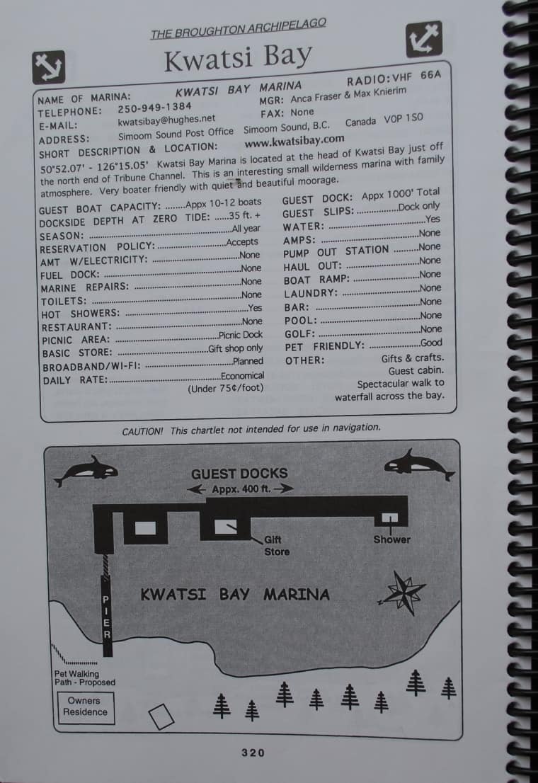
The Burgee book is a great assemblage of marine resort and marina information for every cruiser stop between Tacoma and the Broughton’s. Here’s the page for Kwatsi Bay Marina, with a rough-drawn map of the docks and facilities, contact information, and details about everything they have. Unfortunately, the guy who wrote this hasn’t updated it in 2-3 years, so we’re working off information that’s sometimes out of date.
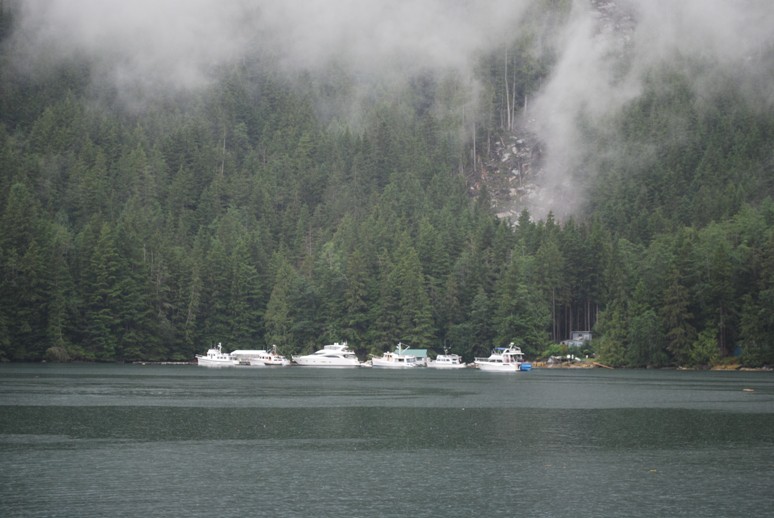
Approaching the tiny Kwatsi Bay Marina. It’s tucked in behind an island out in Kwatsi Bay, and if it wasn’t for the boats along the dock, you’d never know it was here. NOETA and Royal Sounder beat us here by about an hour – NOETA is the boat on the far left end and Royal Sounder is behind her. We tied up at the last space available on the dock just in front of the bow of NOETA. Max and Anca’s house is on shore, where there’s also a short “dog walking” trail that’s really handy for us. Note the rockslide behind the house (almost hidden by the wispy clouds). This slide happened at 6AM on a still-dark winter morning two years ago. Anca said it sounded like a freight train coming right through their house – miraculously; it stopped barely 50’ behind their house.
After about 10 miles on Tribune Channel we turned north into Kwatsi Bay. It’s about two miles long, and at the top end of it is the quaint and very friendly Kwatsi Bay Marina – only about 10 years old, and run by Max, Anca, and their two kids (now young teenagers). Max is from Spokane, and Anca is from Scandinavia (don’t know if it’s Norway or Sweden – she reminds me of Ingrid Bergman from Casablanca movie fame), and they are about as nice as they come. The tiny resort is all on floats, and somehow, they’ve been granted a license to build a house on shore. It’s great for us, as we can get ashore with Raz and Gator for their morning and afternoon walks. Once the cruising season ends, Anca moves to an apartment in Port McNeill where the kids go to school, and Max stays at Kwatsi Bay. Anca returns on weekends with the kids.
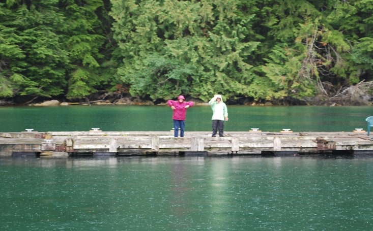
Linda Lewis (left) and another woman who’s name we never got but she was on a motor cruiser called Intrepid, mugged for us on the dock as we arrived. You can see rain drop in the water – this was a precursor of the very heavy rain we had all evening and all night. It was still raining in the morning, and stopped just about the time we were leaving.
Kwatsi Bay is one of our favorite places to stop in the Broughton’s. There’s no water at the dock (which is OK, because much of the mountain run-off water in the Broughton’s is called “cedar water” – red in color, and needs to be boiled), and no shore power. Their dock is only 400’ long, so there are never more than 10 boats. That means typically 20 people for the evening Happy Hour at 5PM. Every other night there’s a potluck dinner, where Max fixes a large pizza that will provide a slice for everyone, plus a large salad. Unlike other places on our cruises, the cooks aboard the boats go out of their way to fix really good potluck dishes. I brought Andouille Sausage and baked beans in BBQ sauce; Christie from NOETA sautéed fresh scampi, another favorite dish was lasagna (made from scratch), a chicken curry dish over rice, cheesy mashed potatoes, and a couple of other very good pasta dishes. Over glasses of wine, we talked late into the evening – well, until it was time to take the dogs for one last walk. It rained hard all evening, and luckily the potluck dinner is under a plastic tarp-covered roof, on a special float built just for the Happy Hour.
Back on Flying Colours, because we’d be without shore power for the night, we began our shutdown of everything we could on the DC circuits to conserve batteries. Even with the fridge/freezer running, we can easily make it through the night on our house bank batteries. We turn off the hot water heater to conserve, plus the Insinkerator hot water tap in the galley sink, plus we shut down all of the equipment in the boat’s “entertainment system” – the satellite TV dome, the Mac Mini holds our movie collection, and the several switching boxes that allow us to direct TV and stereo around the boat.
That’s all for now.
Ron